Via Domus
Outside of the Weimaraner brown rain-fly the stars woke up, mountains began their secret lives, and small insects came to life. The short and thin golden-brown crunchy grass that grew in the rocky loam enjoyed its respite from the sun and slowly turned an iota darker as it went about its cycle of life, death, and rebirth. The Sierra winds picked up and rocked the staunch, weathered trees back and forth. And the permanent residents of the Sierra Nevada looked towards the glowing nylon walls of our nightly home.
Plan.
It was not long after getting in to the tent that I began to feel better about the previous day’s hellish ending. Horizontality has very soothing, rejuvenate qualities to it. Maps were out, notebooks were open, pens were uncapped, and the trail guide book was sprawled open as Lindsey and I brooded over what was to come in the morning and the following days on the trail.
The good news, if there was any to be had, was that we had very little food which made our packs as light as they’d been on the entire trip. The bad news was that all of our artificially illuminated planning was for an exit and not a finish.
“Miles away” was my ultimate determination. We were miles and miles away from Onion Valley and we were a good few Passes from having our boots (or shoes, now) hit pavement. I studied the day that was to come featuring Pinchot Pass. Being appeased with our current elevation, its ultimate elevation, and the fact that it wasn’t named Mather, I put my personal effects in to the little mesh pocket by my head and curled in to my faithful and surprisingly not-too-foul smelling Marmot Arroyo sleeping bag.
The body shouldn't idly comply with what it’d been through the past 2 days; the reserve supply of food, the elevation gain and loss, and more specifically the muscle groups utilized and the required repetitive movement of them. I was certain I would awaken sore, tired, and absolutely on low fuel in every way you can imagine after the Golden Stair Case and Mather events.
The night was bright thanks to a full moon and the reflective granite mountains around us. Though the night was over quickly, life seems to move slower in the sierra. I’m inclined to think the sun does too, lazing its way above the horizon and hiding behind the cold gray granite before it inevitably shows itself and resumes its normal rate of passage in the sky. And why not? Why care about hurrying up or time at all for that matter? Seconds are days in the sierra. Minutes are months. All told, a year in the Sierra Nevada may as well be a blink of an eye. The mountains play by their own rules and have a pace all their own. The struggle is learning how the mountains do it and adjusting accordingly.
I woke with surprise that I was not stiff, aching and unable to move. I felt quite well by the time solar radiation began to reverberate in the thin and crisp dawn air. I prolonged my stay in my sleeping bag all the same, opting to maintain my horizontal state as long as possible. My fear was that Pinchot Pass would become another Bear Creek for me, and though every hike starts the same in the morning (a little slow, a few adjustments, a bit of time getting in to a rhythm) after about 30 minutes, the inevitable truth of the state of things comes out. Very soon after moving, you know what kind of day you’re in for.
The sun washed out the mountains and set the sky a deep indigo as we sprawled our belongings around camp. Slowly, things found their way in to their right place inside of our packs. My Osprey Exos 58 smelled like a homeless man save the tinges of stale urine. Hundreds of miles of carrying a bear vault had worn a hole in the hydration sleeve and back panel (and the bladder itself).
The bear canisters themselves echoed as we filled them with what little we had left.
Benefits of carrying a tripod for 150 miles.
Around 10am zippers closed, buckles clicked, and all at once we were standing on top of where we had slept. Everything we had was strapped on our back and the path home led south and east.
Lindsey started off a little slow. After my initial diagnosis of myself, I realized I was feeling great.
Hiking never got easier. There was still labored breathing, sore muscles, tired bones, rest stops, and sweat…so much sweat. We did get faster and better conditioned, though. From where we camped at about 10,800 feet, 3 miles and 1500 vertical feet kept us from Pinchot Pass. Pinchot Pass kept us from wherever we'd stop that night. That one night kept us from the end.
Part of me wanted to go fast and get there…to the very end. Part of me didn't.
The miles, the tendons, the lack of food hit morale hard. Yet still, I didn’t want to leave this landscape. I didn’t put too much thought in to it, honestly. I avoided thinking about it as much as possible knowing that if i did not avoid it, it would consume me.
Easy to do when your heart is thumping heavily as it forcefully displaces deoxygenated blood in favor of blood with the sierra air bonded to it.
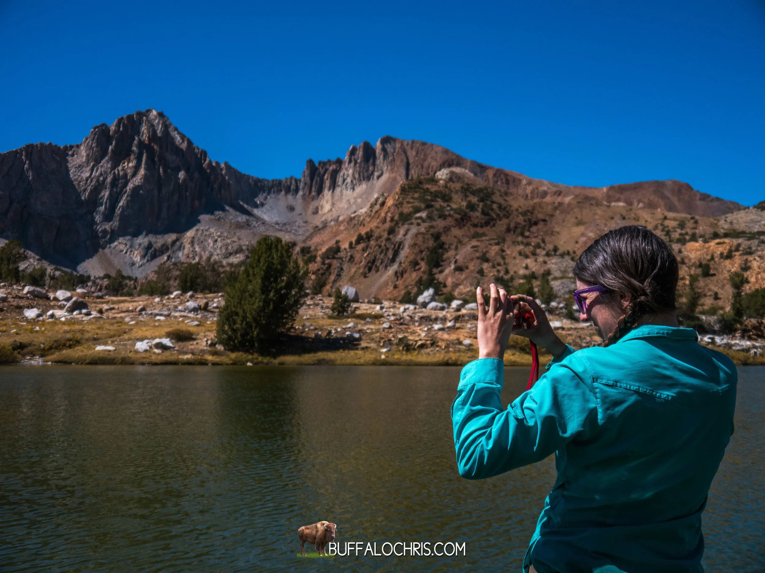
We strolled past mountains as we ascended the lightly vegetated terrain. Below the peaks, glass-still lakes waited for the winter.
It’s quiet. Breezy but not windy. Brilliantly blue above us. Clouds nowhere to be seen. Not a sign of a soul in front of us or behind us. This area was ours alone. I prefer to think The Sierra Nevada was giving us a moment of silence. Truly, though, that's just life in the mountains.
The trail crested a saddle betwixt Mt Wayne and Crater Mountain. Beyond lay more lakes dotting a lightly vegetated granite landscape. In many ways, the view and descent were similar to the view and descent atop Mather. Everything about Pinchot seemed a bit smaller in scale though. The pass was a little easier, a bit lower. The view was immense but the valley below seemed a bit smaller, more hospitable.
Not long after 11:30am Lindsey and I started down towards the jagged peaks and cold ponds.
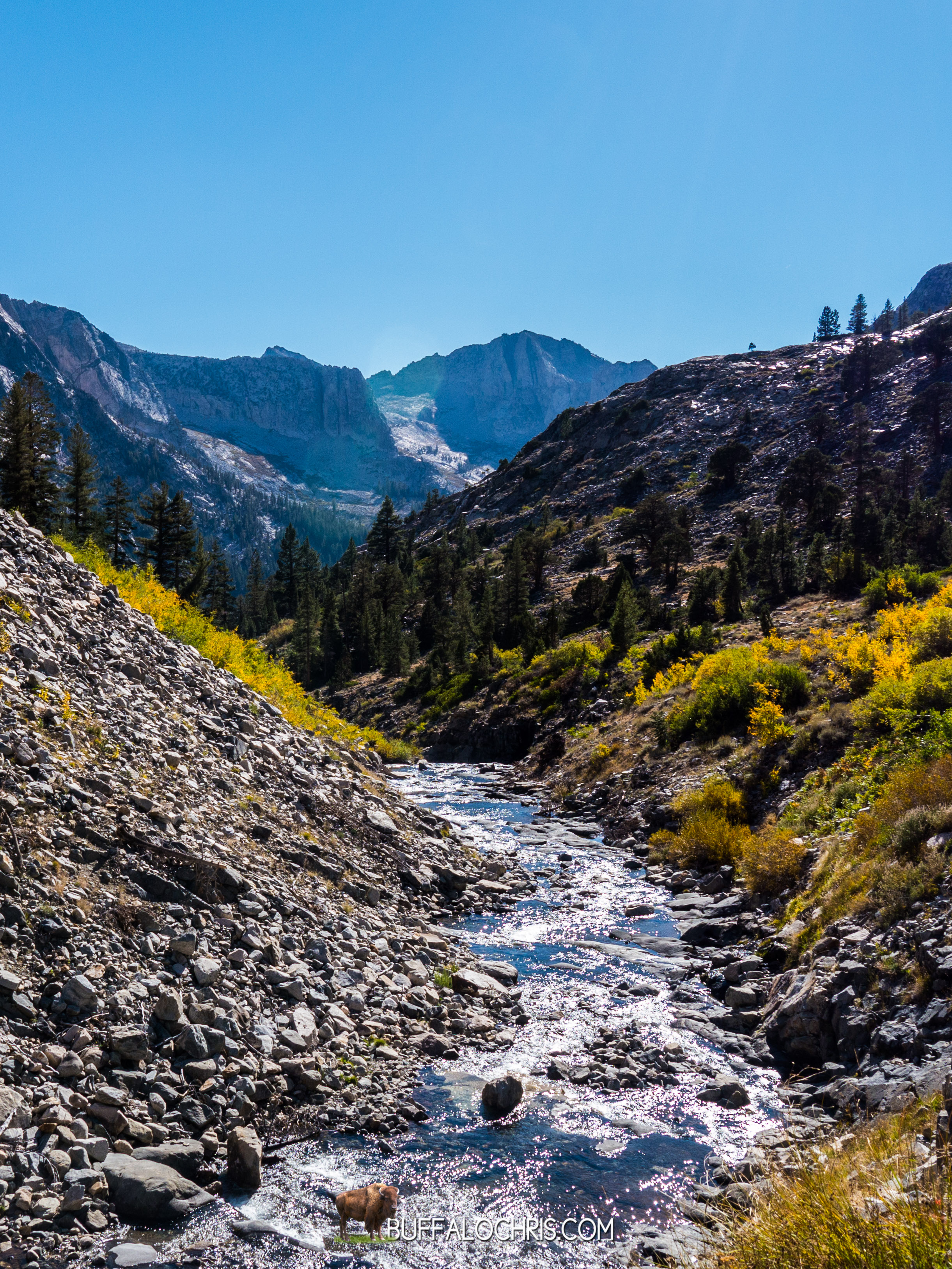
The landscape around Pinchot Pass is broken up by igneous intrusions, oxidized rocks, and rust colored scree piles that break up the color palate of the landscape.
Some wispy clouds would creep in as we sank in to the tree cover past Mr Cedric Wright, a fortress of rock that dominates the basin beyond Pinchot Pass. The trail follows Woods Creek in a south, south westerly manner passing a few small tributaries that feed the main creek. Lunch was taken just off trail at an unnamed water feature. Like all of the other sierra water masses, it was crystal clear, cold, and delicious to drink. The bottom was a very fine silt that was easily disturbed, but we couldn’t resist walking in it anyway.
Basking in the sun, we marveled at the landscape beyond the lake, ate our remaining rations, and enjoyed the respite from joint jarring, bone pounding hiking. I indulged in our last fruit roll-up.
It was the best fruit-roll up I’ve ever had in my life.
Not far beyond the lake, a side trail over Sawmill Pass takes off to the east. We’d talked about using this trail to exit the JMT but ruled it out speculating a lack of facilities and humanity (i.e. potential rides) at the trail head. The John Muir Trail descends in elevation beyond this junction as it follows the strengthening Woods Creek.
Shadows grew long as we left miles in our wake at the rate of about 3 for every hour. It was an emotional day. I can sparse remember the scenery that lay between the lake we stopped at and the famous suspension bridge over Woods Creek, and I can’t remember what the reason for the argument was, but I do know that for the 3 or 4 miles, we walked fast. Anger has a way of making the body move faster regardless of food supply, terrain, fatigue, squeaky tendons. So the silver lining of whatever useless argument we had which caused us both to be angry and walk far apart from one another was that we covered some ground.
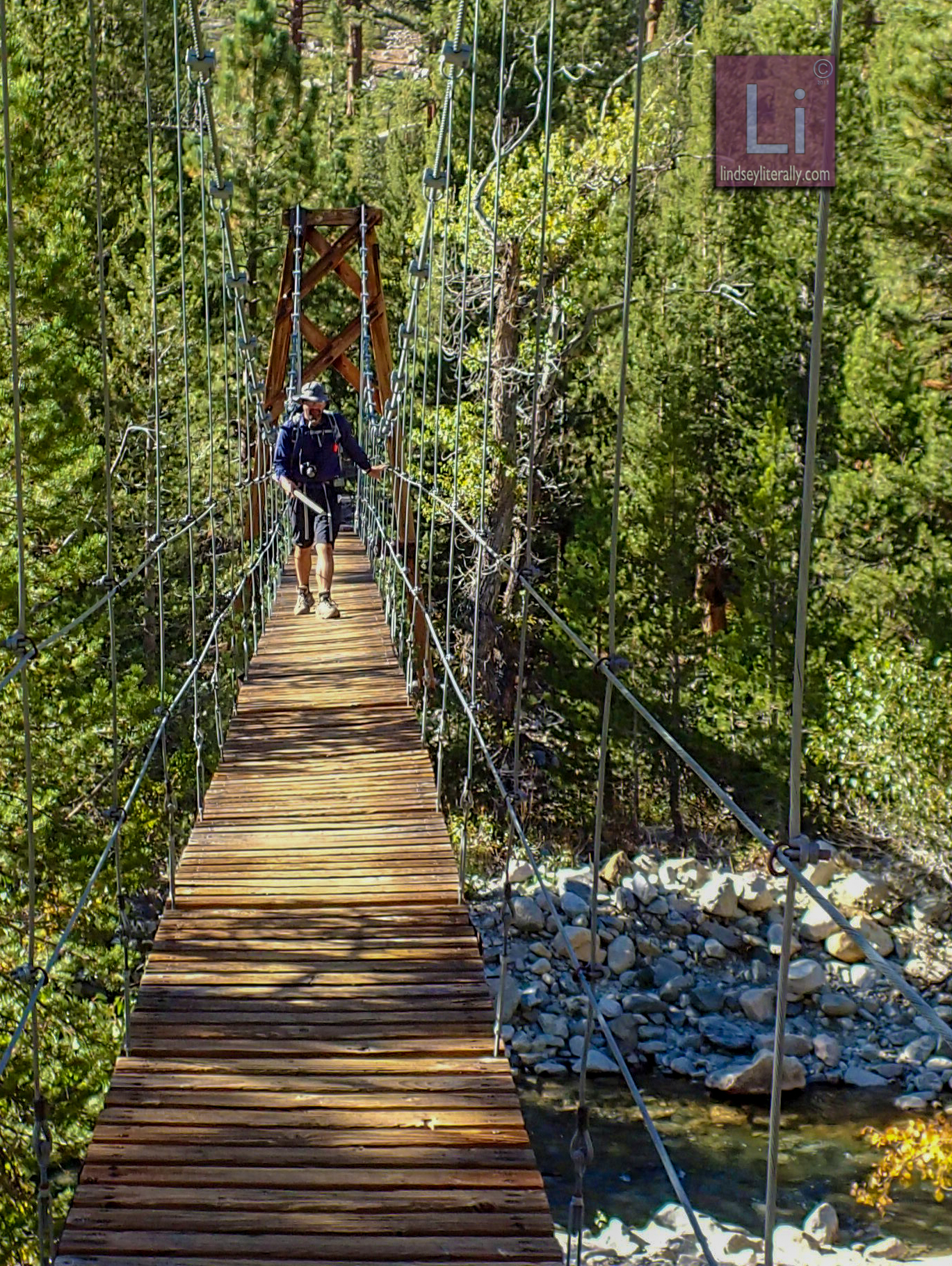
Hiking south bound, the JMT makes its hard left across Woods Creek and in to a canyon. The sight of the iconic bridge changed the mood quickly, though it’d begun improving slightly earlier. This bridge was one of my first 2 memories when I was studying the JMT. I’d heard accounts of it, seen a photo, and gazed through my screen at a place I’d never be.
It’s larger than I thought. It’s higher above the creek than I thought. It shakes more than I thought. It’s like something out of Indiana Jones or Legends of the Hidden Temple. Quintessential rickety suspension bridge. It was realer than I ever thought it’d be.
Lindsey went across first after telling me to not shake the bridge while she was on it. Once she’d repeated that 4-5 times and felt slightly more assured that I might not shake it while she was on it, she walked across. I didn’t shake it, but only because I needed to video with 2 hands.
Once she was safely on the other side, I began my trip across as to oblige the aluminum sign on the pole- “One person at a time.” The bridge wobbled far beyond what I’d anticipated and I had to hang on to the suspension cables, but made it across easily. I would have stayed and played on it but some folks on a shorter backpacking trip were behind me, and I decided I didn’t want to look like a fool more than I needed to.
On the other side of the bridge, we watched shadows grow taller and we discussed our camping options for the night. We’d not gone as far as we needed to per my plan that I thought we needed to follow. On a giant trail side boulder I sat and ate a tortilla with Nutella on it and talked Lindsey in to hiking further. It was 4 miles to Dollar Lake from that point, and the hike was an ascent of about 2000 feet. It looked all very gradual on the map, though…
It almost always looks gradual on the map...
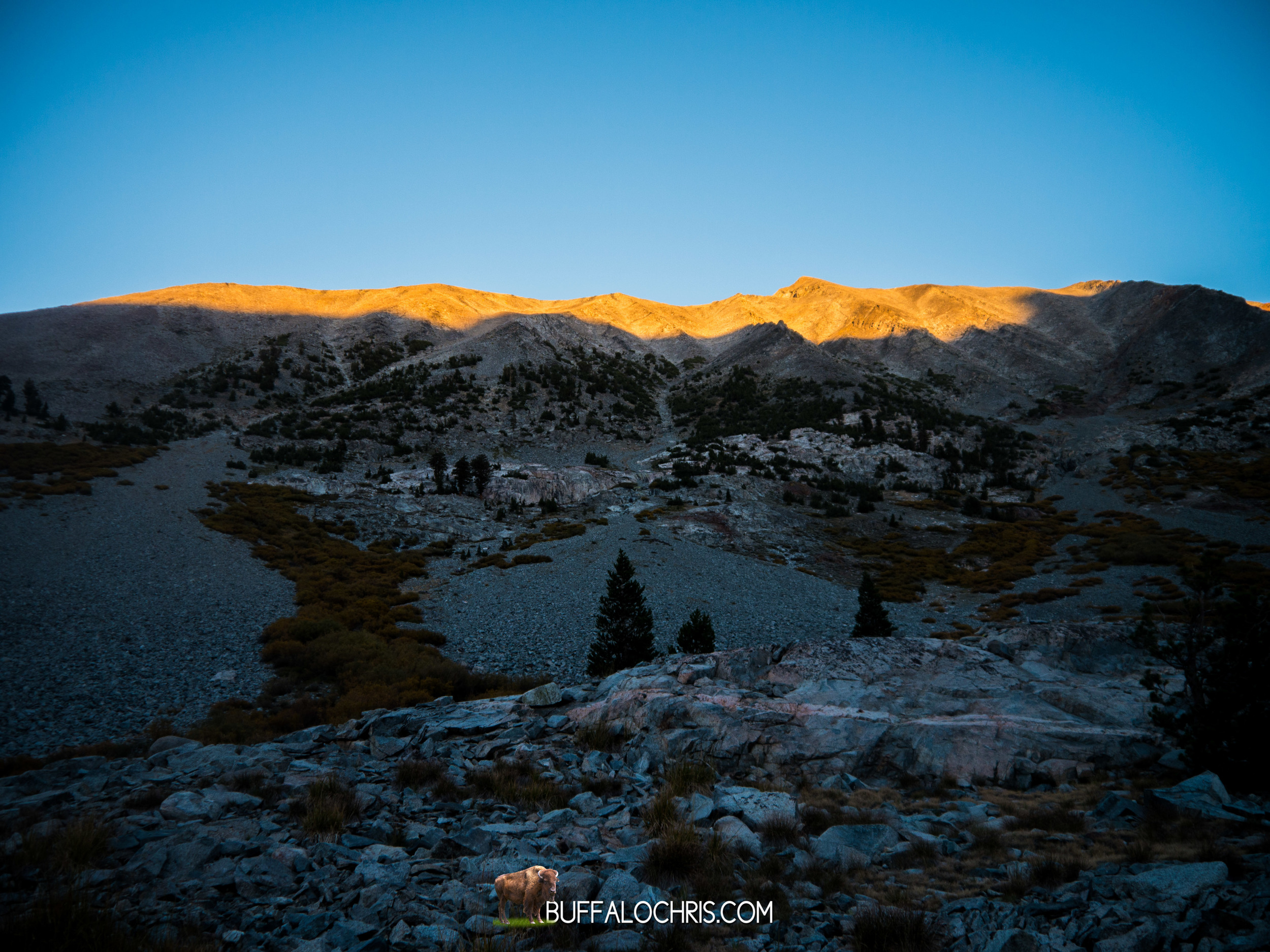
We hiked briskly as the sun started to fall behind the ridge in front of us. The streams and rocks and trees turned greyer as the world we were in fell in to the shadows.
It was a beautiful part of the trail, and another area I’d picked out as a good habitat for bears. I kept my eyes open but never saw anything. Spurred on by the idea of rest, food, and knowing that the end was in sight for this day and the whole trip, ultimately, we made it to Dollar Lake with time enough to set up in the waning moments of light.
Like the night before, as the sun went down the moon sprang up as if counter-weighted. It lit the sky in a side canyon beyond Fin Dome, and it was an hour before it surmounted the ridge and cast the area with bright white light.
The stars were incredible. I can’t fathom how it would look without a moon.
I stayed up and took some photos and watched the fish jump from the water to eat bugs and insects. Winds blew sporadically, at times making the surface of Dollar Lake as smooth as ice and other times making the whole surface smear with ripples.
With Diamond Peak high to our East, Mt. Clarence King in the West, and Fin Dome dominating the landscape South of us, we crawled in to the tent for what might have been the last time on the trip. We’d put ourselves in position to make it to a trailhead tomorrow with a 16 mile day. A 16 mile day that would have 2 passes…
The bear canisters lay far away from our tent, cavernous. Filled only with the first aid kit, a few snacks, fuel cubes. Tooth paste.
Not a soul else was around, and the mountain world was quiet. The moon and the mountains did their dance as we slept under the stars at Dollar Lake.
NOTES FROM THE TRAIL
9/18
21:14
14.7M, LEFT @ 10, HIKED TIL 1900
@ DOLLAR LAKE. TONS OF FISH. FULL MOON.
FINN DOME IN BACKGROUND
2ND TO LAST DAY.
TWO PASSES TOMORROW.
OUT TO ONION VALLEY
FELT GREAT TODAY W/ FOOD IN ME
SAD WE DIDN’T PACK ENOUGH TO FINISH
LEFT ACHILLES HURTS PRETTY GOOD.
CAN’T FEEL LEFT BIG TOE.
LOTS OF ELEVATION TODAY
10.5 ->12.1->8.9->10.5
TIRED.
I LIKE KINGS CANYON.
WARMER TONIGHT.
14.5 TO TRAIL HEAD.