Filtering by Category: John Muir Trail

On the shoudlers of giants

Factors for planning a hike are numerous and daunting: Shuttles, business hours, resupply packages, and the entire minutia associated with those is enough to make the planning part of the brain short circuit and freeze.

Then there’s the unknown: What if I have to reset a femoral fracture? What if someone gets altitude sickness? What if I get bitten by a snake? What if I get attacked by a bear? What if I get attacked by a bear that was contemporaneously bit by a snake?  What if that snake had hypothermia? What if I get seriously hurt and no one knows where I am? What if someone kills me out here? What if I just wake up dead one day?

It’s never as bad as all of that, I assure you, but the fear of the unknown is very real. I was fortunate in that Lindsey was the planner, and she was a damn good one; the perfect mix of bookworm, researcher, and logistician.  My approach was a much more audacious one, a tinge less methodical and consisting only of the following mentality: “You won’t die out here. Let’s go.”

I’ve come to rely on my problem solving skills, resourcefulness, and general outdoor skills to get me where I need to go. I think that setting a training plan, meal testing, and accruing lighter gear are all excuses to delay doing the hike. I dare say that I prefer when things don’t go to plan. That’s where adventure lives- in those strange crevices of unforeseen unpreparedness and ever changing conditions. As a hiking team we struck a complementary balance. She was 60% planner, 40% outdoor woman. I was 99% outdoor guy, 1% linguist that knew the definition of “plan.”

Over the course of the prior days, our plan had faltered. In the beginning, when we were young, we were going to hike the John Muir Trail, drink whiskey on Whitney, hike down to the trailhead, hitchhike to Lone Pine, shuttle back up to Yosemite.  Some photos, some high fives, a cool story to tell, and then back to Texas.

The trail teaches you a lot of things. One of the first and most eye opening and valuable things I learned- You can get anywhere by putting one leg in front of the other and repeating. Over creeks, snowfields, mountains, roads…you’ll get there. No training regiment, guidebook, map, class, assurance, or safety net needed. Find the path in the dirt. Walk. Keep moving forward. Stay vertical. You’ll get there.

Beyond Glen Pass

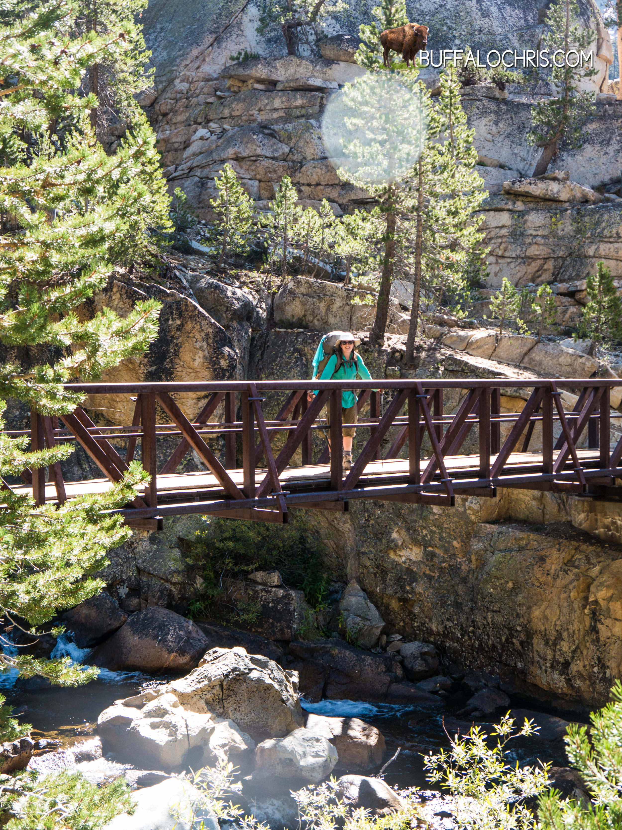
Standing on Glen Pass, it was never more apparent that not only had our original plan faltered, but it had stalled, started a nose dive, and then caught ablaze. Our plan now was to eject, and there’s a whole lot less certainty that comes with that. Specifically- getting back to civilization once we reached the end of the trail.  In truth, there really isn’t much you can do. We knew we were exiting. We’d deal with getting back to actual civilization when we hit asphalt in Onion Valley, similar to what we did when we started down that long asphalt stretch of road from Red’s Meadow to Mammoth…we’d walk until we got to Independence, some 13 miles down a winding mountain road. One foot in front of the next. In the worst case scenario, we could camp at the campground there before arranging transportation or hitching a ride. We’d figure it out…

After Lindsey emerged from behind the particularly beefy rock she’d chosen to hide behind, we didn’t tarry on the serrated ridge. Though we had no company on the pass and no one in sight on the trail in either direction, we knew we had miles to go and another mountain to climb before the day’s light was done so in short order we were steaming downhill on steep switchbacks.

My water bottle was about empty after the massive effort spent going over Glen Pass.

“I’m thirsty…” I whined.

Sometimes I thought that if I was an annoying, petulant child that it would make the miles go faster. Not that they needed to go faster, it was more of a way to entertain myself. Unfortunately, my audience didn’t like my act much and grew instantly tired of this bit every time I did it. This was often. It was a bit I adapted from Russel, from the movie UP. I paraphrased the movie lines and would typically spew forth the following in a whiney childlike voice, no fewer than 3 times per day-

“I’m tiiiiiired. My feeeeet hurt. I need to go to the baaaaathroom. Can we stop walking?”

It amused me every time. Lindsey groaned a few steps ahead of me and muttered something under her breath. Something good, undoubtedly. I smiled a satisfied smirk and remembered my water bottle that was in my hand.

“Oh yeah…almost empty…”

My smirk turned to a slightly perturbed grimace.

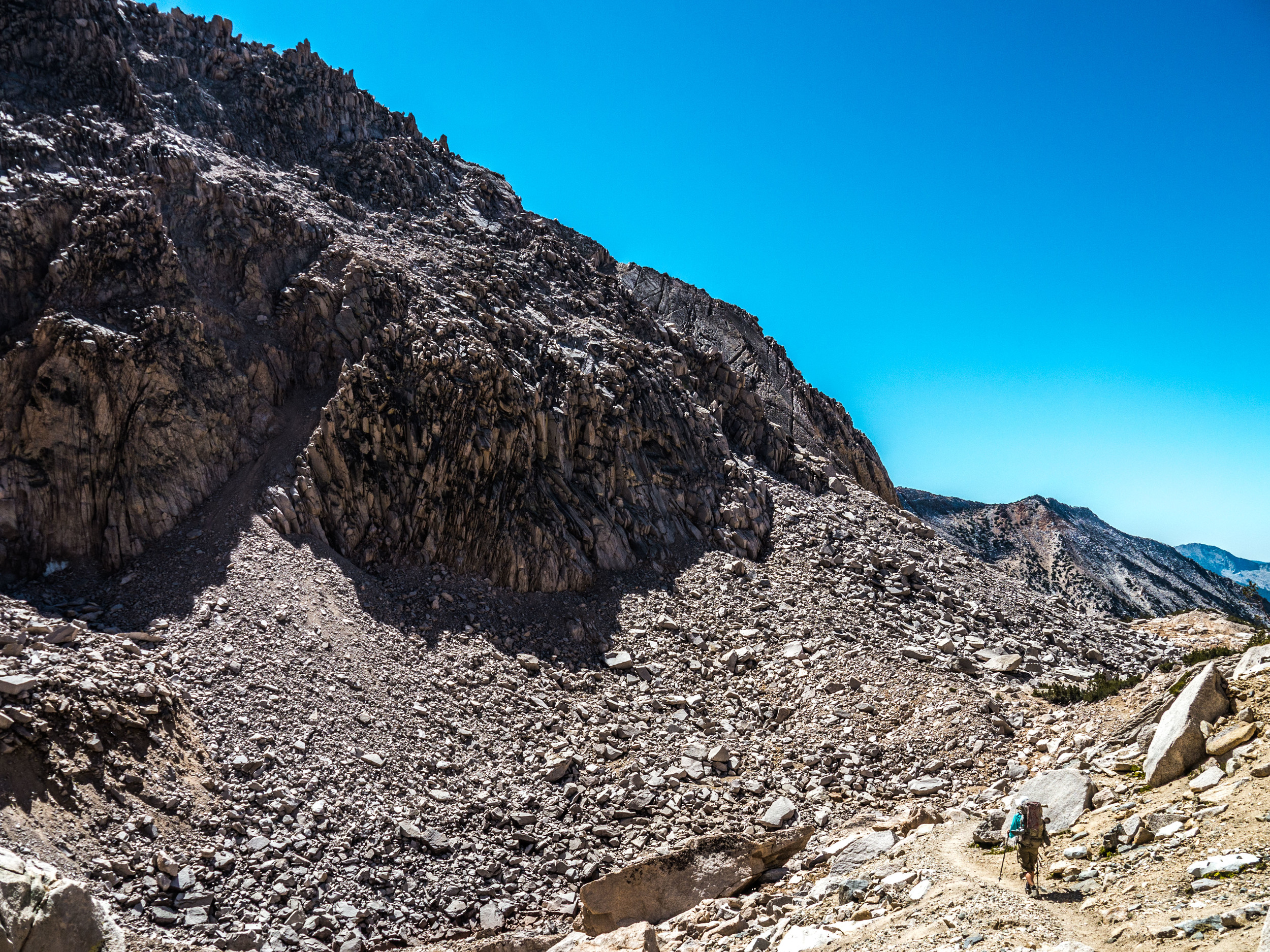
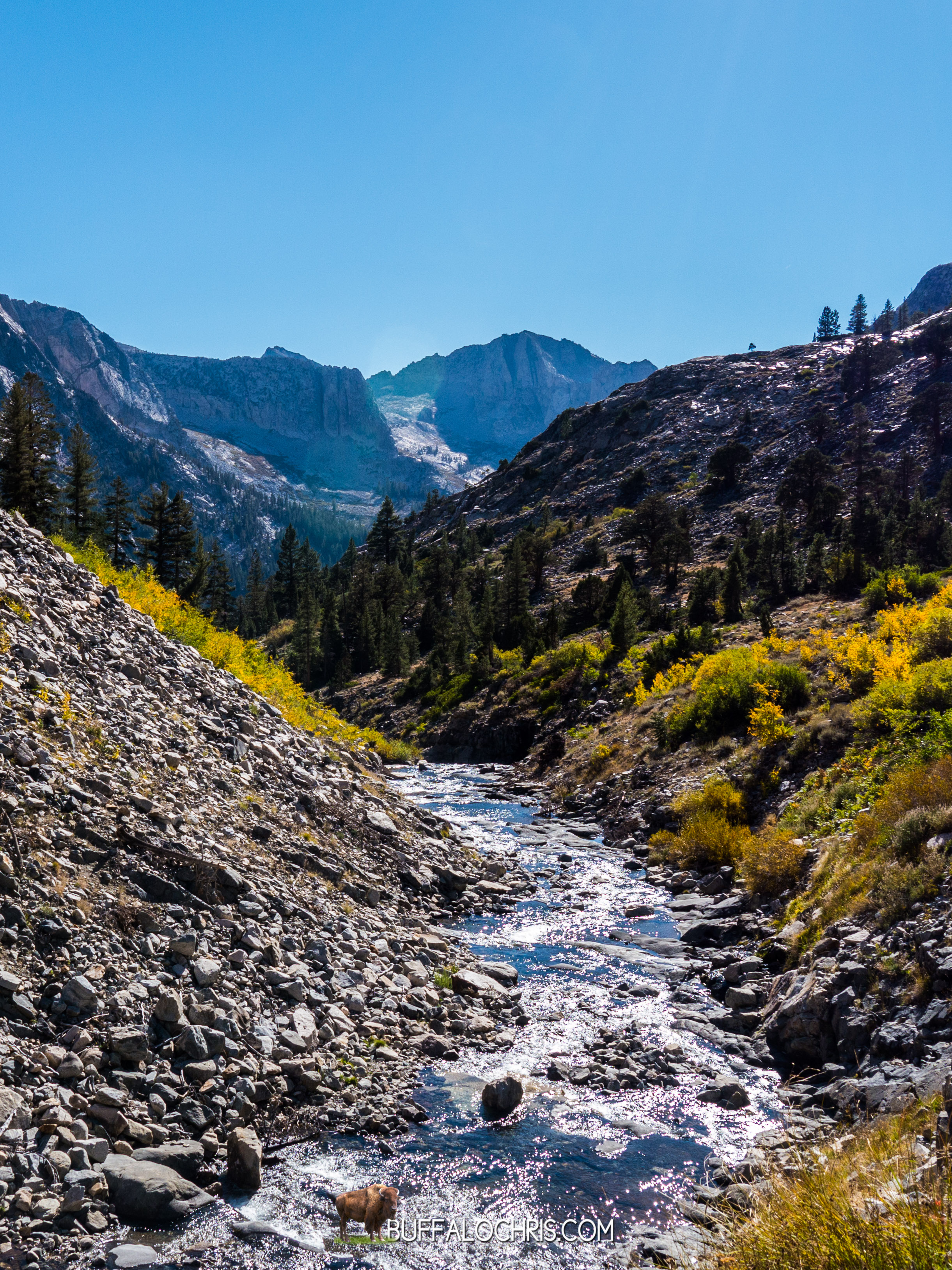
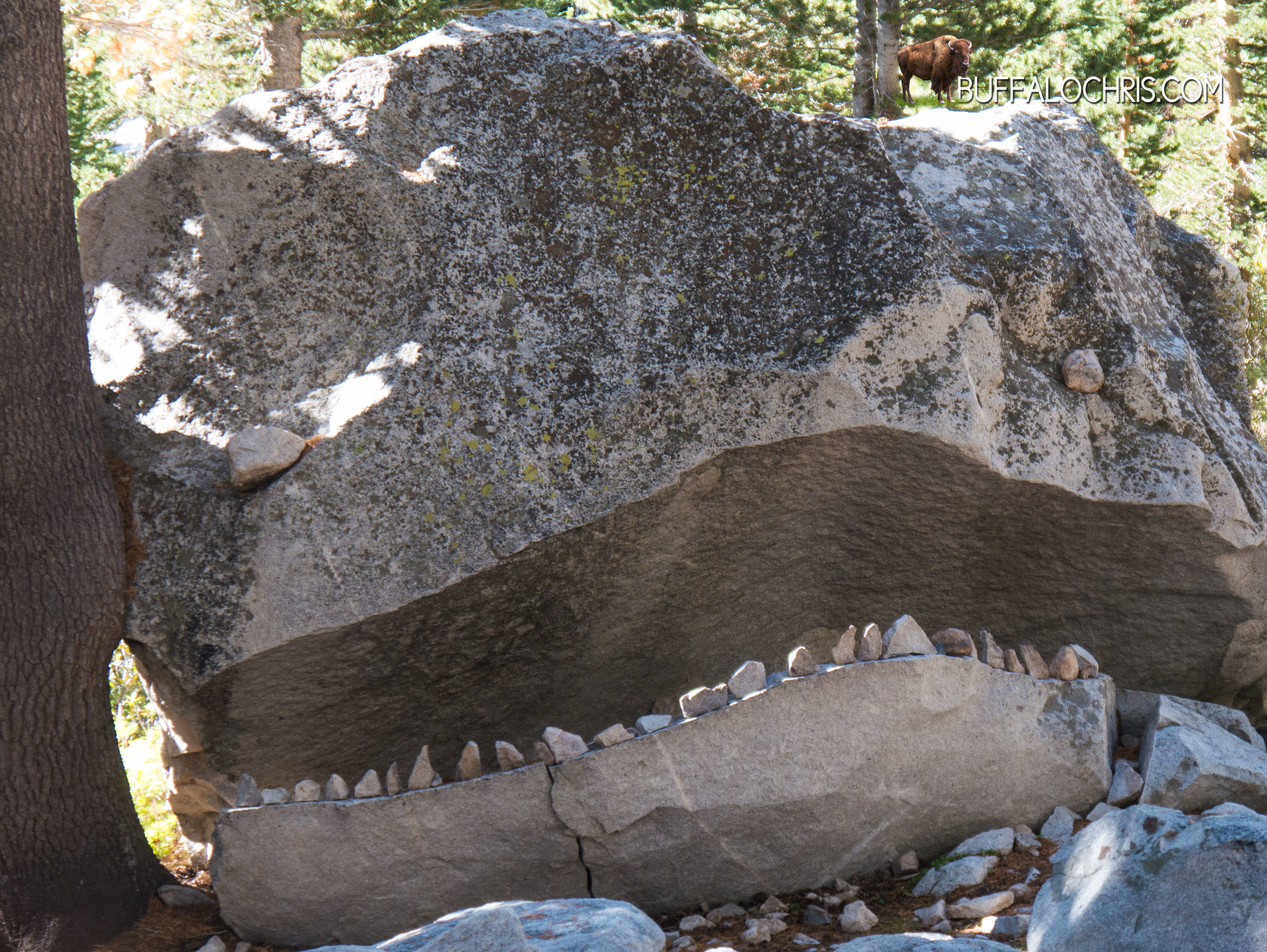
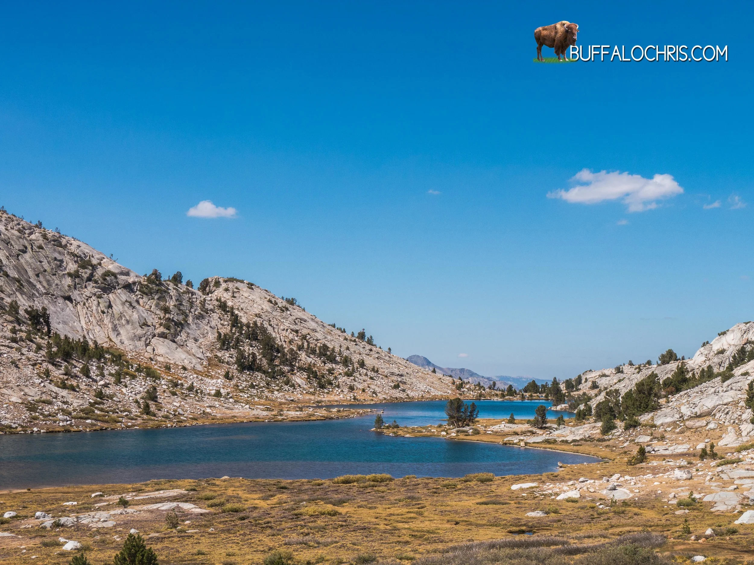
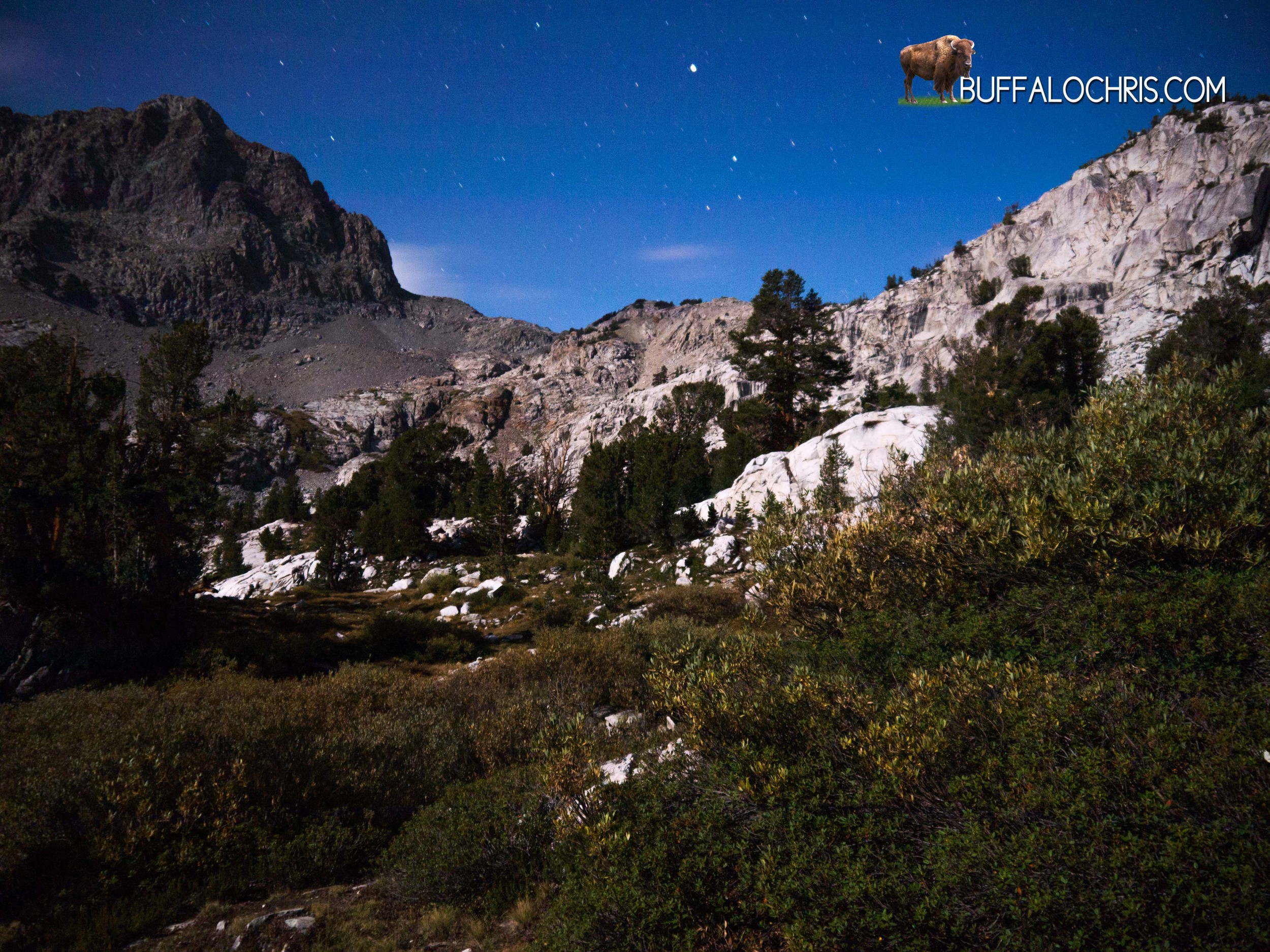
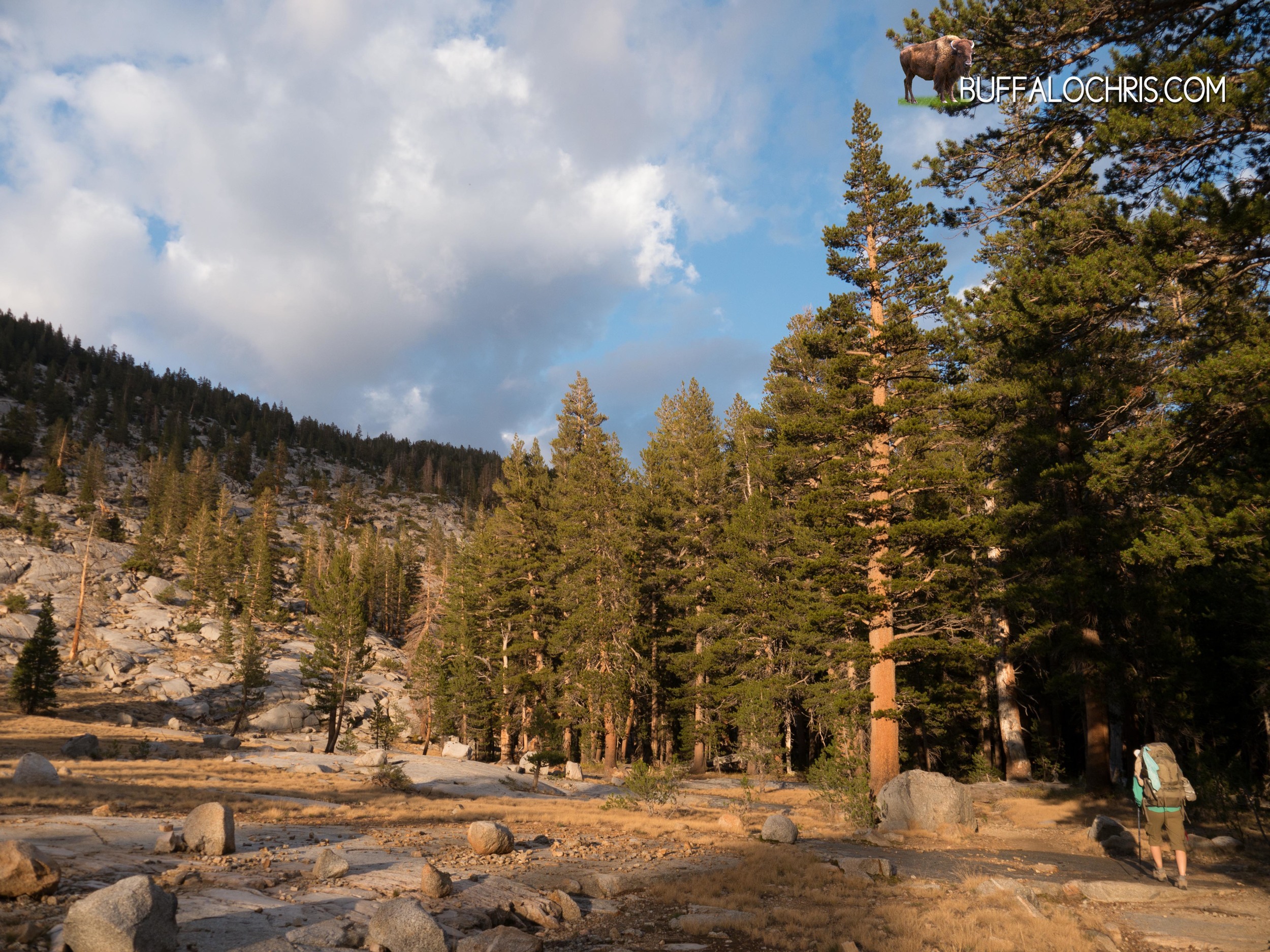
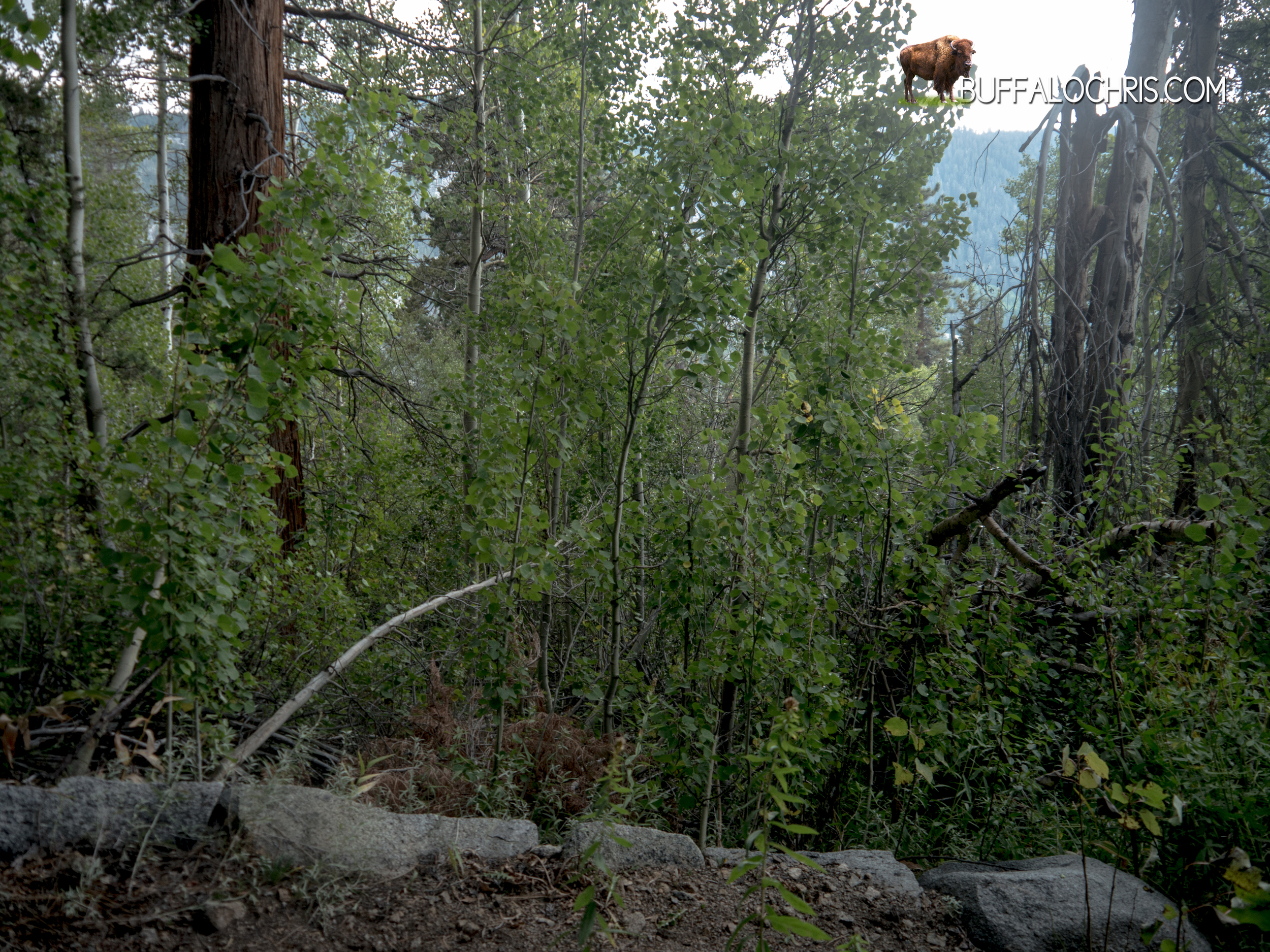
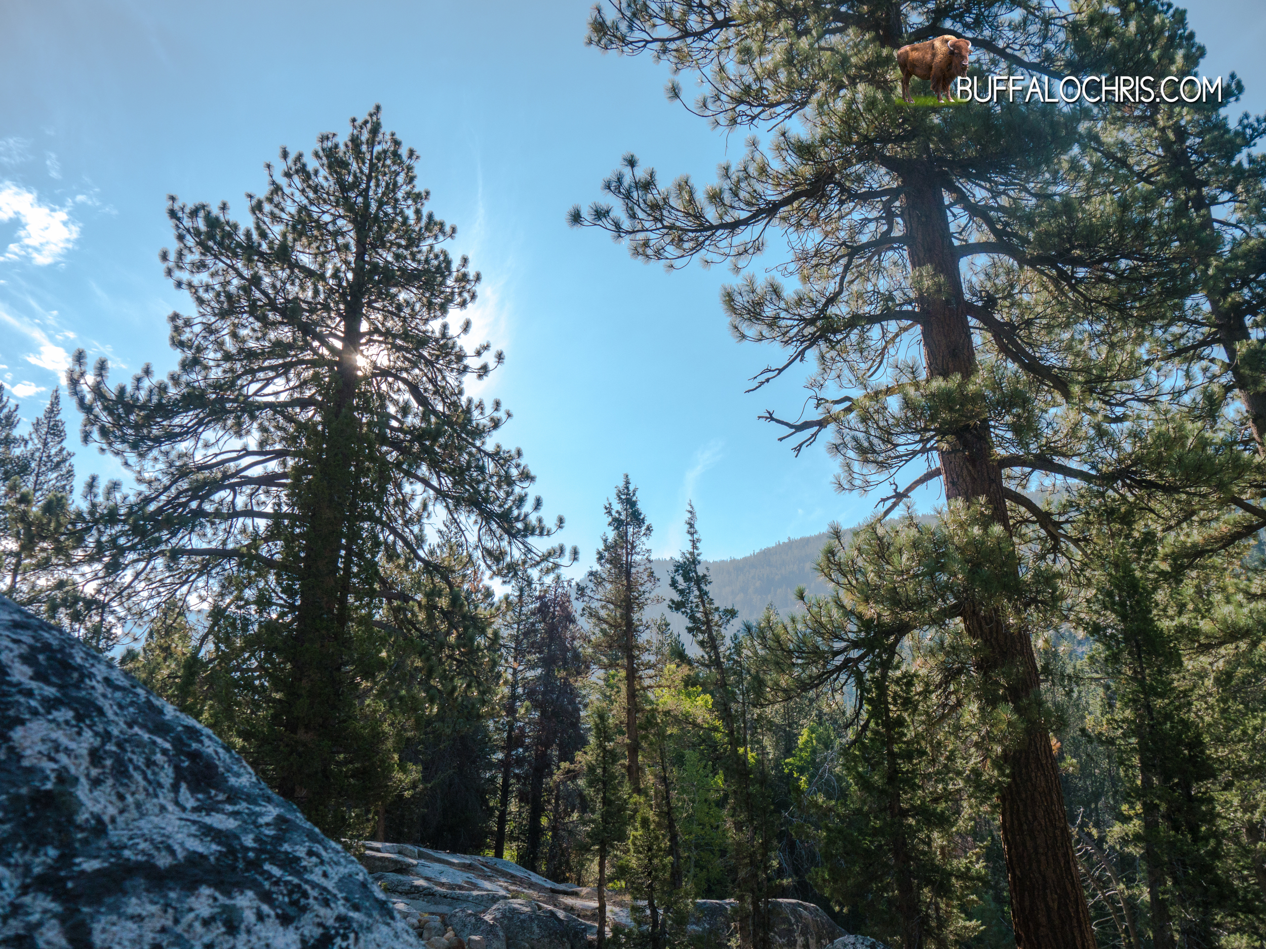
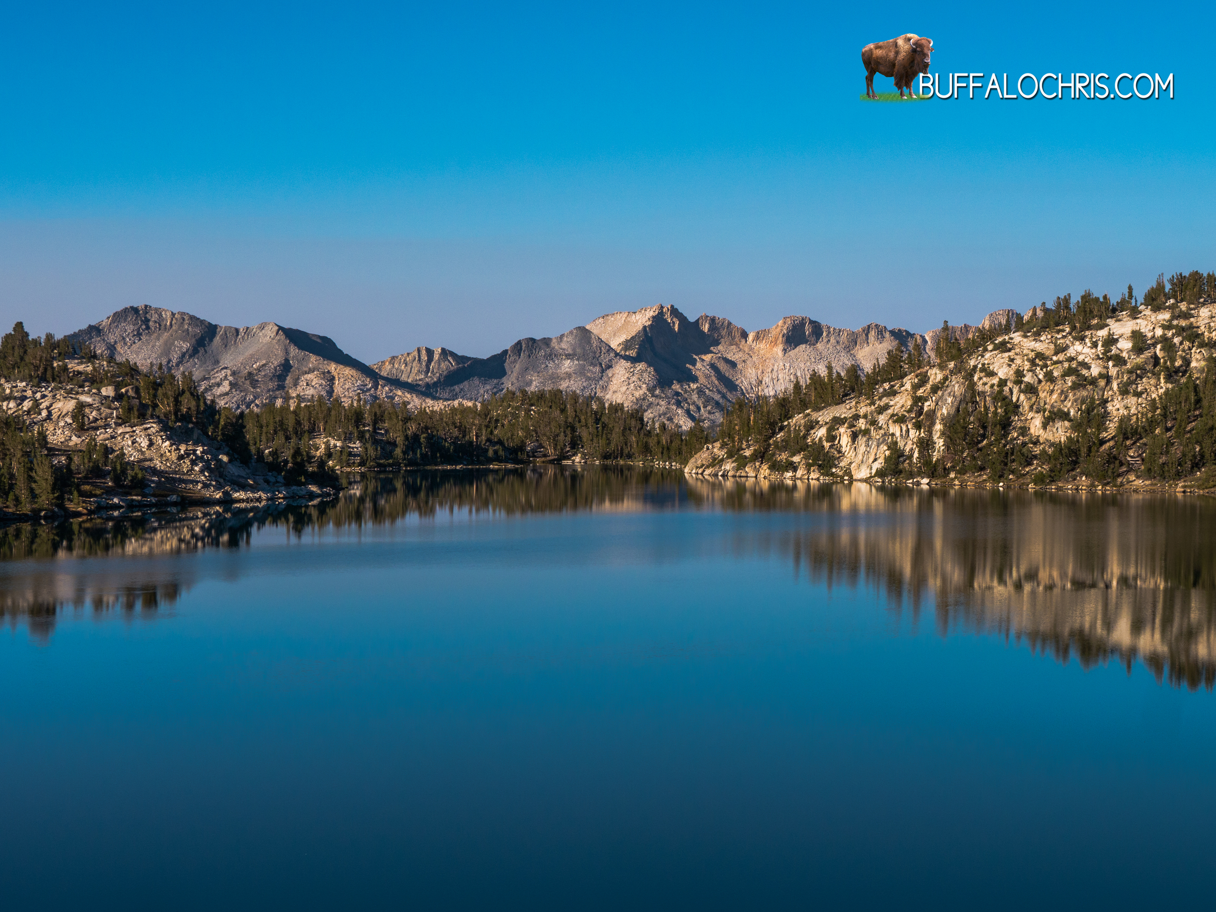
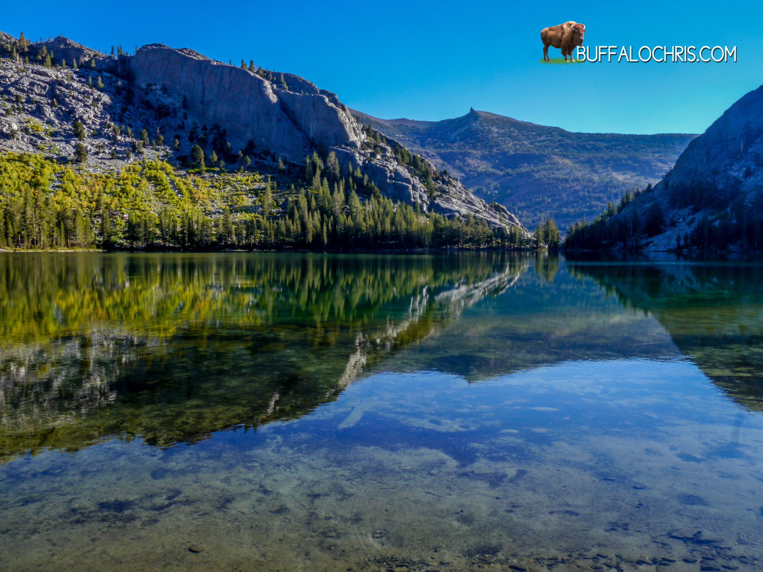
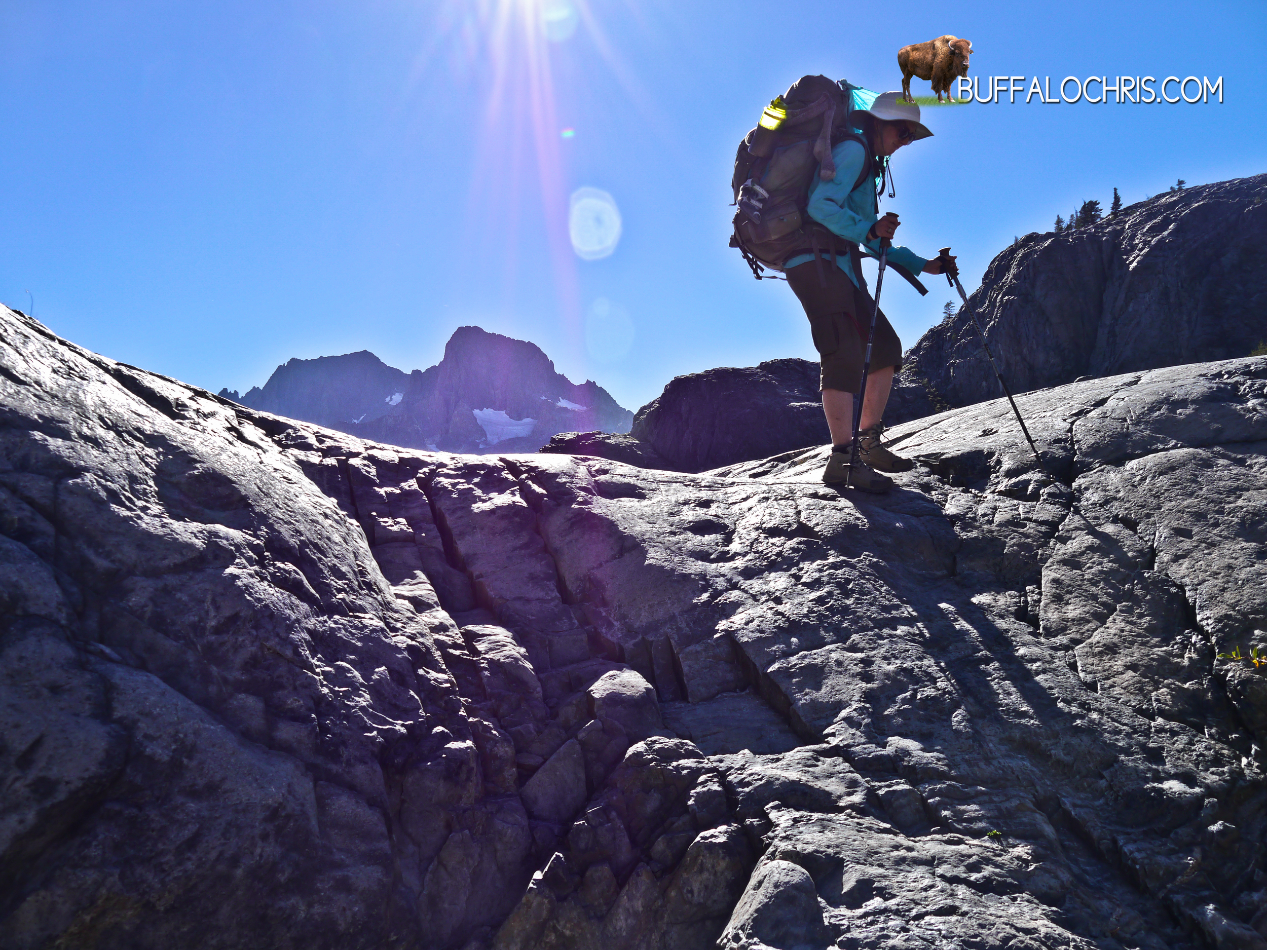
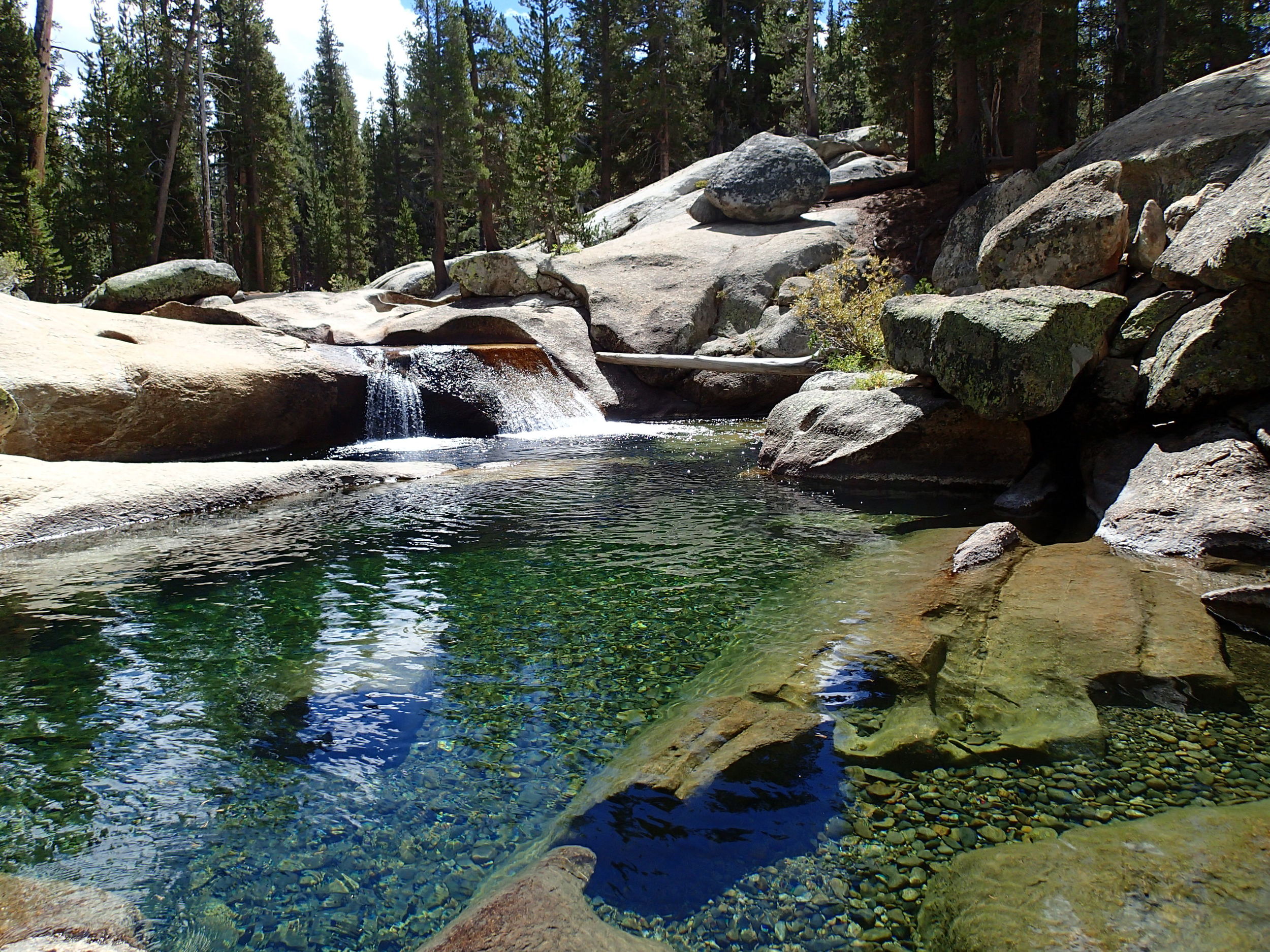
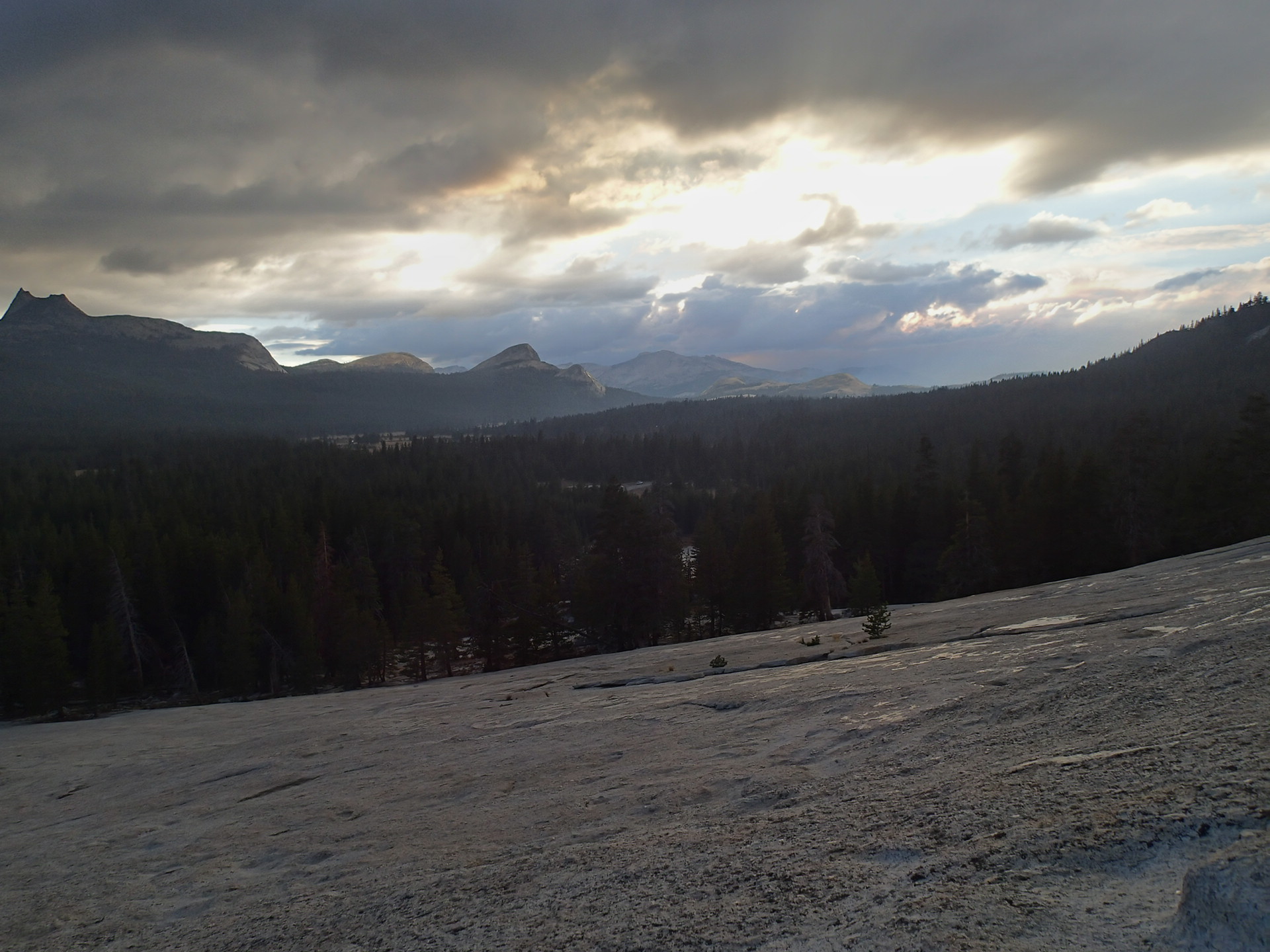
The trail was more sheltered from the wind on the southerly side, almost to the point of an eerie calmness. The rocks had morphed from black on top of the pass to grey to a tan color with the faintest amount of orange tint to them. The lot of rocks sat silent and baked in the warm sun.  It was a dry and dusty descent in an otherworldly landscape of hard angular shards. Scree slopes and fallen boulders and the remnants of once proud spires lay beneath our feet with no sign of vegetation around.  I like to imagine that we kicked up a fair amount of dust in our very deliberate descent. After 30 or 45 minutes, Charlotte Lake could be seen shimmering in the distance.

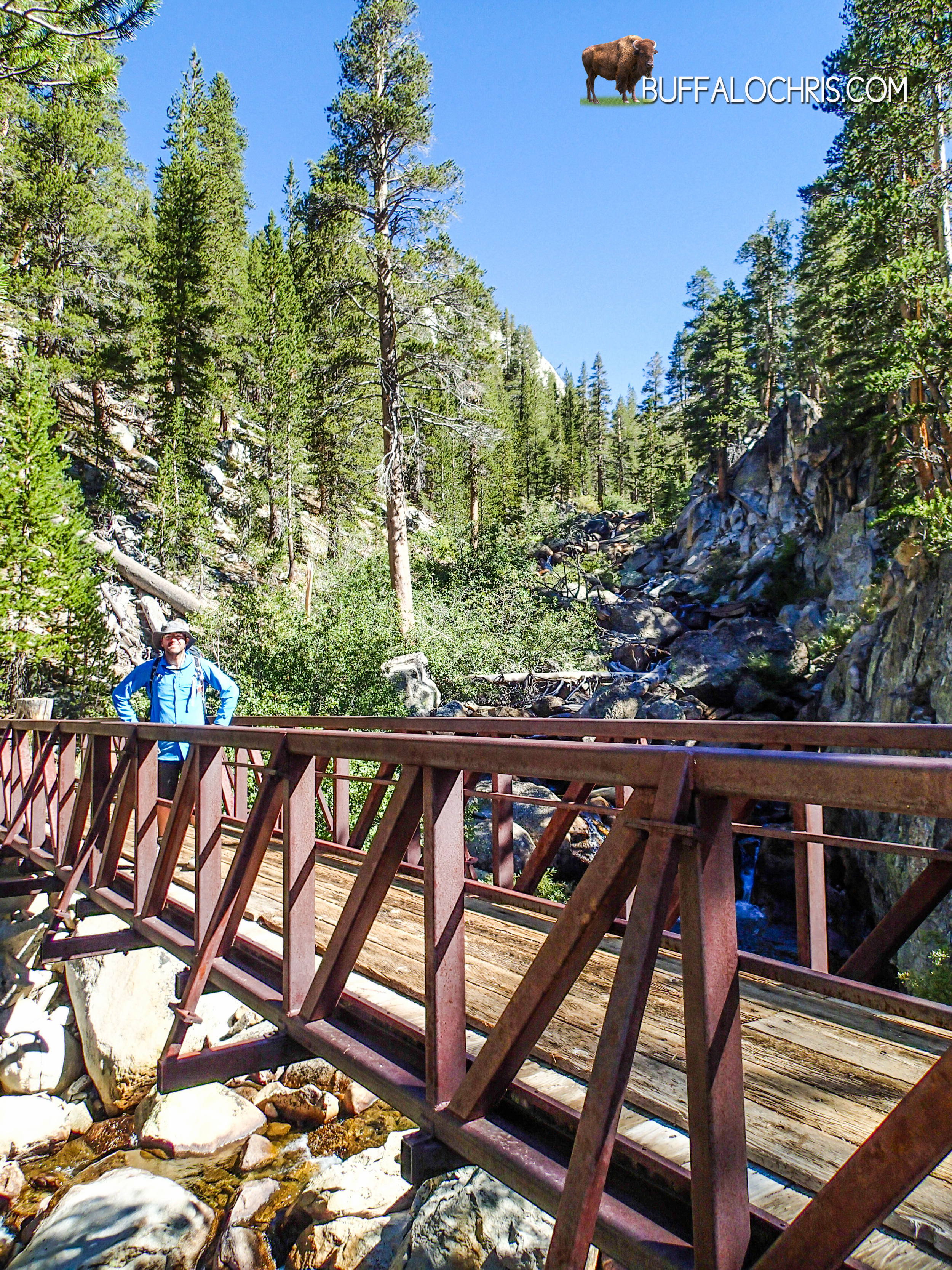
The stretch from the final Rae Lake to Charlotte Lake is long, and it’s quite dry. We were both low on water so it was a relief seeing the source of our impending hydration. 1st Rae Lake was the last reliable filling point, and the ascent over Glen and the xeric extraterrestrial rockscape on the other side offered only opportunities to suck down sips of water from an ephemeral spring here and there but never a spot to refill. 

Descending Glen Pass

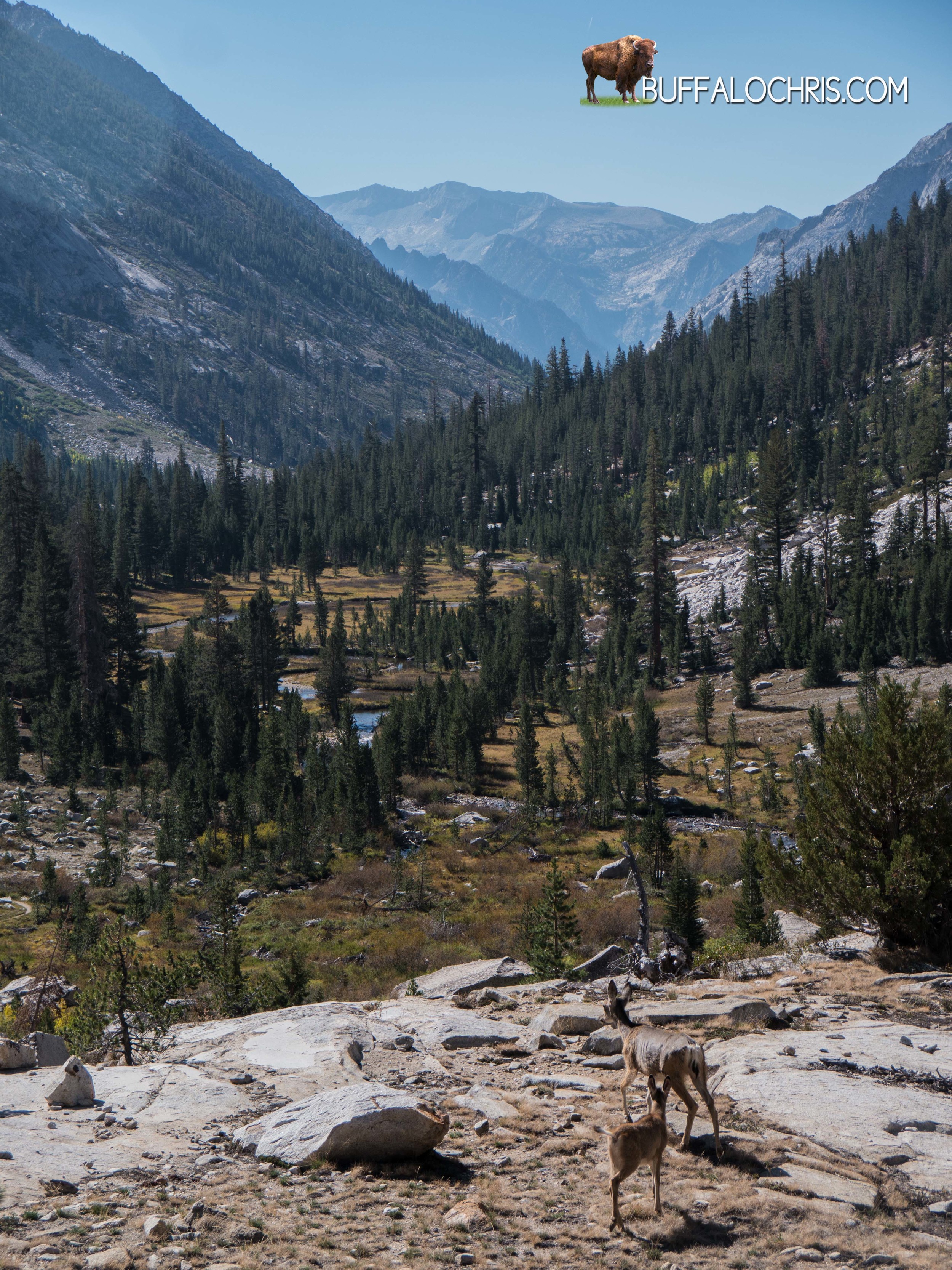
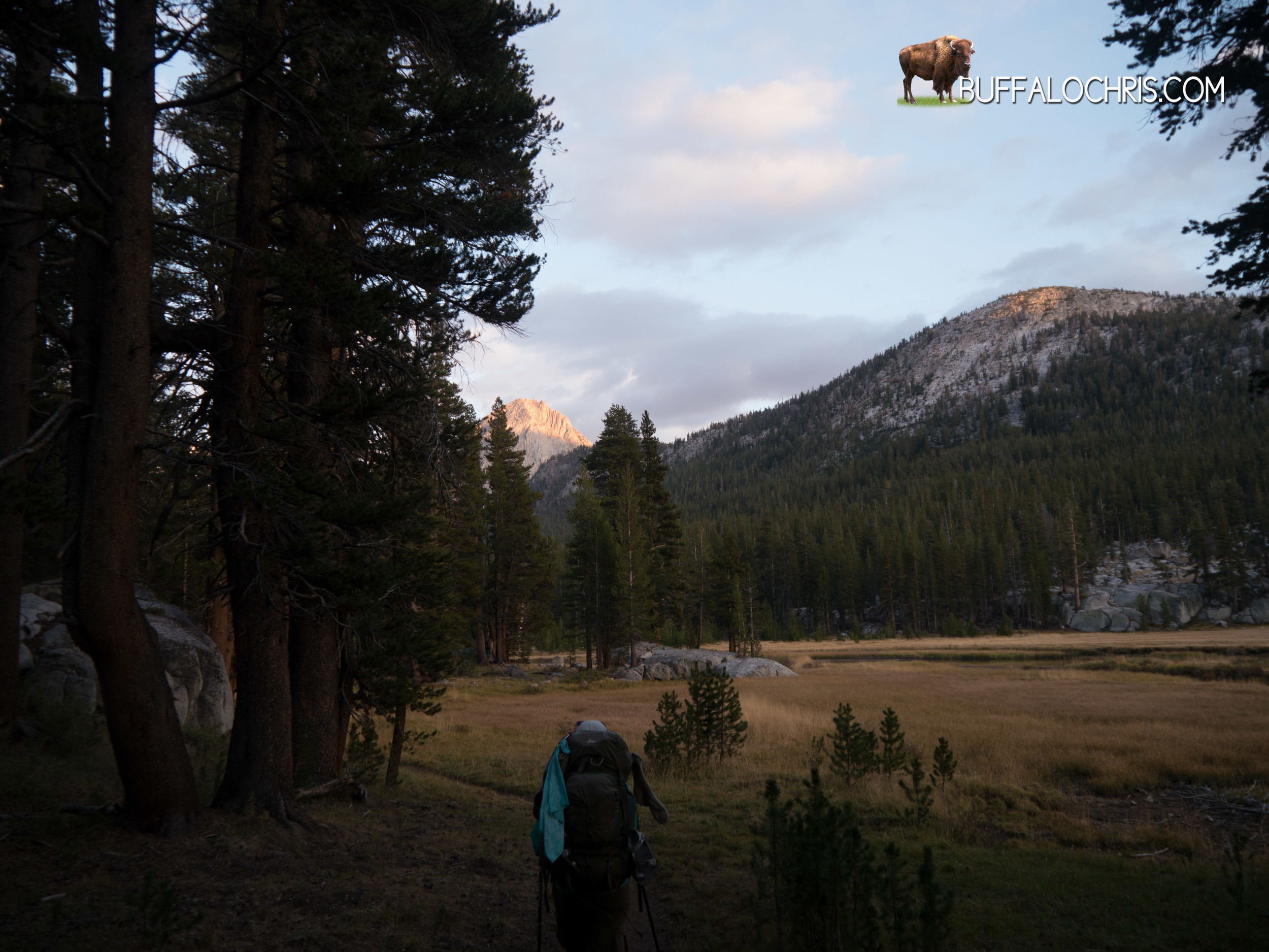
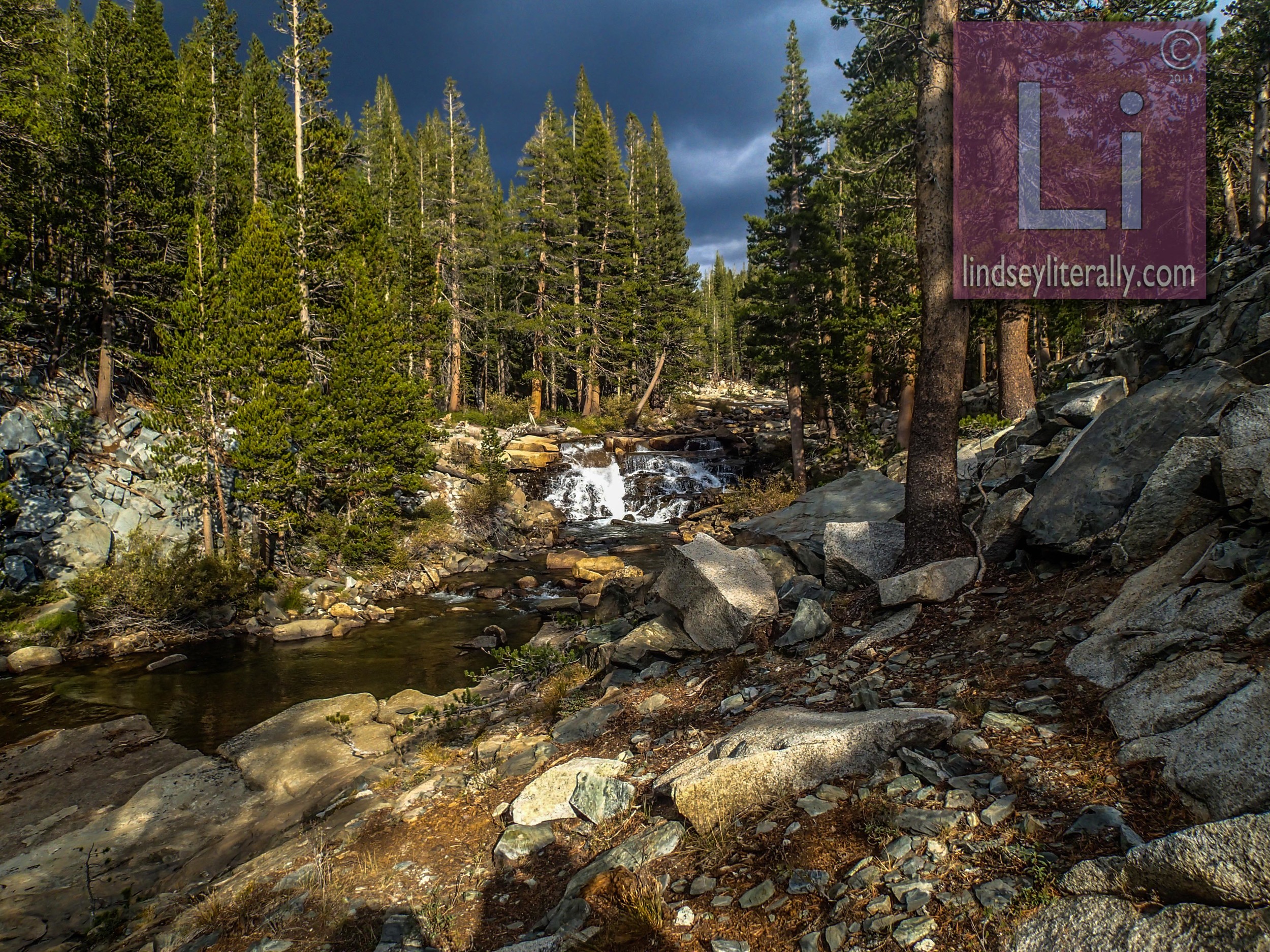
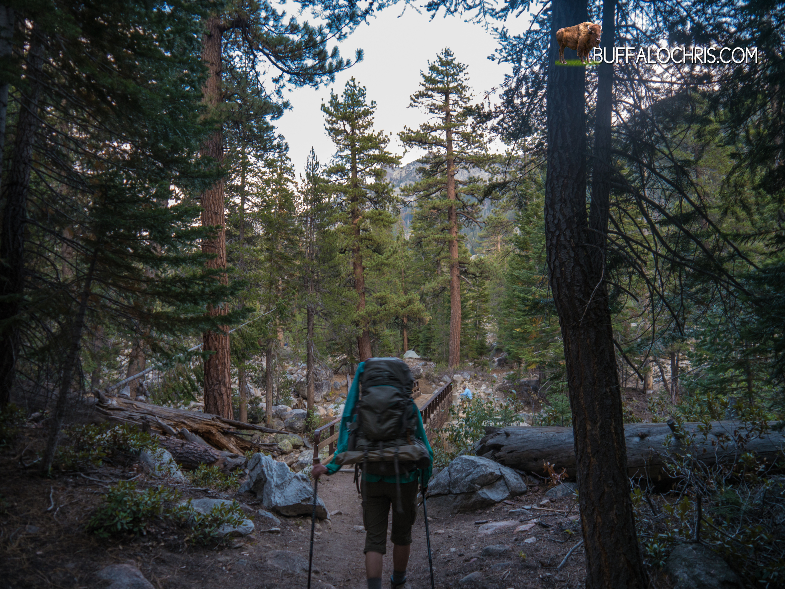
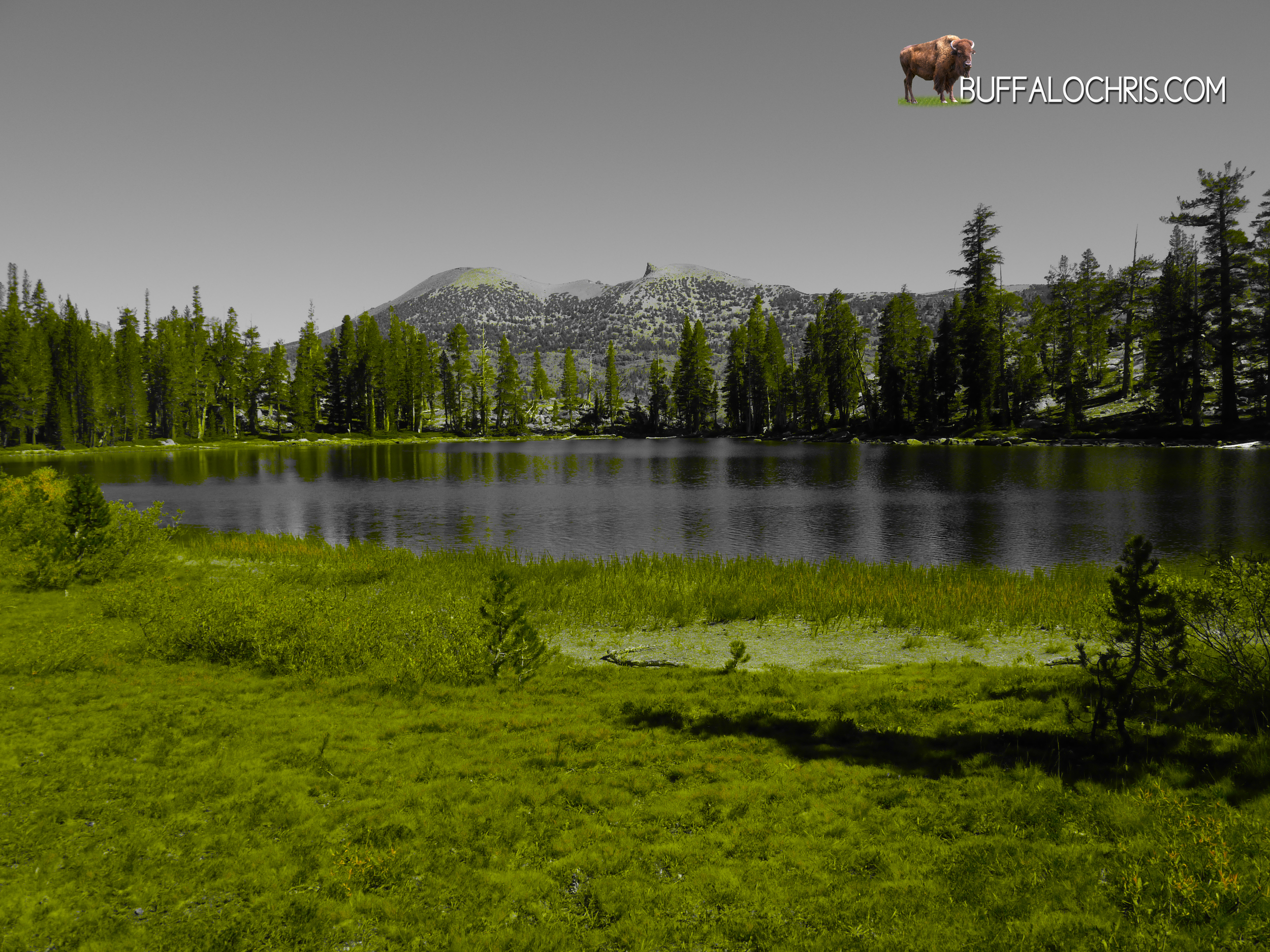
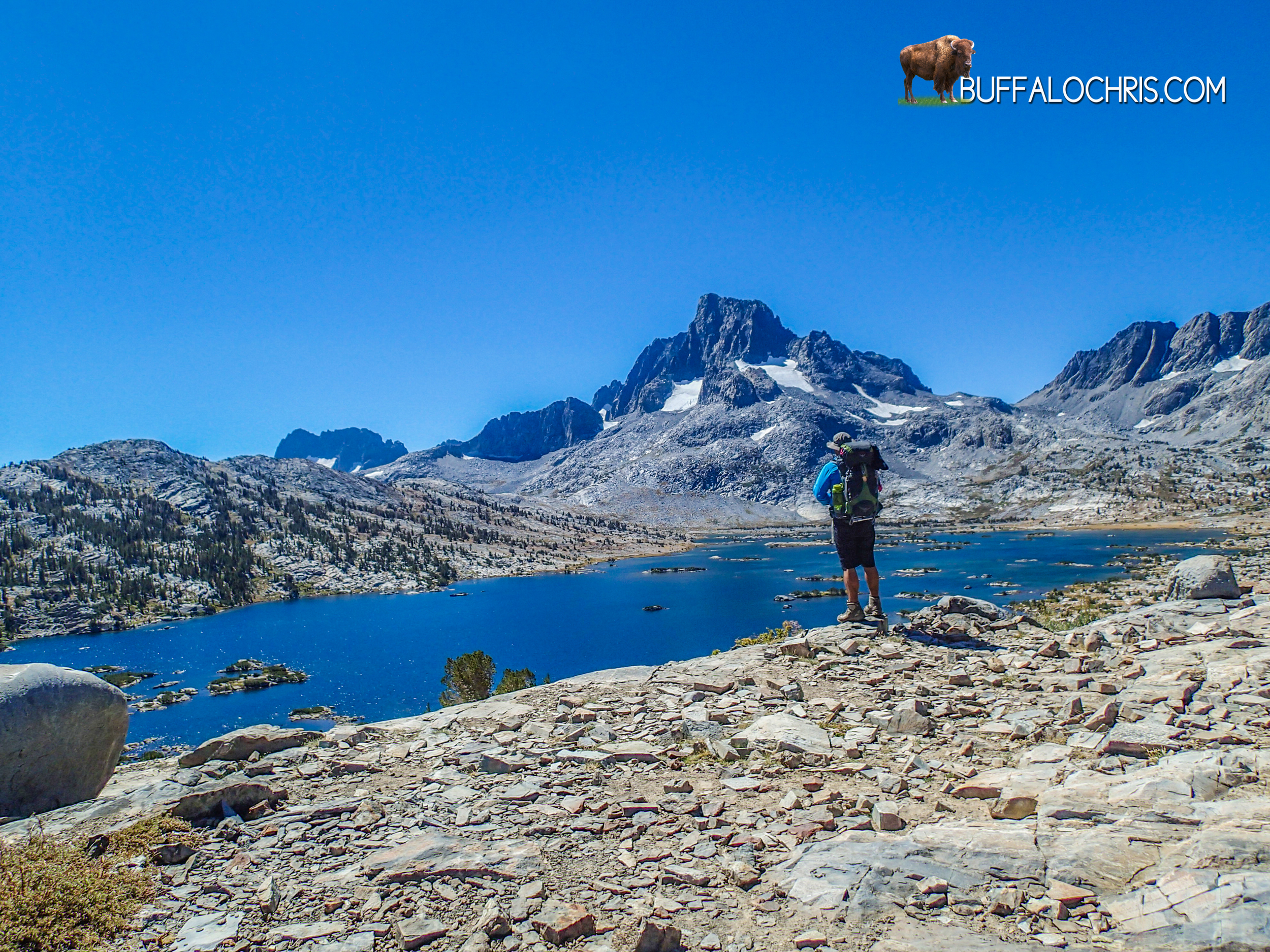
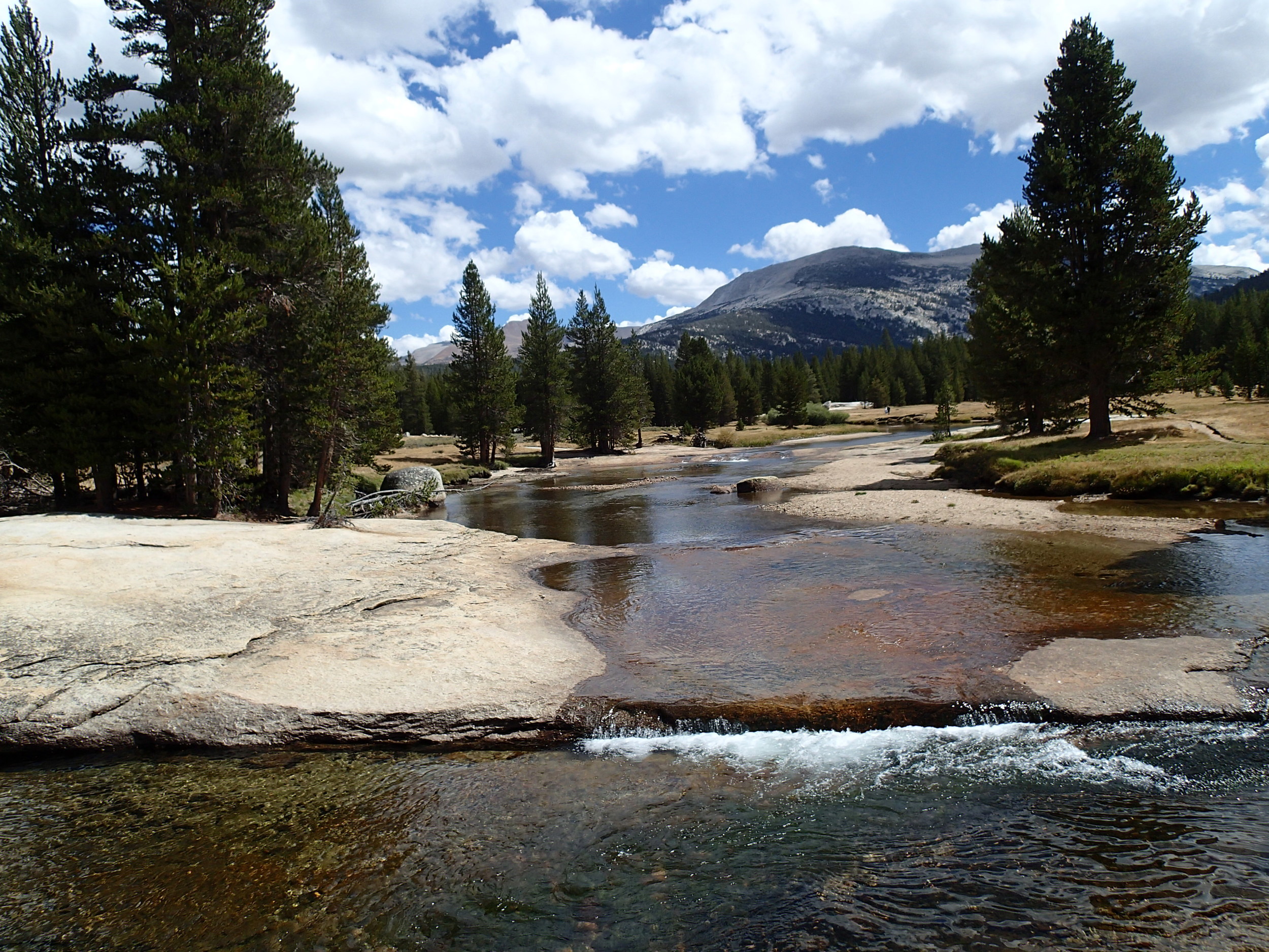
We walked the rocky wasteland further and as we descended it became dotted with greenery. Stout grasses at first, then some short pines that offered a respite from the strengthening afternoon sun. Soon the trees had gathered in density and height enough to pass for a sparse forest. A sparkling gem of ultramarine flashed through tall brown branches and long slender fingers of green pine needles.

“I’m thirtyyyy. I’m tiiiiiired….my feeeeeet hurt….”

Lindsey didn’t acknowledge me, but I thought the comedic timing was perfect.

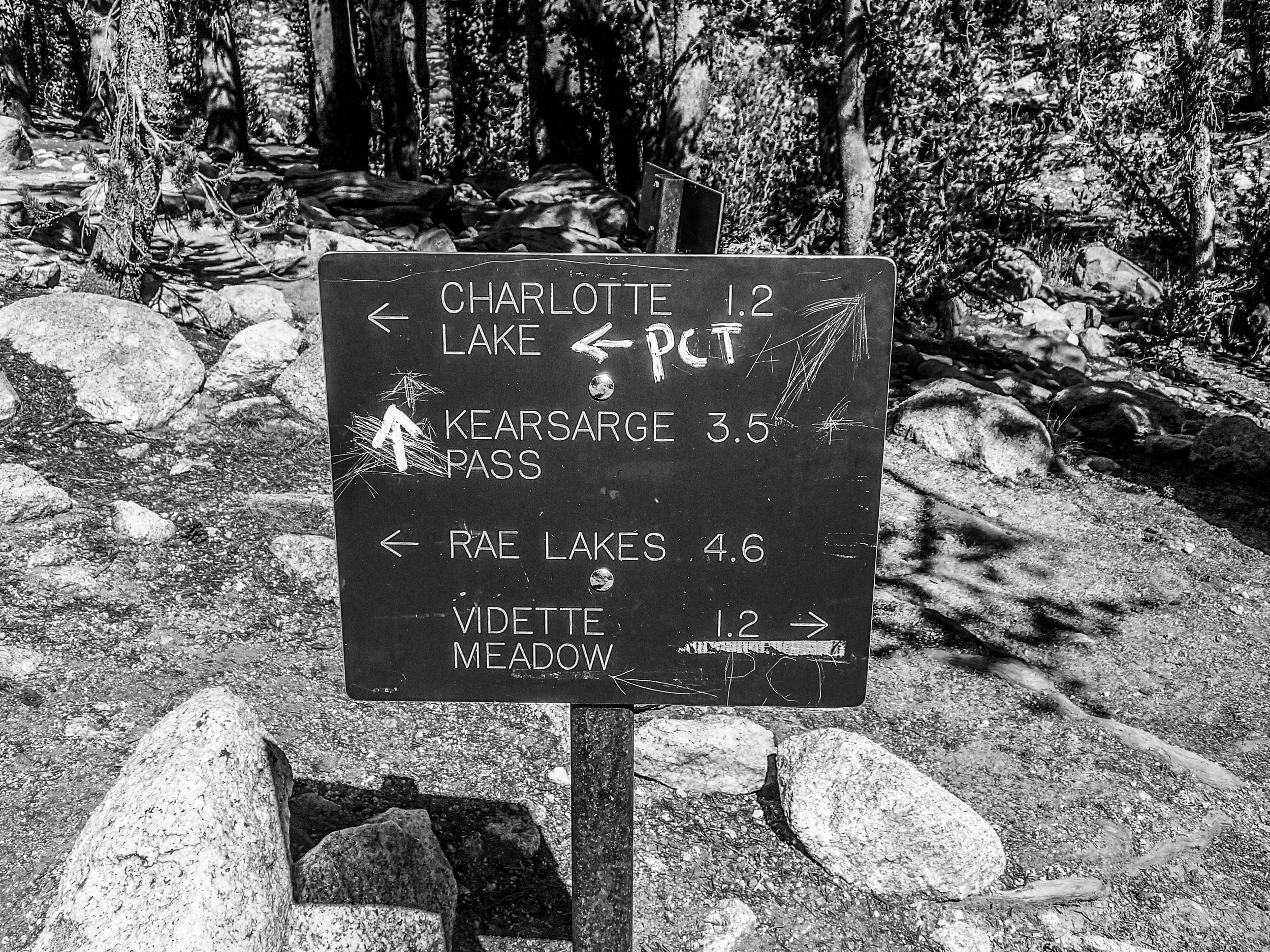
One of the best parts about hiking is trail signs. Trail signs mean you’re getting somewhere. It means you have a choice (most times) or that you need to take in some important new information, like how there are no fires permitted, or how there are bears around that will take your foodstuffs. At the bottom of the steep, seemingly incessant descent we came to such a sign. It was your standard directional sign- an arrow pointing to Charlotte Lake, and arrow pointing down the John Muir Trail. I liked the sign so much I leaned on it while Lindsey went down a short spur trail to extract water from Charlotte Lake.

No sense in us both walking further than we had to…

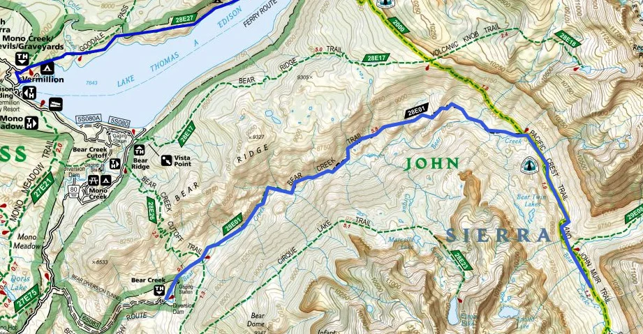
There are two trails that exit over Kearsarge Pass. One is a high road, the junction for which meets up with the John Muir Trail about .3 miles before the turn off for Charlotte Lake. The high road doesn’t go by any water sources, though. The lower road takes you down in elevation but scampers past the junction to Charlotte Lake and the northern side of Bull Frog Lake before ultimately climbing back up the 300 or so feet lost as it meets the high road. Both paths converge  after a couple of miles and turn in to a singular trail that leads over Kearsarge Pass and down to Onion Valley.

On a dusty, warm, barren clearing on a small hill we reached our junction with the low road. The sign stared at us like a bouncer. Kearsarge Pass via Bullfrog Lake, this way. John Muir Trail, the other way.

I knew if I stared and thought about the sign and the implications of our turn long enough I might over think things or continue down the JMT. I glanced at the sign, looked down the trail towards Kearsarge Pass and Onion Valley, and put one foot in front of the other. That was it. We were done with the John Muir Trail.

Some 5 or 6 weeks prior to that exact moment, a man that called himself Riley appeared at the end of the Onion Valley Road just west of Independence, California. It might not be ironic, but it is fitting, if nothing else, that this man would be the first person we’d have met in Tuolumne Meadows. Riley was camped adjacent to us in Tuolumne Meadows as he had just finished his trek from Kearsarge to Tuolumne; the exact opposite of our eventual path.

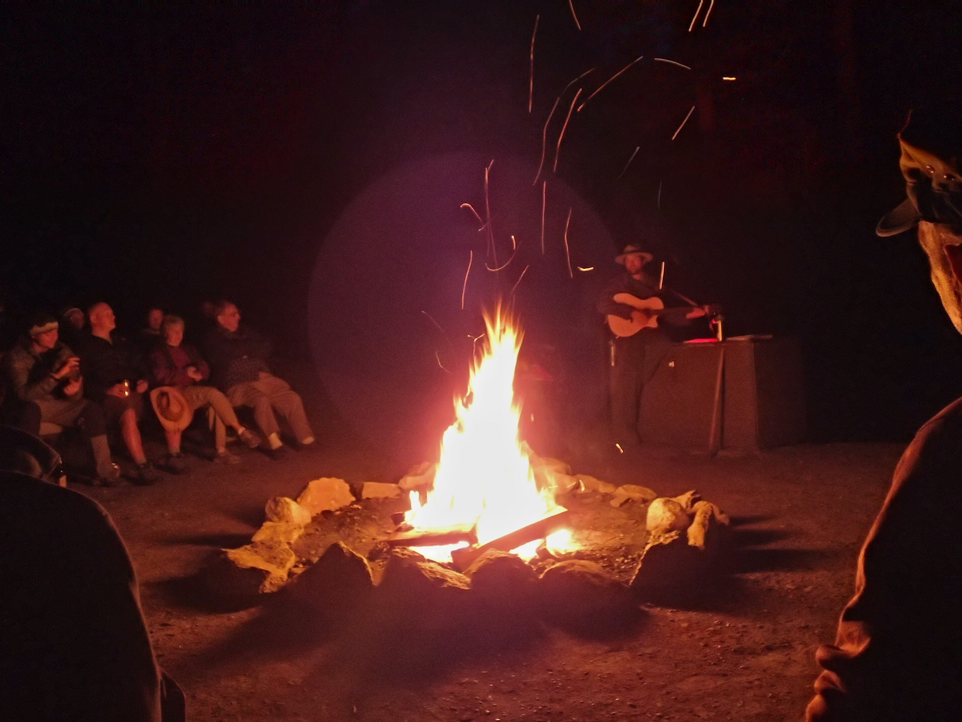
The first night of the entire trip, with the glow of the fire in the center of our world, and the world rife with excitement, wonder, and adventure, Lindsey and I listened to Riley talk of his failed attempts at getting a Whitney permit, of bear sightings, of sharing a single person tent with his girlfriend for a couple of nights when she joined him, and of the Rim Fire.

“Yeah I had to come in over Kearsarge.” He said.

I nodded and smiled, assuming he had mispronounced something since I’d never heard of anything called Kearsarge.

“Going South to North is hard, but by day 4 or 5 your body adapts and you’re good to go.” He’d said.

Riley was long gone by now, but I couldn’t help but think about him walking this same stretch of trail, only in reverse. We marched out knowing it was an end. Riley pounded the dirt with his trail runners knowing it was the beginning.

There’s uncertainty with beginnings. As the sun rises, no one knows what the day might bring. Just so on a hike of this scale. There’s expectation, a buildup, and finally a resolution; a sunset. For Lindsey and I, we could see the sun was setting sooner than we’d originally planned.

Kearsarge Pinnacles

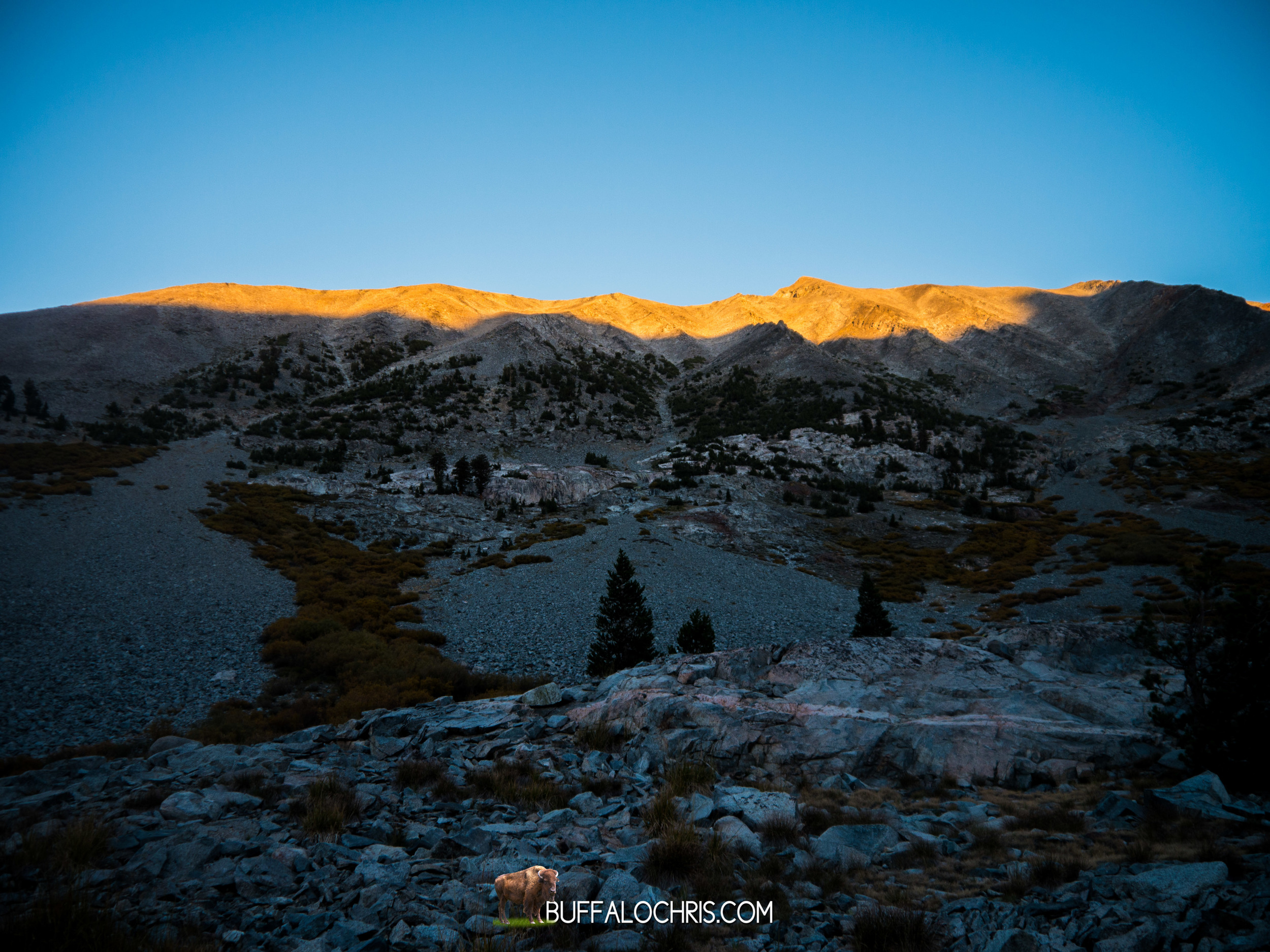
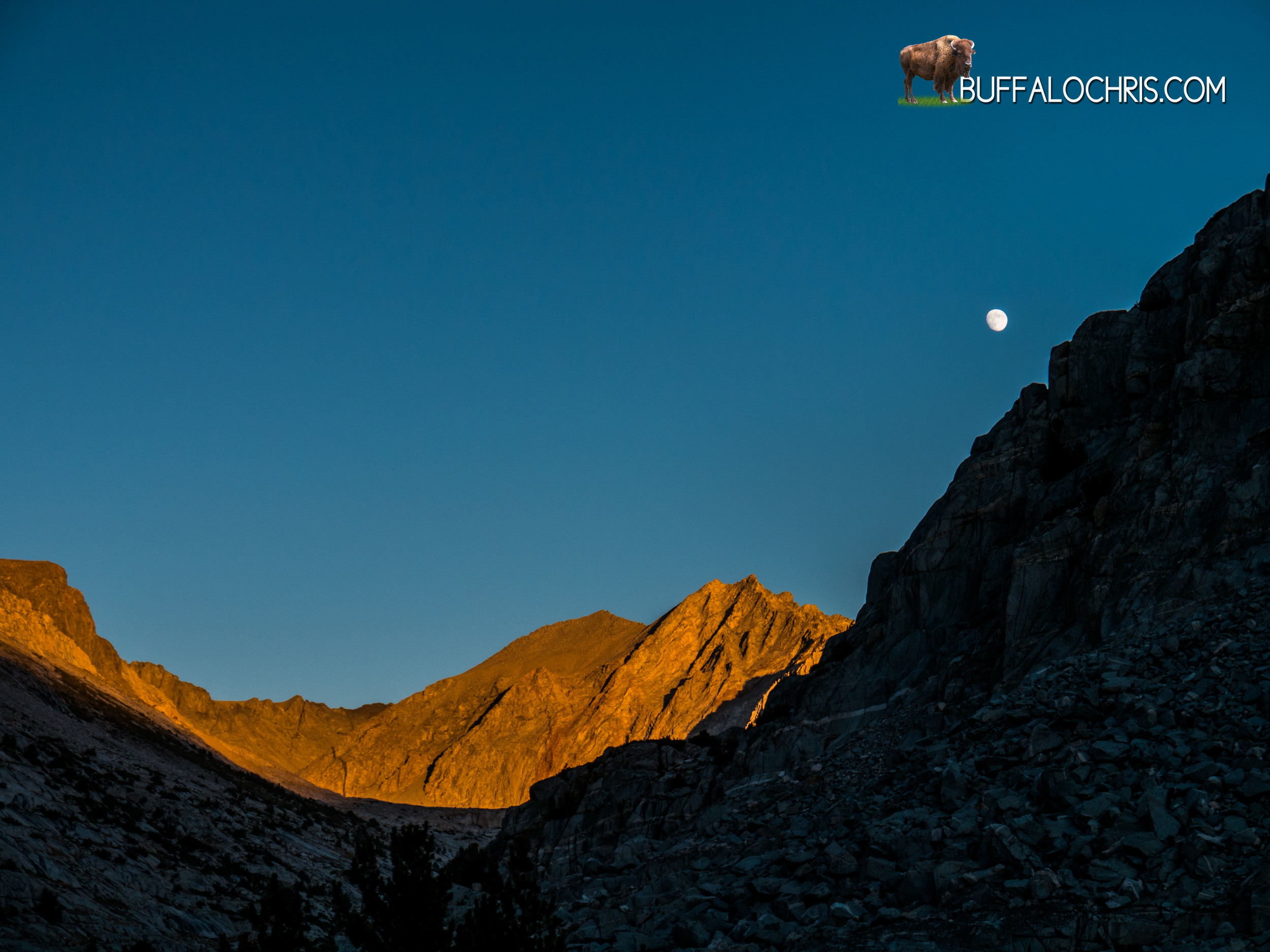
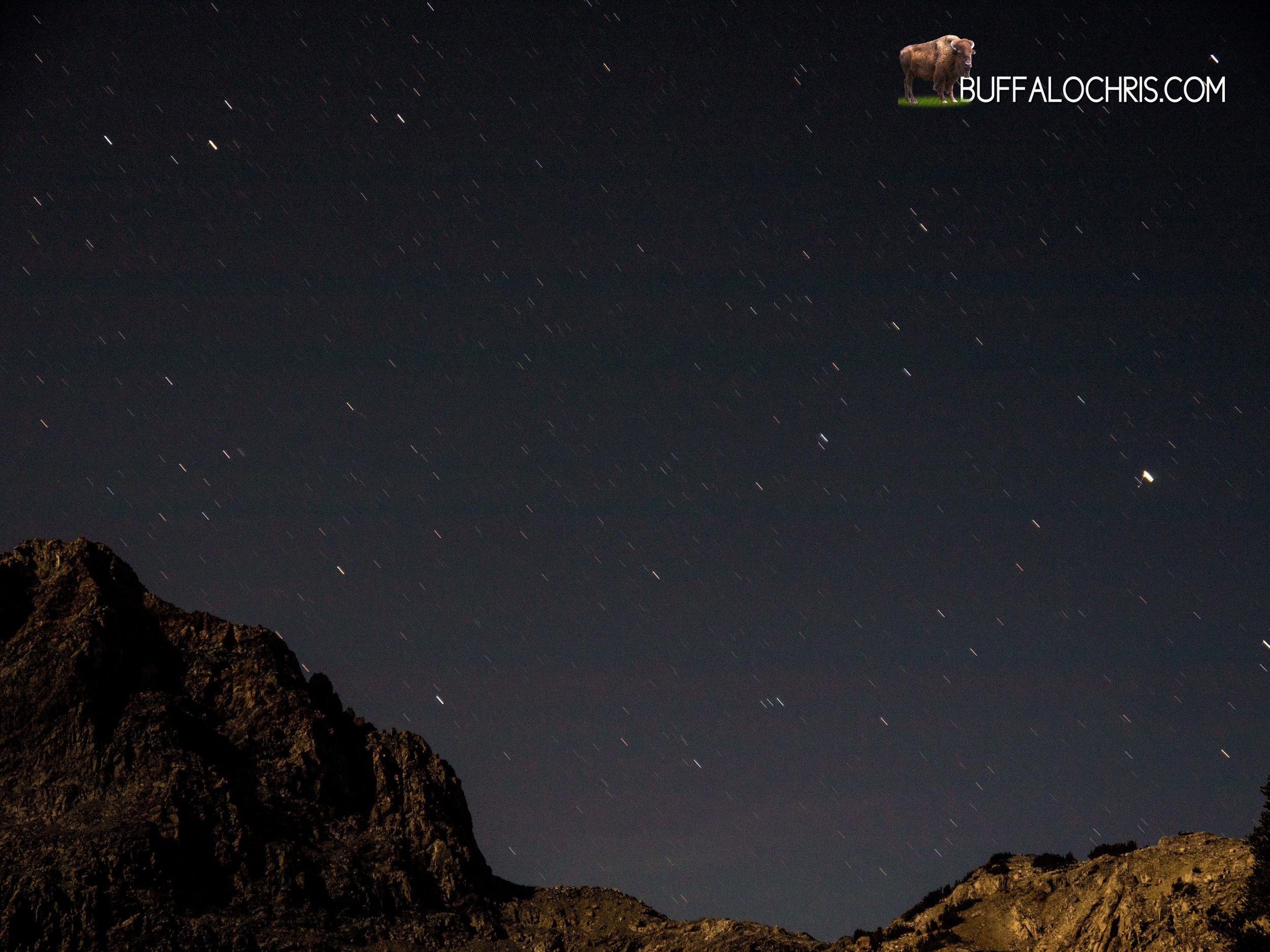
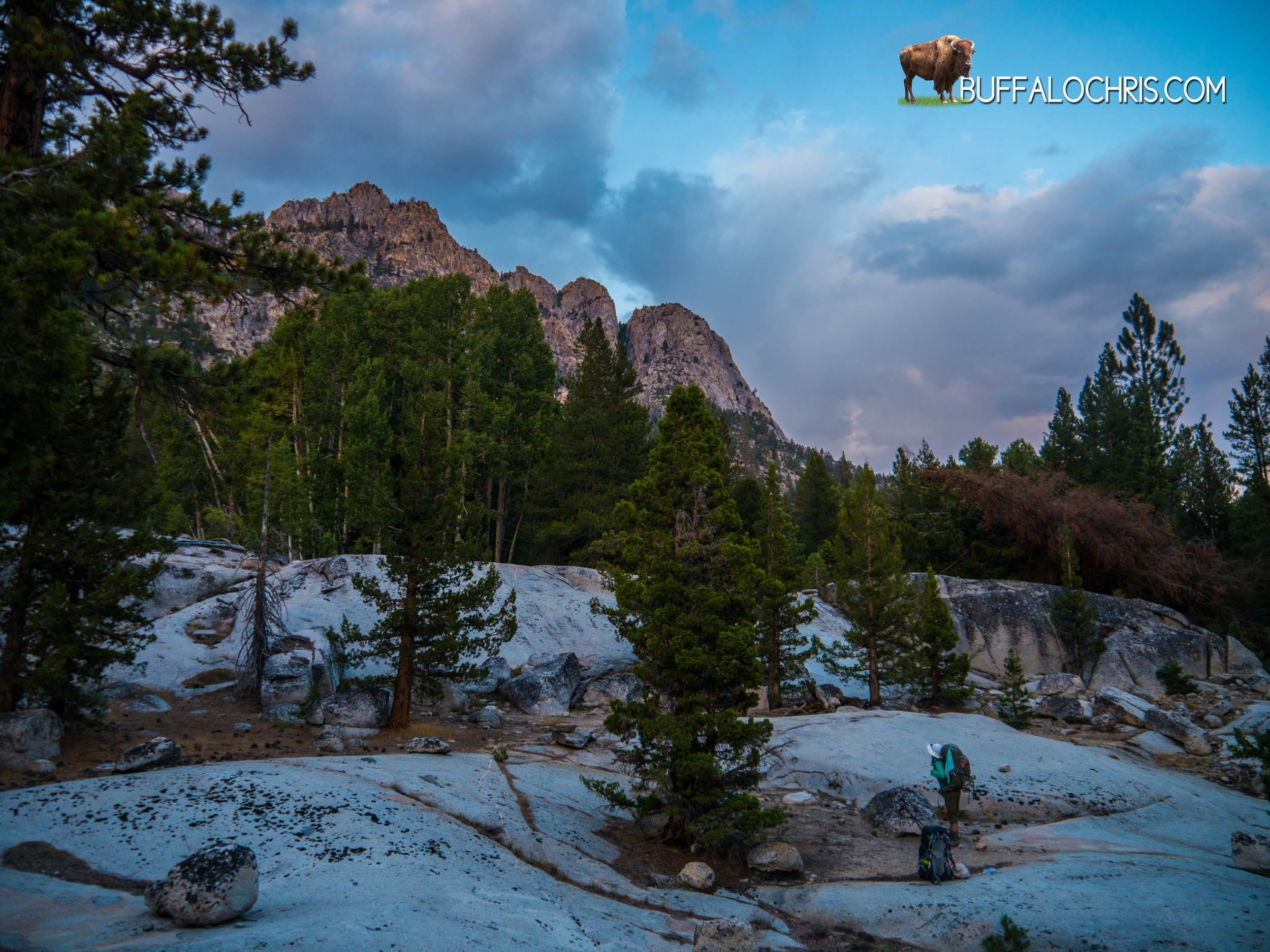
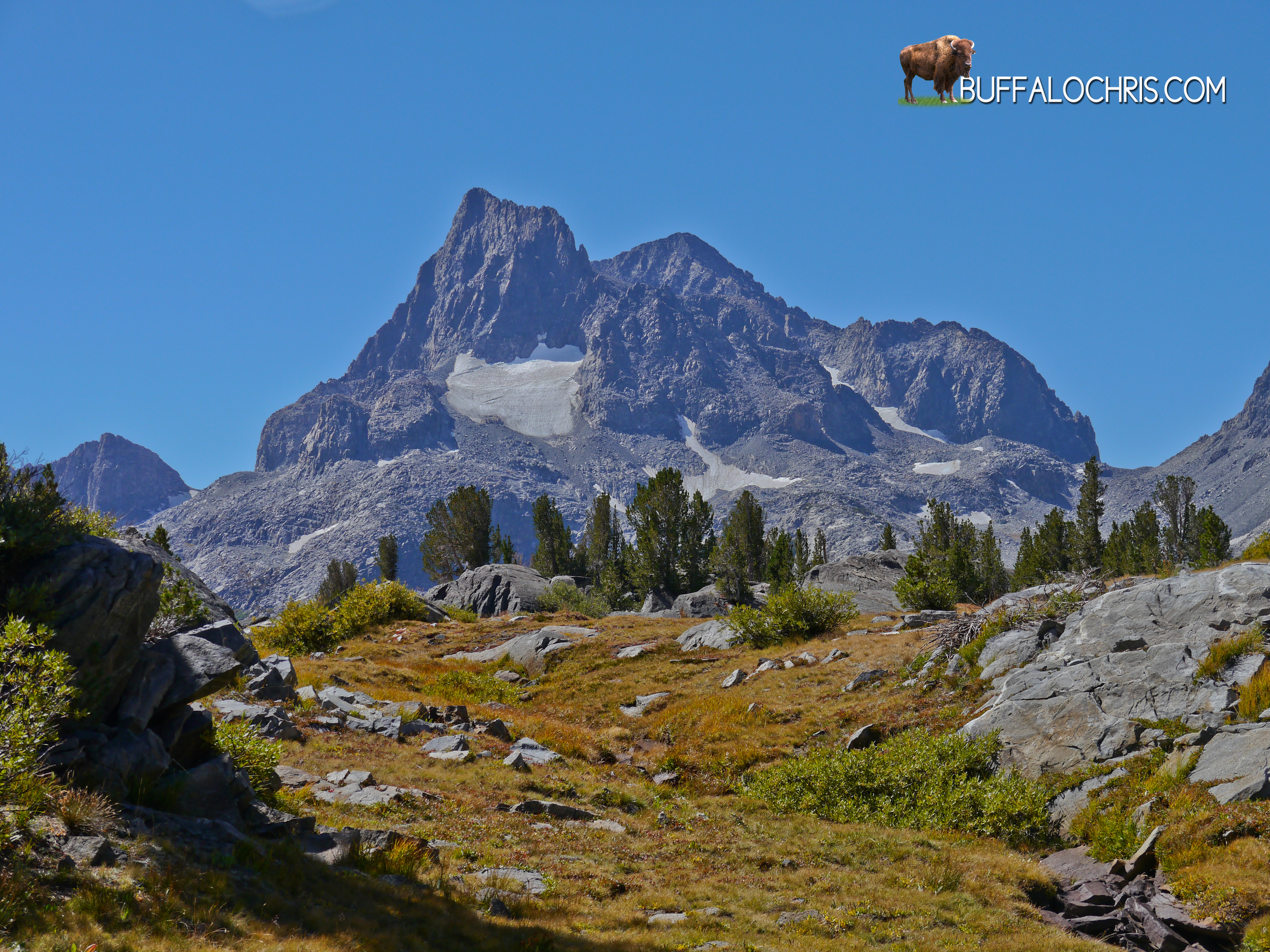
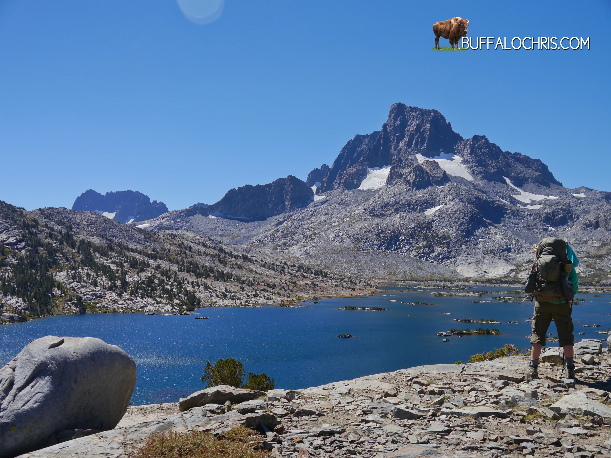
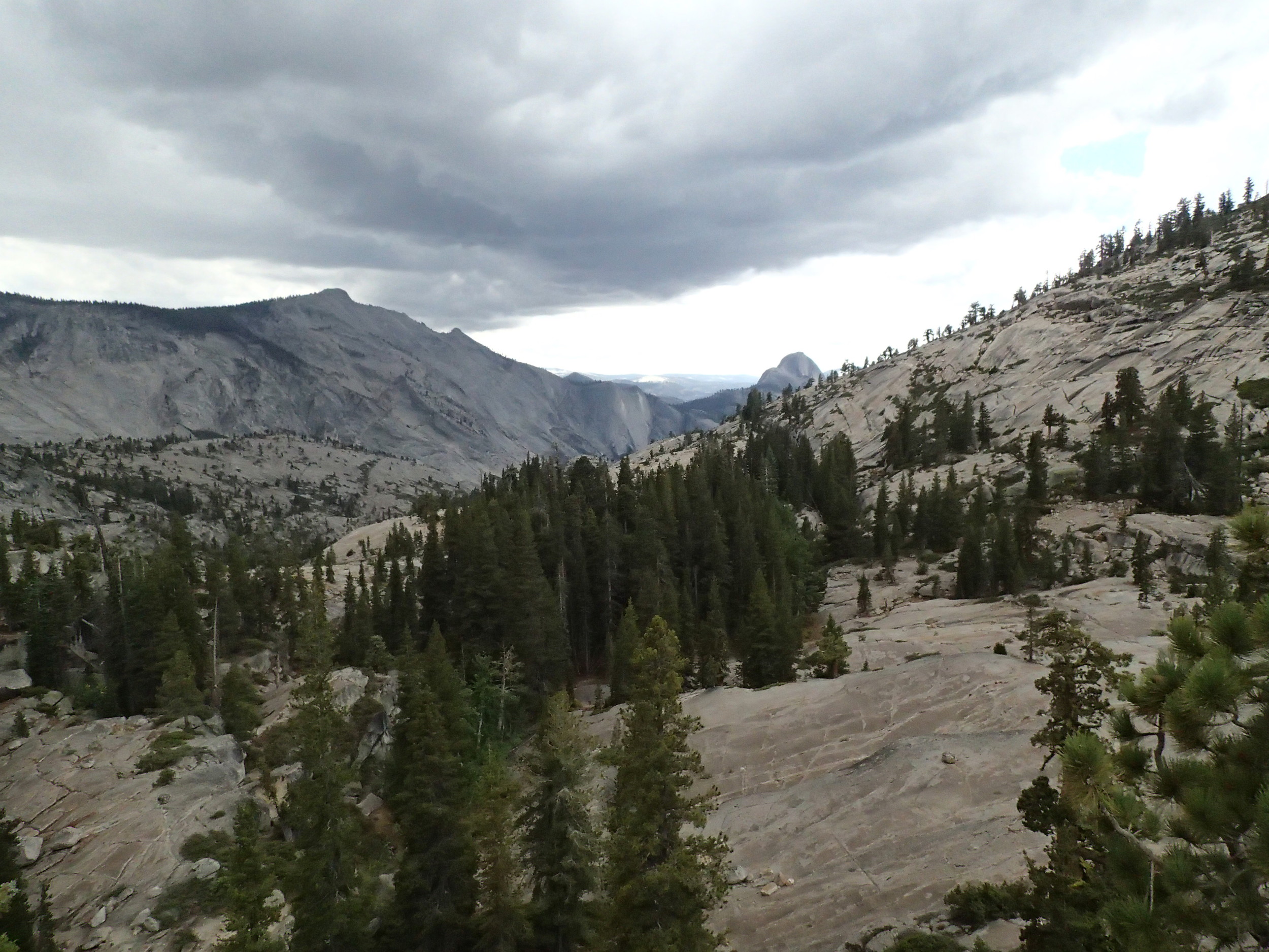
We could see the sun setting literally as it set the mountains around us aglow in a warm light. Trail and trees and rocks and small rodents and mammals and dirt and switchbacks came and went as we advanced further down the trail and higher up the side of an exposed slope towards Kearsarge Pass. A magnificent ridge mirrored the other side of the valley we were climbing out of. The Kearsarge Pinnacles. Stark and sharp and steep.  I stopped in the middle of the trail to admire them across from us and to catch my breath.

“I’m. Tired. My. Feet…”

I trailed off and drank some water.

It looked as though the pass was within sight, but I’d been burned too many times before to think for a single second that the end of a mountain climb could ever be in sight. It’s an attitude which makes for really anti-climactic summits because I’ve spent the whole climb conditioning myself to believe that whatever clearing or apex it is that I see…it CAN’T be the summit. I hate being disappointed.

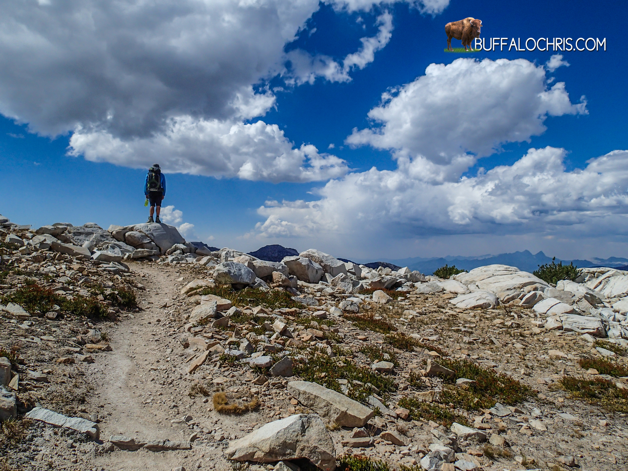
The route to Kearsarge pass was similar to Glen Pass in that the final ascent was a long, drawn out gradient instead of a litany of short switchbacks. I like the long ascents more because after a while, it seems like you’re walking on a flat surface. You’re really climbing at about 10 to 20 degrees, but without the perspective added by switchbacks immediately above and below your position, it seems flat. The long gradient also affords a peak at your ultimate destination ahead, be that the pass or a false summit.

I sped up my pace as the gradient pointed dead ahead towards a distinct notch flanked by fractured, angular boulders on either side. The climbing…all of the daily, ceaseless climbing. This was it. All the steps, all the miles, all the contour lines on maps and vertical feet ascended: this was the final ascent. Everything else was literally all downhill. I started to get a sincere sense of overwhelming excitement. Every milestone and in a way, every step, was a final moment. Final water stop, final trail split, final pass, final climb, final step. I took a deep breath and relished in that moment as I approached the end of the uphill, exposed climb on the side of a mountain.

And then I saw the switchbacks above me.

“I warned you about that…” gloated the part of my brain that is smart enough to not walk down the cookie aisle at the grocery store.

“I thought for sure this time it would be different.” Replied the part of my brain that makes me eat a bag of oreos in one sitting.

P9190445.jpg

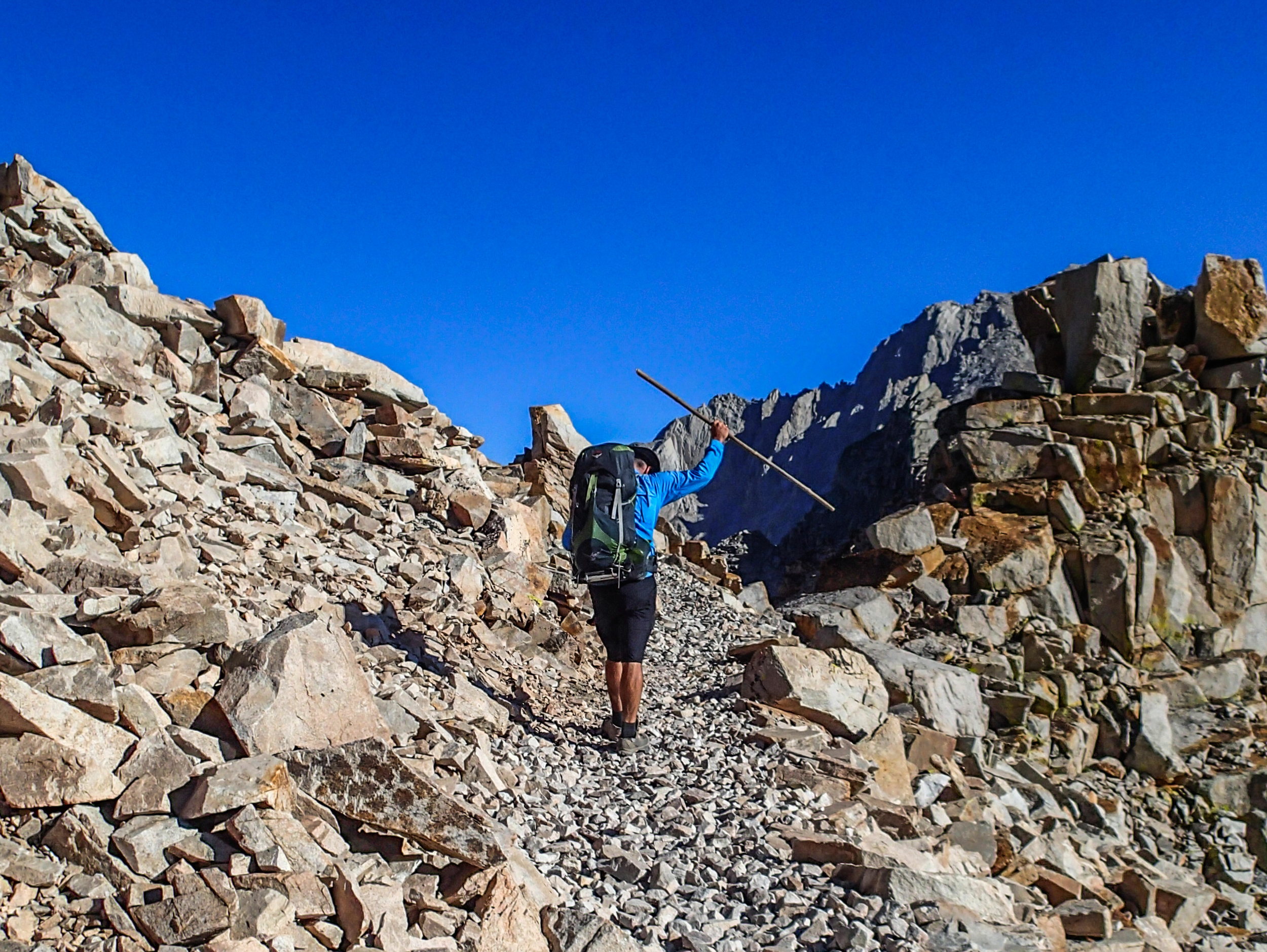
4 switchbacks. The final 4 switchbacks followed by 400 feet of linear distance were all that stood between us and the high point of Kearsarge Pass. I walked in front of Lindsey, fueled by another microburst of adrenaline. As I stepped on to the ridge, I raised my walking stick above my head with one hand in triumph. On the pass I lingered, waiting for Lindsey.

That very point I stood held a lot of power. It was a spot that divided east from west, light from shadow, Fresno Country from Inyo County, National Park from National Forest, victory from defeat, the trail from home. Lindsey joined me not long after and we rested and took the requisite photos.

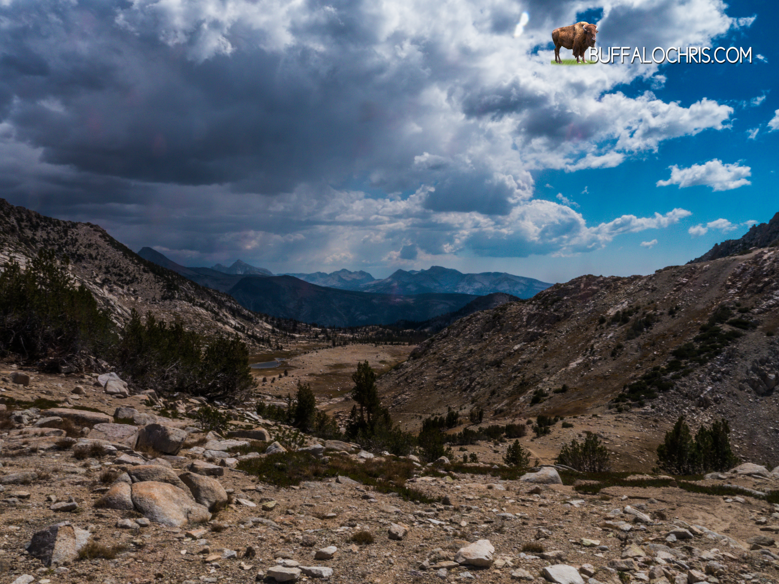
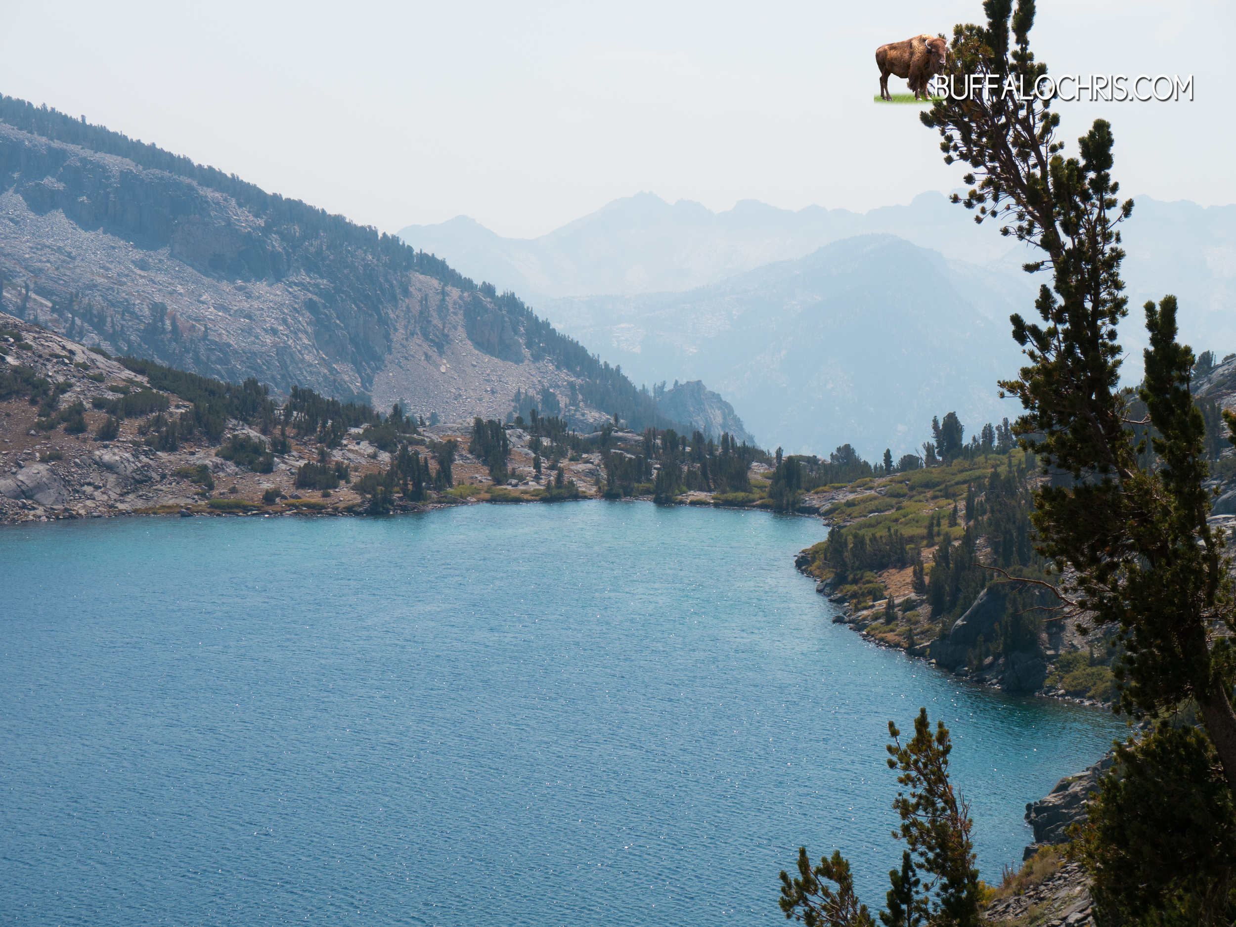
Beyond the pass: An absolutely gnarly traverse across a seemingly infinite slope of rock, a steep descent and a long, lush valley of pines and lakes and streams.

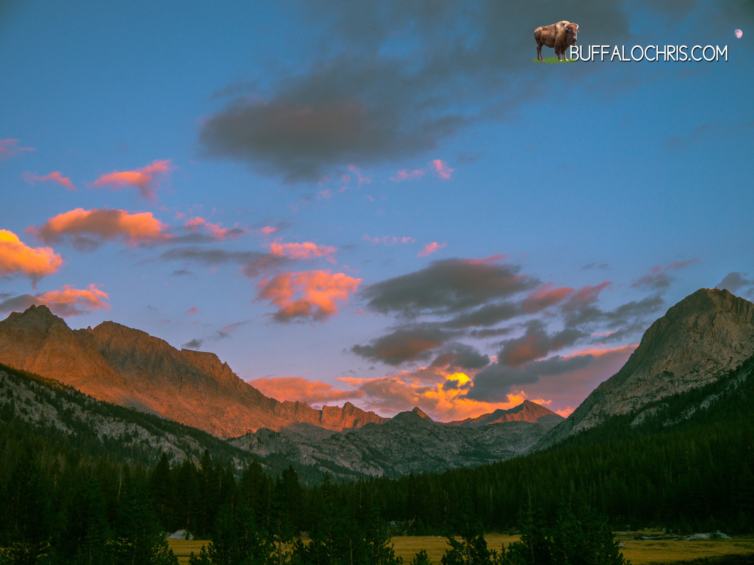
I stared in to the setting sun and gave a look back on the High Sierra, the unrestrained rays of light assaulting and bleaching the grey and white granite, casting shadows on where we were to be heading. The wind blew cool, clean and quietly over the countless peaks and spires and notches and serrations of the Sierra, hiding thousands of secret valleys and pristine lakes. Going over Kearsarge pass was like walking out the door of a strange, beautiful, enchanting, enrapturing landscape where your only job and your only responsibility is to exist; to be. As I stood there looking west on the shoulders of a giant, gazing at the place from whence we’d come, I saw further than I’d ever seen before.

The atmosphere that rests high atop the granite spires of the Sierra Nevada is clear, and not surprisingly, I found that clarity of mind comes with it as well. I saw the landscape as it was, but also salvation and life as it was meant to be lived. For a mere 18 days we lived the bulk of our lives sleeping inches above the dirt in a non-permanent structure, but it felt like a wonderful life time. Our days were filled only with hiking. Thinking. Talking. Arguing. There were no bills, no deadlines, no current events, no sports, no shootings, no new products. It was pure; simple. The mountains absorbed the foolishness of everyday life and the lunacy we force ourselves to deal with as we swallow the putrid pill of social acceptance that we determine we must take so as to fit in with the rest of the majority who have chosen that medication as well.

The mountains didn’t care that we were there. They neither shunned nor accepted us. And that humbling feeling of total insignificance was absolutely liberating. The mountains were not our world that we’d created, tamed, and bleached; The elements fought out here, and we were travelers through their battlefield. The clouds cried and when particularly enraged, they would spit pellets of ice. Trees lived, died, and lay on the ground to rot. The winds would whip and howl strong enough to move mountains and in the next breath, blow a gentle breeze across our brow. Streams would flow in to lakes which would feed torrents and roaring waterfalls, or lakes would dry up from a lack of snow melt and wither in the light of day. Under the golden orb of the sun and beneath an effervescent spectator of a color changing sky, the world put on its show and for a short time, we had a front row seat to see things as they were meant to be; to see the world as the world was before it became infected with waste and filth and trash and excess and garbage.

I turned away from the sun to look at my shadow in front of me, and I moved my right foot down the trail. The left foot passed it. We had been in a paradise.

A few steps and it was gone from sight, and we were gone from it.

In every sense, as I stepped on the other side of the crest and began past Kearsarge Pass, I was leaving heaven on earth. And that’s a very strange, very wrong sensation.


Via Domus

Outside of the Weimaraner brown rain-fly the stars woke up, mountains began their secret lives, and small insects came to life. The short and thin golden-brown crunchy grass that grew in the rocky loam enjoyed its respite from the sun and slowly turned an iota darker as it went about its cycle of life, death, and rebirth. The Sierra winds picked up and rocked the staunch, weathered trees back and forth. And the permanent residents of the Sierra Nevada looked towards the glowing nylon walls of our nightly home.

Plan.

It was not long after getting in to the tent that I began to feel better about the previous day’s hellish ending. Horizontality has very soothing, rejuvenate qualities to it. Maps were out, notebooks were open, pens were uncapped, and the trail guide book was sprawled open as Lindsey and I brooded over what was to come in the morning and the following days on the trail.

The good news, if there was any to be had, was that we had very little food which made our packs as light as they’d been on the entire trip. The bad news was that all of our artificially illuminated planning was for an exit and not a finish.

 “Miles away” was my ultimate determination. We were miles and miles away from Onion Valley and we were a good few Passes from having our boots (or shoes, now) hit pavement. I studied the day that was to come featuring Pinchot Pass. Being appeased with our current elevation, its ultimate elevation, and the fact that it wasn’t named Mather, I put my personal effects in to the little mesh pocket by my head and curled in to my faithful and surprisingly not-too-foul smelling Marmot Arroyo sleeping bag.

The body shouldn't idly comply with what it’d been through the past 2 days; the reserve supply of food, the elevation gain and loss, and more specifically the muscle groups utilized and the required repetitive movement of them. I was certain I would awaken sore, tired, and absolutely on low fuel in every way you can imagine after the Golden Stair Case and Mather events.

The night was bright thanks to a full moon and the reflective granite mountains around us. Though the night was over quickly, life seems to move slower in the sierra. I’m inclined to think the sun does too, lazing its way above the horizon and hiding behind the cold gray granite before it inevitably shows itself and resumes its normal rate of passage in the sky. And why not? Why care about hurrying up or time at all for that matter? Seconds are days in the sierra. Minutes are months. All told, a year in the Sierra Nevada may as well be a blink of an eye. The mountains play by their own rules and have a pace all their own. The struggle is learning how the mountains do it and adjusting accordingly.

I woke with surprise that I was not stiff, aching and unable to move. I felt quite well by the time solar radiation began to reverberate in the thin and crisp dawn air. I prolonged my stay in my sleeping bag all the same, opting to maintain my horizontal state as long as possible. My fear was that Pinchot Pass would become another Bear Creek for me, and though every hike starts the same in the morning (a little slow, a few adjustments, a bit of time getting in to a rhythm) after about 30 minutes, the inevitable truth of the state of things comes out. Very soon after moving, you know what kind of day you’re in for.

The sun washed out the mountains and set the sky a deep indigo as we sprawled our belongings around camp. Slowly, things found their way in to their right place inside of our packs. My Osprey Exos 58 smelled like a homeless man save the tinges of stale urine. Hundreds of miles of carrying a bear vault had worn a hole in the hydration sleeve and back panel (and the bladder itself).

The bear canisters themselves echoed as we filled them with what little we had left.

Benefits of carrying a tripod for 150 miles.

Around 10am zippers closed, buckles clicked, and all at once we were standing on top of where we had slept. Everything we had was strapped on our back and the path home led south and east.

Lindsey started off a little slow. After my initial diagnosis of myself, I realized I was feeling great.

Hiking never got easier. There was still labored breathing, sore muscles, tired bones, rest stops, and sweat…so much sweat. We did get faster and better conditioned, though. From where we camped at about 10,800 feet, 3 miles and 1500 vertical feet kept us from Pinchot Pass. Pinchot Pass kept us from wherever we'd stop that night. That one night kept us from the end.

Part of me wanted to go fast and get there…to the very end. Part of me didn't.

The miles, the tendons, the lack of food hit morale hard. Yet still, I didn’t want to leave this landscape. I didn’t put too much thought in to it, honestly. I avoided thinking about it as much as possible knowing that if i did not avoid it, it would consume me.

Easy to do when your heart is thumping heavily as it forcefully displaces deoxygenated blood in favor of blood with the sierra air bonded to it.

We strolled past mountains as we ascended the lightly vegetated terrain. Below the peaks, glass-still lakes waited for the winter.

It’s quiet. Breezy but not windy. Brilliantly blue above us. Clouds nowhere to be seen. Not a sign of a soul in front of us or behind us. This area was ours alone. I prefer to think The Sierra Nevada was giving us a moment of silence. Truly, though, that's just life in the mountains.

The trail crested a saddle betwixt Mt Wayne and Crater Mountain. Beyond lay more lakes dotting a lightly vegetated granite landscape. In many ways, the view and descent were similar to the view and descent atop Mather. Everything about Pinchot seemed a bit smaller in scale though. The pass was a little easier, a bit lower. The view was immense but the valley below seemed a bit smaller, more hospitable.

Not long after 11:30am Lindsey and I started down towards the jagged peaks and cold ponds.

The landscape around Pinchot Pass is broken up by igneous intrusions, oxidized rocks, and rust colored scree piles that break up the color palate of the landscape.

Some wispy clouds would creep in as we sank in to the tree cover past Mr Cedric Wright, a fortress of rock that dominates the basin beyond Pinchot Pass. The trail follows Woods Creek in a south, south westerly manner passing a few small tributaries that feed the main creek. Lunch was taken just off trail at an unnamed water feature. Like all of the other sierra water masses, it was crystal clear, cold, and delicious to drink. The bottom was a very fine silt that was easily disturbed, but we couldn’t resist walking in it anyway.

Basking in the sun, we marveled at the landscape beyond the lake, ate our remaining rations, and enjoyed the respite from joint jarring, bone pounding hiking. I indulged in our last fruit roll-up.

It was the best fruit-roll up I’ve ever had in my life.


Not far beyond the lake, a side trail over Sawmill Pass takes off to the east. We’d talked about using this trail to exit the JMT but ruled it out speculating a lack of facilities and humanity (i.e. potential rides) at the trail head. The John Muir Trail descends in elevation beyond this junction as it follows the strengthening Woods Creek.

Shadows grew long as we left miles in our wake at the rate of about 3 for every hour. It was an emotional day. I can sparse remember the scenery that lay between the lake we stopped at and the famous suspension bridge over Woods Creek, and I can’t remember what the reason for the argument was, but I do know that for the 3 or 4 miles, we walked fast. Anger has a way of making the body move faster regardless of food supply, terrain, fatigue, squeaky tendons.  So the silver lining of whatever useless argument we had which caused us both to be angry and walk far apart from one another was that we covered some ground.

Hiking south bound, the JMT makes its hard left across Woods Creek and in to a canyon. The sight of the iconic bridge changed the mood quickly, though it’d begun improving slightly earlier. This bridge was one of my first 2 memories when I was studying the JMT. I’d heard accounts of it, seen a photo, and gazed through my screen at a place I’d never be.

It’s larger than I thought. It’s higher above the creek than I thought. It shakes more than I thought. It’s like something out of Indiana Jones or Legends of the Hidden Temple. Quintessential rickety suspension bridge. It was realer than I ever thought it’d be.

Lindsey went across first after telling me to not shake the bridge while she was on it. Once she’d repeated that 4-5 times and felt slightly more assured that I might not shake it while she was on it, she walked across. I didn’t shake it, but only because I needed to video with 2 hands.

Once she was safely on the other side, I began my trip across as to oblige the aluminum sign on the pole- “One person at a time.” The bridge wobbled far beyond what I’d anticipated and I had to hang on to the suspension cables, but made it across easily. I would have stayed and played on it but some folks on a shorter backpacking trip were behind me, and I decided I didn’t want to look like a fool more than I needed to.

On the other side of the bridge, we watched shadows grow taller and we discussed our camping options for the night. We’d not gone as far as we needed to per my plan that I thought we needed to follow. On a giant trail side boulder I sat and ate a tortilla with Nutella on it and talked Lindsey in to hiking further. It was 4 miles to Dollar Lake from that point, and the hike was an ascent of about 2000 feet. It looked all very gradual on the map, though…

It almost always looks gradual on the map...

We hiked briskly as the sun started to fall behind the ridge in front of us. The streams and rocks and trees turned greyer as the world we were in fell in to the shadows.

It was a beautiful part of the trail, and another area I’d picked out as a good habitat for bears. I kept my eyes open but never saw anything. Spurred on by the idea of rest, food, and knowing that the end was in sight for this day and the whole trip, ultimately, we made it to Dollar Lake with time enough to set up in the waning moments of light.

Like the night before, as the sun went down the moon sprang up as if counter-weighted. It lit the sky in a side canyon beyond Fin Dome, and it was an hour before it surmounted the ridge and cast the area with bright white light.

The stars were incredible. I can’t fathom how it would look without a moon.

I stayed up and took some photos and watched the fish jump from the water to eat bugs and insects. Winds blew sporadically, at times making the surface of Dollar Lake as smooth as ice and other times making the whole surface smear with ripples.

With Diamond Peak high to our East, Mt. Clarence King in the West, and Fin Dome dominating the landscape South of us, we crawled in to the tent for what might have been the last time on the trip. We’d put ourselves in position to make it to a trailhead tomorrow with a 16 mile day. A 16 mile day that would have 2 passes…

The bear canisters lay far away from our tent, cavernous. Filled only with the first aid kit, a few snacks, fuel cubes. Tooth paste.

Not a soul else was around, and the mountain world was quiet. The moon and the mountains did their dance as we slept under the stars at Dollar Lake.


NOTES FROM THE TRAIL

9/18
21:14

14.7M, LEFT @ 10, HIKED TIL 1900
@ DOLLAR LAKE. TONS OF FISH. FULL MOON.
FINN DOME IN BACKGROUND
2ND TO LAST DAY.
TWO PASSES TOMORROW.
OUT TO ONION VALLEY
FELT GREAT TODAY W/ FOOD IN ME
SAD WE DIDN’T PACK ENOUGH TO FINISH
LEFT ACHILLES HURTS PRETTY GOOD.
CAN’T FEEL LEFT BIG TOE.
LOTS OF ELEVATION TODAY
10.5 ->12.1->8.9->10.5
TIRED.
I LIKE KINGS CANYON.
WARMER TONIGHT.
14.5 TO TRAIL HEAD.


Golden Rule

Day 13. 9.16.13

Beneath the boulders of the Black Giant we camped and we rested. The diffused light of dawn slowly filtered up the canyon and cast a cold light through the trees and creek. The direct orange rays bounced off the higher topographic lines of the mountains that flanked us and for a few minutes, the world glowed orange.

Inside of the North Face Mica 2, I ran my hand on the inside of the loosely staked out vestibule wall. Cold, but dry.

Today would be a good day.

Most of the days, it didn’t matter how far we would go or where we'd stop. The only exceptions were resupply days (which we'd finished by this point) and today. Back in Tuolumne Meadows as Riley, Lindsey, and I sat around a hydrocarbon fueled camp fire, Riley told us there were two distinct hikers he'd met as he walked North and the others walked south: Those who went up the Golden Staircase and Mather pass in one day, and those who planned their day to end after the Golden Staircase and then climb Mather the next.  He noted that those who did both climbs (really more of one, long, continuous climb) in one day hated their lives. Accordingly, Lindsey had been eyeing mileages and planning on getting us to a spot where we'd not tackle both passes without a night's rest in between.

Lindsey's endeavors in bipedalism without pain were going well. Having no shoe tops had seemed to make all the difference. In my stubbornness and general unwillingness to cut up my $220 dollar boots, I pressed on in varying degrees of pain and varying amounts of tape and varying dosages of Aleve.  

Our morning in camp was a quick one. Inside the cozy confines of the small tent pad that was sandwiched between pine trees and a granite boulder we went through the morning routine. It was not a super cold night or morning even as the sun struggled to rise above the heights of Mt. Gilbert, Johnson, Goode, and the others that made the mighty ridge to our East. Certainly, by this point in the trip, the routine was a finely tuned system; a well oiled machine of efficiency, repetition, function. The packing system was concrete. Even in the 58 liters of space, I knew where every item was. I knew what I needed. Best of all, everything in my pack, I used. There were no freeloaders, no luxury items that went unused. Every item had a purpose. It seemed almost like I didn’t have enough; I'd get bored at looking at the same 7 pairs of socks, 2 shirts, 2 shorts, and other few items. In reality, it's a feeling of exhilaration and a sign of precision. My life was in a backpack. I needed nothing, I wanted nothing. My food, shelter, love, adventure, health, and life was in, around, or tied to that bag.

Fully loaded and resting on the cold earthy soil, I yanked the pack on my shoulders with a quick, smooth motion that used to be hard when we started. I was getting stronger. I felt it. I felt my body changing throughout the trip, but this day was one of the first when everything came together as a whole.

The bright yellow sun baked the infinite Earth sky in to a deep blue. Cloudless skies; endless blue that would make Montana jealous. The trail would lead us East and South. We had camped on the upper fringes of tree line. We'd hike down in to Le Conte Canyon through an artery of the Kings River that bisected mountains. This Middle Fork of the Kings River synthesized from lakes, snowmelt, and high altitude creeks. The river did not exist before Muir Pass. As we walked the other side, the river was born. It's awesome watching something as simple and as oft overlooked.

A couple of guys speed past us. They're weekend visitors who've been in this area many times. The other creatures we see, a few deer, are foraging ahead of us. They keep their distance as they meander the path we're walking. Eventually they break from the trail and head down to water as the 2 mothers and 2 fawns eat shrubs.

Maybe 40 minutes in and somewhere around Big Pete Meadow we pull over to make breakfast. There are a good smattering of established campsites in the area and since the trail parallels the path of the infant Kings River, it's a great point for us to fill up, eat some oatmeal, and tend to any medical needs.

Aside from a little tape, blister prevention, and chapstick, I'm feeling good. The morning is an array of tangerine colored sun rays warming the granite ridges and prominent peaks that envelop us. As we hike overall Southbound, at this very specific spot on the trail there are monstrous, sheer spires to our right and a very steep high grade to our left. Water did this…kind of cool. A tall, lanky NPS Ranger stops by to chat. I figure it's a permit check. And it is, but he doesn’t make me break open the pack and get out the permit. Nice guy. We chat briefly and he carries on going North on the JMT. He's got the best job in the world. But he didn’t know the score of the A&M/Alabama game.

We march on with ease (trail is a comfortable grade and downhill during this part) past Le Conte Canyon Ranger Station. Here at the ranger station is a Junction with a side trail that goes out over Bishop Pass. 12.6 miles to a trailhead. Ever since Muir Trail Ranch, I wondered if we'd go out early and exit the trail on one of these access roads. I didn't want to, so my plan was to always just keep my mouth shut and hike on the JMT unless otherwise told.

The JMT is interesting in that once you're on it, you don't really want to leave the formal JMT. David wanted to hike the exact route, every step of the way. Lindsey and I didn’t care to that level of specificity, but we did care. I wanted to stay on the well worn ruts of the frequently traveled iconic Sierra trail. There's much to explore and there are hundreds of miles of side trail, obscure loops, little seen lakes, and all are worthy of visitation. But this was a John Muir Trail Trip. Plus Lindsey and I were both feeling pretty good, albeit a little dirty. The Bishop pass trail junction came and went.

Another 3.3 miles down the Middle fork of the Kings River (which had grown considerably since we first saw it at higher elevation in the morning) and the trail makes a hard turn almost exactly east. Before reaching this junction we pass Grouse Meadows. Beautiful spot.

We reach the trail Junction. JMT goes east, Road's End Trail goes south. We're surrounded by peaks. The Citadel to the northwest. Giraud Peak to the northeast. Rambaud Peak in the southwest and Mt. Shakespeare to the southeast. All of them roughly 12,000 feet and we're sitting river side, taking a hobo shower at 8,070 feet.  We filter water, rest, refresh ourselves, and prepare for the impending ascent that is by most counts one of the most daunting of the entire trek: The Golden Staircase.

There are 13 maps in the JMT Map series that we had. We started on map 12. Today, we would start on map 5 and end on map 4. It was a good morale boost, not so much in an "ok-we're-almost-done-only-3-maps-to-go" way as a "damn. You've-hike-a-long-ass-way" way.

This eastern jaunt of the JMT starts easily enough. It meanders up Palisade Creek through a lush valley that is beautifully dotted with remnants from a fire. It's roughly 5 miles from the trail Junction to The Golden Staircase. As we slowly ascend out of the valley we hiked in to, I prepare for the big push by utilizing a secret weapon I've kept stored in my bear can- Gatorade mix. It's grape and low calorie. It was delicious. I wish it had been double-calorie. The day's food intake was scarce. Oatmeal, a meal-pak bar, NUUN tabs and some trail mix. And Gatorade mix. I felt good, energy wise. After hiking pretty consistent miles for so many days, your body adjusts and starts to perform.

We didn’t have the luxury of having the proper amount of food per person since we didn’t plan on finishing the trail when we packed our final resupply at MTR, so we rationed and we got by. Days like this one, where we wake up at 9,800 feet, hike down to 8,000, and then climb up to 10,600 have a way of burning many calories. We knew how much food we had. We knew how long it would need to last. So we managed.

Up Palisade Creek, the trail dashes in and out of forested segments. In the open sections, hikers are afforded a very clear view of what they are going to be going up and over. With subtlety, the ascent up the Golden Staircase starts as you slowly start to climb up the canyon that encloses Pallisade Creek. A few steep steps here and there and the heavy breathing starts and with it, so does the Golden Staircase. Quickly after the unimposing start, the trail begins to veer away from the creek and the work begins. A 1500 foot climb in a fairly short amount of trail.

My Friend

The skies still radiated brilliant blue but the sun was sinking ever lower. A few hours or so were all that was left in the day by the time we were about halfway up the climb. We stopped and had to eat. I had a really good rhythm going up the switchbacks. I'd figured out my secret breathing technique while going up to Muir Pass and I implemented the same strategy here. It worked brilliantly, but the body…it won't do anything without energy. We split a Snickers. I saw a caterpillar next to me.

We chatted for a bit. We had our ups and downs. There was a time I thought I killed him or her. In the end, it was just afraid of me. And for that reason I'm sad. But as long as I live, I'll never forget my moment with that caterpillar, a fatigue induced delirium that is the lone memorable spot in a span of about half an hour.

My brain protested more than my body, but eventually I rose to dusty boot covered feet and we kept marching up, and up, and up. The views were amazing as the sun set directly behind us. The light was beginning to cast the trademark hue on the golden staircase. Had we been 30 minutes slower, it would have been an epic sight. I'm content settling for the awesome sight that it was.

Most climbs have a false summit and then a moment of triumph when you're at the undeniable summit. Golden Staircase is kind of similar. There are a couple of points when you think you're there at the top. The time comes when you are at the actual top of the Golden Staircase. You can look back, marvel at the view and what you've just done, and then you think you can go on to "normal" hiking. Maybe it's because I was so tired and needed food, maybe it's because I expended all my energy climbing 1500 feet…

There should have been a lake here. 

The trail beyond the Golden Staircase wanders over to the Palisade Lakes. On paper, the trail appears flat or at the least, nothing near the steep haul we'd just come up. My recollection is that this is not the case. The trail goes up and down varying steepness of terrain. By this time in our day, the sun was no longer in sight as it dropped below the ridges we were now concealed behind. We were exhausted and in a weird trail purgatory; caught between an insane climb and a good camping spot. Around every mountainous hill I expected to see a lake. We'd camp there. It'd be great. I could eat dinner.

Around every mountainous hill- I was wrong. No lake. A creek, sure. But no lake. This happened a few times before Lindsey and I decided to say "screw it." We decided that we'd camp at the next spot that looked appropriate.

Sure enough, minutes later we found a spot. I dumped my backpack off and I sat on the sandy, flat patch of land that we would call our own for a few hours. Priority 1 was eating.

Last night when we rolled in to camp, I was light headed, tired, slightly weak and I knew it was from a lack of food. Today was a similar feeling and situation. It was probably slightly dangerous to be hiking this way, but I could feel what my body needed or wanted. It's a pretty cool ability you get used to after a few days of eating for fuel and not to be full. This long trek up the Golden Staircase was particularly memorable because I specifically recall feeling my body get smaller. I had to keep cranking on the belt of my shorts.

So we opened up the bear cans and made some Bear Creek soup. The soup, Bear Creek Soup, unlike Bear Creek Trail, is actually good. We made some mashed potatoes, and then I ate a tortilla with Nutella. I hoped this dinner would be like last night's dinner. Whatever was in the food I had eaten 24 hours prior was amazing.

I wandered around in the bright moonlit night to find water for drinking and more cooking and stumbled upon a torrent of a creek with a cool 5 foot waterfall. We set up camp, put on our jackets, and watched the mountains under the glow of the moon for a bit. Then I took notes. And then I slept like a champion knowing that tomorrow morning, we'd be starting by doing the same thing we'd just ended with- a 1500 foot climb to Mather Pass.


Notes from the Trail-

9/16 20:36

14-15M DAY. AT OUTLET OF PALISADE LAKES.
CLIMBED GOLDEN STAIRCASE.
END WAS A BITCH BECAUSE OF NO FOOD ENERGY.
HAD AMAZING DINNER- MASHED POTATOES, SOUP, TORTILLA W NUTELLA.
FELT AMAZING THIS AM AFTER INSANELY GOOD DINNER LAST NIGHT. (TONS OF PROTEIN)
WE'LL SEE HOW THIS GOES.
COLD TONIGHT @10,500FT. COLDEST DAY I THINK WAS GOING OVER MUIR PASS
HAVE ENOUGH FOOD FOR APPROX 6 DAYS. 5 IS BETTER.
MOON IS AWESOME. GOT GREAT PICS LAST TWO NIGHTS
IF THERE WAS NO MOON
MILKY WAY WOULD BE INSANE.
DRANK LOTS OF WATER.
GETTING USED TO TENT SLEEP. ALMOST RESTFUL NOW.
LEFT AT 8:30 THIS AM. STOPPED AT 7:00PM
POWERED UP MOST OF GOLDEN STAIRCASE LIKE A BOSS
MATHER PASS TOMORROW, ANOTHER 1500FT GAIN
HAVEN'T HAD ANY CONTACT WITH OUTSIDE WORLD.
NO ONE KNOWS A&M SCORE.
FAM PROB THINKS DEAD.
LOST FAIR AMT OF WEIGHT.
BACKPACK IS GETTING BEAT UP.
I SMELL. 

Aether and Vulcan

Day 12. 9.15.13

The September atmosphere of the Sierra Nevada calmed itself throughout the moonlit night. The creek next to us trickled like an old toilet that won't stop running and the air brought with it a certain chill. It had rained the past few afternoons and dampness was still lingering. The miniscule drops of moisture hovering in the cooling air nucleated together. Nary would a droplet fall from the sky, yet by dawns early light, our equipment was drenched; soaked thoroughly by the cold condensation.

I was starting to learn that camping near rivers and creeks is bad news. I've camped many places in many tents. Truthfully, the morning ritual for camping had degenerated in to this: become half conscious. Stir in sleeping bag. Stretch. Feel tent walls to see if they are wet.

This was never a more critical process than when we owned a single wall tent. It was a short rogue period in ot7 and really, we only bought the Eureka domicile out of necessity. Our other tent, a 13 lb Wenzel monstrosity of 5 person living space had run away. We had set the Wenzel up at Big Bend on our inaugural backpacking and traveling road trip (yes, we bought a 5 person dome tent and took it backpacking). The Wenzel tent stood tall and mighty in the Texas desert after we'd slid the fiberglass poles though, but the ground would not take a stake. We weighed the corners down and went off exploring knowing that this would be enough to keep our shelter stationary. The one rainstorm per year that comes through the desert of West Texas came after we left our camp, and it was preceded by some winds. So as we are coming back home to our tent that we had previously put in a very conspicuous location (bright maroon and grey tent in a flat brown desert) we had to do a double take. Our chairs were there. Our little table was there. But that was it…no tent. Nothing. Lindsey found the tent a hundred meters away in a gulch. It had run away to be with a mighty ocotillo. At first they were inseparable, but after some hard persuasion, we separated the two. No idea how that ocotillo is doing these days. I knew it had to be done though. And like most hard separations, you know damn well there were hundreds of tiny holes in the rain fly. And you know damn well the rains would come that night. Half a roll of ducktape kept us mostly unsaturated, but we still got dripped on. Good thing we had a shit load of room in that tent. This all happened on day 2 of the anticipated 40 day trip. So by the time we hit Vegas we went to Dick's and bought the Eureka Zeus tent. Waterproof, light weight, and cheap. That's the story of how I came to own a single wall tent. The condensation is why I will never own another. I think every night we slept in the Eureka tent we woke up wet. Every morning in the tiny one door, 2 person teal Zeus tent I'd wake up and run my hand on the inside fabric of the single wall. Every morning it was wet. It's physics. This ritualistic habit persisted…

So back on the JMT I'm doing the Eureka condensation test and we are in bad shape. Real bad shape. Maybe the wettest night to date and that we would see on the whole trip. From the fringes of the trees where we had camped with cuben fiber camera man, the sun was blocked perfectly by the tallest peak around us. This was becoming a pattern I was figuring out. The revelation clunked in to my brain. "Tall Mountain block sun." It was a caveman-like revelation.

So we went through the process that was familiar at this point. Delicately take apart the rain fly.  Set in a place to dry. Pack gear.  Lay out tent to dry. Trouble was we had no direct sun for a good while which meant the cold and moist air was all we had.  When the sun did surmount the granite spire in the east, the rays bathed us in beautiful warmth and cast a splendid light on the valley we were in.

Slowly and steadily we watched and waited for the moment. I could see the bright white glow in the sky behind the mountain and I knew it had to come over the peak at any moment. It was a pretty spectacular scene standing in the dying grassy meadow that was cloaked in thin, ground level foggy mist and watching the sun rise inch by inch over the mountains. The light dusting of crystalline frost that clung to brown blades of grass transpired back into the atmosphere from whence it came. All at once, the magic and warmth and light of the sun kick started our journey. A light breeze began to float through the meadow.

Today was going to be a map changing day, which was exciting. From McClure Meadow, a long 9.5-mile stretch would lead us to Muir Pass, one of the keystones of the trail. Perhaps one of the most famous passes for its name and its hut. For years, I'd scanned Google Earth images and satellite photos. Today, I'd be on the ground and in real life. I could touch the damn thing if I wanted to.

In the morning I was feeling well enough. About 30 minutes in to the hike, I'd warmed up enough to start shedding layers. I was down to my REI Base layer and my trusty, well worn, smelly, salt infused Colombia Freeze Degree shirt. The Columbia piece was laced with their new Omni-Freeze technology which I'd planned on putting to use in late August when we'd originally planned to be on the trail. In September, when we actually did the hike, there were times that the omni-freeze worked too well. But it was my go-to shirt, and on this day I was comfortable in my standard outfit. 95% of the time-

Outdoor Research SOL hat.
Columbia shirt.
REI base layer
Mountain Hardware Canyon shorts
Icebreaker 250 Merino boxer briefs
Icebreaker socks
Kayland Zephyr Boots.

(Full gear list)

It was a money combination. In the cold mornings and nights I'd throw on the down sweater. On super cold nights, I'd throw on the Revel Cloud vest. Thus far, I'd not been cold enough to wear the insulating layers while hiking.

Even though it was 50 degrees and we were 45 minutes in, I was sweating like a whore in church. The trail wanders next to Evolution Creek for a ways past McClure Meadow and then makes a turn to climb up to Evolution Lake. Up until that turn, it's a nice flat walk. By the time we hit the switch backs, I was tired. Today was one of those days…switch backs were going to be slow, clumsy, and with heavy breathing. Much like two nerds making out.

The morning was so bright and clean and clear though. It was alright with me. Slowly and steadily we climbed up and out of the green and tan lushness of McClure Meadows and we ascended back in to the granite crags and rocky talus of the High Sierra. This was Muir Pass Country. This is what I thought the whole trail would be; Barren moonscape. Winds. Rocks. Lakes. Isolation. Beauty. Solitude.

David, Cuben Fiber Camera Man, had gotten a jump start on us in the morning.

Lindsey was looking forward to Evolution Lake, which we were supposed to be approaching. I wasn’t as enthused. I was still breathing heavily, going slow, and carrying my hiking stick as a passenger in my hand. It felt weird at this point to not carry the stick with me. As we rounded a bend, the trail leveled out and the terrain changed a bit. The trail opens up to a new, higher level of a mountain valley. Only a few trees dot the terrain around us, but high peaks frame us in on both sides. Lush and thick green grasses around us in the lower part of the land indicate water is near. Large, eroded and weathered boulders lie in the middle of tiny meandering brooks.  At this point, we are maybe 10 vertical feet below Evolution Lake. Looking in the distance, I can't see the lake but I can see the moraine that is holding it back. It's a cool feeling knowing you're standing in front of a mighty mass of cold, untamed, ancient water. And all that's holding it back--the boulders, rocks, and debris that a glacier plowed in front of it.

As we hike and make it to lake level, we stop for a decent break at a large rock mass that juts out into the cold blue depths. It's windy now. Really windy. And though it's not cold, the wind makes it chilly when you aren't moving and your body is wet from sweat.

Lindsey filters water, eats, does laundry, and I lay down in the fetal position in the sun. I'm still not feeling well. Slow, sluggish, inefficient.

It's hard to figure out what your body is trying to say sometimes. I thought mine was saying "Stop being an asshole and feed me." To which I deposited into my stomach some Nuun tabs, a meal-pack bar, and whatever rations we had. We were getting hungry but we did not have a ton of food, so we cut back a little. Maybe it wasn’t food, maybe I was just tired. It wasn’t a soreness or tired-of-walking sensation. I drank water. I laid in the sun. I watched a beetle. I looked at the ants. I stared at the crystals that made up the granite sand that was on the granite boulder in the clear, cold, blue water of Evolution Lake. I watched the wind kick up waves on the water. After 30 minutes it was time to go.

By my guess, we were about halfway to Muir Pass and the trail would keep climbing steadily.

Crystal clear blue skies matched the translucent waters of Evolution lake as we headed further south on the JMT. Through perfect Pika habitat, we wandered as ancient, giant peaks watched us, their shadows almost nonexistent by this time of day. Through the glacially carved corridor we marched under Mt Mendel, Mt Darwin, Mt Spencer. The trail hugs the side of Evolution Lake and the creek/lake system that feeds it as it leads us in to the higher, more barren lands.

Once we made it to the southern point of Evolution Lake where the influx point is, I was moving. I'd gotten a pattern of breathing down that was absolutely dynamite. Two quick, sharp inhales and one longer exhale. It sounded like "huh huh whoooo." It kind of sounded like a train, which is what I felt like at this point. My body was doing better. I felt a little headache but I felt capable. I chugged like a train up the trail. Steady pace unaffected by topography, 35lb pack, stiff head wind that was growing in its might. We marched.

At Sapphire Lake, the first big lake past Evolution Lake, we stopped for another break. While sitting here we came across the two guys we'd seen at Muir Trail Ranch. They were rockin in their 70-pound backpacks. We exchanged greetings and they marched on. The one guy still had his 18" long Kermit the frog doll pinned on the outside of his pack. The only others that we'd seen on the trail so far were a small group heading north and back at the beginnings of Evolution Lake, two ladies that'd we'd been leapfrogging since MTR. We never exchanged words with them, but I liked their style. They were fast hikers.  After our stop at Sapphire lake, I figured we'd not see the team of guys or the team of girls again.

Lindsey and I started speculating where the pass was. Dead ahead of us on the trail was a notch in a huge mountain. I figured that was it.

Terrain from a distance is a hell of a thing. It never looks hard, it just looks far away. And then you get closer, and you realize it's a real bitch. It's steep. Those tiny rocks are the size of houses. It's not as friendly, welcoming, and easy as it looks from afar.

After a fruit roll up and some water, we march on South for a few minutes and then the magic time comes.

New map page.

Mercifully, the trail curves to the east. So that notch I thought was the pass was actually just a giant mountain. Even better, it was a whole divide. Goddard divide. We weave in-between large and small lakes and head east to Muir Pass. An unnamed lake of small size passes us on the left. On the right, and absolutely giant and idyllic Wanda Lake danced in the stiff wind, sparkling like a constant rain of diamonds. Wanda Lake has a few small islands and a pretty sweet craggy peninsula in it. This whole area is one of my top areas I want to explore with more time.

That lake is hiding something in her depths. I can feel it.

At 11,426 feet, Wanda Lake is within striking distance, elevation wise, to Muir Pas at 11,955.

The relentless, cold wind blows hard and shadows are starting to regain some length. I've layered up now. For the first time on the trip. I'm hiking in the vest and immediately putting on the down sweater during breaks.

Lake McDermand goes by on the left. Winds nudge us off the path we're walking and we push back.

In the distance, we guess where the pass is.  A tiny blip looks like it might be the famous Muir Hut.

A small lake goes by on the right.

The Hut is easily visible now, and the easy gradual climb that I thought would lead us to it turned in to a fairly steep switch backing affair. Judging terrain from a distance. Should know better…

A large group that I think was a family passed us. They were going northbound. They looked worn the hell out. They'd left from one of the Pete Meadows (little or big, I forget). From that point on the trail where we met, Big Pete Meadow is about 5 miles away. It sounds like a long day, but doable if we want to get there.

We switch back up and up, thinking that each next turn will be the top until it's finally true.

In sheer wondrous massive glory lies a structure that looks like it was raised from the surface of the mountain itself. Muir Hut.

The winds whip and blow hard and we take the opportunity to rest inside of the hut. It blocks the wind, but damned if the rocks that it's built of don't absorb and then radiate the cold. Inside I sat in my sweat soaked clothes for a bit. I took off my shoes and my socks. I took off the Omni-freeze shirt since it was not really in its element and put on my REI Sahara shirt. 

REI sizes are weird, I think they size everything larger than normal. I've got a size large Sahara shirt and it wears like an XL. So for this trip, I bought a purple/dark blue Sahara shirt in Medium. When we left, it fit snug but I figured I'd make do. When I put it on in the hut, it fit almost well. Sleeves are too short, but it was an indicator other than my integrated shorts belt that my body was changing and adapting. And it's the first time I've ever worn a medium in anything.

We exited the rock cathedral through the wood and wrought iron door and were met with a blast of the cooling and strengthening wind. Until this day, I'd not hiked in my insulating layers (vest or jacket.) Today things changed. It was chilly.

Past Muir Pass, the terrain descends in to some of the gnarliest, wickedest, coolest, most awe-inspring and geologically impressive terrain there is on the trail and the world (that I've hiked.) The Black Giant, a massive feature that dominates the landscape in this section of Kings Canyon stands like an ancient mythological god. Far removed from the bright white granite, this thing is a beast. And whomever named it has the same uncanny skills that I have. Short, to the point, descriptive, unavoidable. Black Giant. You god damn right it is.

(My friend once found a little black dog abandoned on the road. I "watched it" for a day…and that ended up being forever. She was sweet and maybe the best dog I've ever owned. Her name: Black Dog. She and Orange Cat were best friends. That's a 100% true story.)

The terrain that lies at the feet of this geologic sentinel is a hell-scape. Black, red, orange igneous rock and mica litters the trail with its sharp and jagged shards. You can't move fast through this terrain if you wanted to. Steps are large, rocks are large, the trail bobs and weaves through the mangled terrain going past Helen Lake and some other small, unnamed bodies of water.

I quickly understand why that family that passed us looked so worn out. If you're climbing through this section going North, I can only imagine all of the effort and energy it takes out of you.

For my money, Helen Lake might be the most beautiful lake on the trail. Obviously It's hard to pick, and it's subjective. But the size, location, color, depth, and remoteness made it an instant favorite for me. Its outlet stream is subterranean. The rocks and boulders that comprise the trail allow for the water to flow well beneath the surface. You can hear and sometimes see the water but for the most part it's unseen in many parts. Sitting next to Helen Lake- a spire I'll call Little Black Giant.

I'd originally thought that this black mini-mountain was Black Giant. I apologize, Black Giant. I realize what an insult that was to you. Seriously, you need to see this thing. In the range of light and in the land of peaks, ridges, mountains- Black Giant stands alone and in its own class.

We slowly descend through the madness. Going through the terrain, geology, and completely different color and texture of the land put me in a surreal place. It felt like I was in a video game or post apocalyptic world. There's something really primal and really human about walking through this area. You can feel the power and the rage and the force of the earth that shaped this region. It's the most violent, powerful area I went though and I loved it.

Today happened to be the day before Lindsey's birthday. I'd not prepared a cake or brought anything on the trip to gift, so as we walked down into the infancy of LeConte Canyon I thought about what I could do.

Sun light was behind the mountain tops. The sky was turning a dark blue. The clear, crystalline day had succumbed to a few puffy white clouds but they were leaving with the sun now.

Holed up in a sheltered flat spot was a Go-lite Shangri-La tent. A few hundred feet past that was our two friends with the 70 pound packs. They were setting up camp in a small flat spot with a couple of trees.

The trail wandered on endlessly. Each downward step was heavy and abrupt sending jolts through my frame. I was tired. My form was shot. We were both tired. On our descent, a small unnamed lake rested on our left.

It's perfect. Lindsey loves lakes. I gave it to Lindsey for her birthday in true anglo-saxon fashion.

After consulting the guide book, we determined there were some campsites within a mile so we started searching and found a secluded area tucked up in the side of a ridge. Directly west- The massive Black Giant. Behind us to the North- The wicked and convoluted trail from whence we'd come. To our south- LeConte canyon and an almost full, bright white moon that shone bright through the invisible winds that filled the canyon.

We set up camp in a small tucked away campsite and were welcomed with the scurrying of a few little mice. They knew the drill. They knew people meant food. By the time we stopped, I was famished. Light headed and weary I knew food would fix it. We got the dehydrated Szechwan soup Lindsey had made from the bear can. I added about half a pound of peanut butter to it and rehydrated it all with boiling water. It was the best meal I had ever had.

We ate under the light of headlamps and for the first night of the whole trip, I spent a few minutes playing with the intervelometer and taking night photos in general. The winds were gentler now. The night was bright.

At the end of the day, we'd gone about 13 and a half miles over some of the most iconic, roughest, toughest terrain of the whole trail. My body started slow, but we ended strong. The night wasn’t frigid like some before it. Tucked away between trees and boulders, I wrote in my notebook and then rested. A rouge breeze would lightly shake the tent every so often.


Notes from the Trail

Morning:
UP TO EVO LAKES TODAY.
NOT SURE ABOUT FOOD SUPPLY.
MET DAVID. JET PROPULSION LAB GUY.
CAMPED NEAR US. HAD DINNER
NO IDEA ABOUT GAME SCORE. ASKED A RANGER. HE DIDN’T KNOW.
FEEL LIGHT HEADED.
SAW AMAZING SUNSET LAST NIGHT.
GOT RAINED ON DURING HIKE AGAIN YESTERDAY…

SHOWERS IN AFTERNOON PRETTY COMMON
COLD AND CLEAR THIS MORNING.
FROST ON THE GROUND.

Night:
14 MILE DAY.
FELT WEAK AND SICK FIRST PART.
EVO LAKES STARTED GETTING BETTER.
STOPPED AT MUIR HUT.
USED LITTLE FOOD.
GOT TO CAMP FEELING THE EFFECTS.
BIPEDALISM HAS ITS BENEFITS.
FELT ARCHAIC WALKING THROUGH VOLCANO CANYON.
WONDER WHAT'S HIDING IN DEEP LAKE H2O.
FINALLY TOOK NIGHT PICS. MOON IS CRAZY.
14+/- TOMORROW. ENDING ON TOP OF GOLDEN STAIRCASE.
NOT TOO MUCH ELSE TO REPORT.
SAW ANOTHER PIKA.
A MOUSE LIVES IN THIS CAMPSITE.
LINDSEY BDAY TOMORROW.
TIRED. DIRTY.
COLD ON MUIR PASS. COMFORTABLE NOW.
HOPEFULLY NO CONDENSATION…

The Answer


Day 11 9/14/13 cont.

Tens of thousands of years ago (possibly further back in time than that) man (or possibly dinosaurs) found ways to manipulate regular objects in to tools. From the bones of creatures came javelins, spears, handles. From the limbs and trunks of trees came clubs and structures. From rocks came adzes, axes, knives.

Today knives come in thousands of flavors. They've come a long way from the chert and bone collaborations our ancestors used. In every way though, knives are doing today what they were meant to do back then- kill, cut, and/or set free. Though the Gerber mini-paraframe we carried is made to higher standards than those our ancestors had, and though I will unfortunately never get the chance to pierce thick dinosaur hide in the heat of an all out reptilian brawl, it was always on standby ready to kill if called upon. On this day, it performed its cutting task like a champion. It made fast work of the thick textile shoe. Subsequently, we were set free.

Not more than one hundred feet beyond the gate of Muir Trail Ranch, Lindsey was feeling vastly better, free from the high top part of the shoe that ensnared her hours before. With free range of motion, and no parcel of shoe pressuring the achilles tendon, her foot could live freely. 

I gave quick thought to doing the same thing to my shoes right then, but I couldn’t bring myself to chop up my $220 boots that I'd been saving specifically for this trek. I pressed on.

Back on the trail. 

The trail immediately beyond MTR is mostly flat, wooded, and visually beautiful albeit a bit uninspiring after everything we'd seen. The clouds from the previous few moons lingered over us today as well. They weren't as threatening as they were comforting.

The Piute Trail splits off from the JMT 3.3 miles past MTR. This was our discussed and decided escape route that we'd talked about the night before and settled on earlier in the morning. We traipsed the 7900 foot contour line just north of the San Joaquin River's South Fork in an Easterly direction and followed the John Muir Trail to its eventual intersection with the Piute Trail that would take us out over Piute Pass and back to safety, comfort, hamburgers, and society.

We hiked at a comfortable pace, not grueling but not slow enough to allow for heads held up high and relaxed breathing. The trail comes to cross a mighty bridge that spans the roaring Piute Creek. In the spring and in times of high snow melt, I can only imagine what it would look, sound, and feel like. We stop to filter some water and take a quick break. I set my heavy pack on the ground and sit on a little rock and contemplate while drinking 32 ounces of water that I'd added a Nuun tab to. 

50 feet behind us on the John Muir Trail, the turn off to the North bound Piute trail beckons. In front of us....I can't tell where the John Muir Trail leads but as I look around and try to guess our direction of travel, I figure we're heading into a pretty amazing valley between two monstrous mountain ranges. I slither down to the water and fill it with fresh water so I can stick the Steripen in my bottle of water and wait the 90 seconds for it to kill the bad stuff. Then I grab Lindsey's purple Nalgene bottle and then hike down the steep bank made up of Volkswagen sized boulders.

My water filtering policy is this: filter from where the water moves fastest. Seems fresher, cleaner, tastier in my head. Is it true? World may never know. I put myself in a prone position on a boulder that juts out into the quickly moving, cold water. This position allows me to safely stretch and reach out into a fast flowing channel of the mighty river, but I'm still pretty far extended.

Anyone who knows the simple truths of Chris Oswalt knows that I have no fears, but of all the things in the world, I've got a nice healthy respect for fast moving water. There is not a way in hell or creation that I am going to fall in to this torrent. So I lay belly down on this big rock, I'm secure. The good, rapidly flowing water can only be reached at maximum right arm extension. I hold the empty bottle by its dainty black cap and dunk the 32-ounce cavity into the raging river. The bottle fills instantaneously and due to some laws, bylaws, rules, or regulations of physics, bottle decides that it is taking its mass downstream. The bottle decides to disassociate itself from the black plastic cap that i'm holding. So I'm left with a cap in my right hand and a bottle- One of the two bottles we have on this trip- that's starting to white water raft itself down to the Pacific Ocean.

 With my left hand that's been faithfully by my side this whole time (and my whole life, for that matter) I make one last ditch effort to grab the bottle that has begun to rocket downstream. I stab my arm in the water and hope that I grab a part of the bottle. I close my hand around something round and retrieve my arm from the water. In my grasp- a purple nalgene bottle full of fresh, cold river water. I put the lid back on and climb up the embankment and act as if nothing ever happened. I didn't think Lindsey needed to know I almost lost her water bottle

Water under the bridge, aka the spot the bottle almost got away.

Piute Creek marks the boundary between National Forest and National Park.

We're not going out over Piute Pass. We're going to move on. 

We're going down the JMT and we're in King's Canyon National Park. We've made it into new territory and it's a huge morale boost.

It's a much needed one, because every now and then I get this weird feeling that my achilles tendon is squeaking like a poorly fitted joint on a rocking chair. Weird things happen in your brain when you realize that inside of you, parts of your body are audibly and palpably creaking. I stopped to adjust my footwear and then started hiking.

Couple of steps in and then I felt an I.V. of fire being injected in to my foot. It was the worst pain I'd felt on the trip, and the worst pain I'd ever felt in my foot. I have no idea what it was or how it happened or anything other than I could not move my foot. So I stopped again on the side of the trail and for the first time, I taped my foot up hoping it would help.

What a cruel swing of emotions it was--anticipating with joy the huge food cache at MTR, being at an all time low deciding we have to hike out, last ditch hail-mary slice of the knife and we're back in business, and then I'm down to 1 wheel. All in the span of 24 hours. After resting and taping and letting a few other hikers go by, I get up and we hobble on. The tape feels 1000% better, but I've seen better days. All the while I've been carrying my hiking stick that I found in Bear Creek with me. It's mostly been a passenger, but as we proceed up the river basin, I rely on it as much as I have since the day I found it.

The mostly flat trail keeps following the San Joaquin River upstream and then makes a sharp left. It's here after the sharp turn that we have the privilege of doing some greatly missed (sarcasm) steep climbing. A series of switchbacks placed in the terrain leads us up to Evolution Creek and its amazing meadows, waterfalls, boulders, pinnacles, and scenery. One of the guys from MTR that we'd met, David the Cuben Fiber Camera Man, was hiking at the same pace as us. We all stopped and chatted at the base of the switchbacks and then Lindsey and I went up. 

Evolution Creek below Evolution Meadow. Golden lighting, dark clouds.

From the start of the switchbacks up to the Evolution basin, creek, and meadow system, the trail is pretty much a 3.5 mile straight shot to McClure Meadow where there's a ranger station. Before getting to the idyllic meadows, there are some notoriously challenging obstacles. Namely Evolution Creek, itself. There is an un-aided (no bridge, no stepping-stones, no nothing) crossing of the river about 1 mile in to this segment.

We press on up the switchbacks at a slow, steady, pace marked by heavy breathing.  We walk on hard granite ledges next to roaring white water falls, stunning meandering creeks weaving through pines, and towering peaks.

The welcoming clouds from the earlier parts of the day morphed in to welcoming dark grey masses that produced rain. Golden rays of light shot sideways over the landscape; the dark dense clouds blocking out the direct overhead lighting. The Sierra Nevada was cast in a glow of gold, like someone shining a giant incandescent bulb on Evolution Meadow.

As we came around a bend, the trail descended into a 30 foot wide river and disappeared. On the other side of the shore, the well traveled path was perfectly clear. This was our river crossing.

The dark clouds dropped light rain on us as we figured out what we wanted to do. Posted nearby was a sign that said something about walking up stream if the river was too high. It was not high, by any means. Maybe 3-4 inches above ankle height. It was slick, however, and there were slight overtones of irony in that this was the one and only spot Lindsey probably needed high top boots. I let her cross first. I stood down stream to video her. 5% of my logic was to catch her should she accidently try to emulate her Nalgene bottle's antics earlier in the day.

After a good while, she made it halfway across having only dropped a sock in the river. Her method was to go directly across sans socks and shoes with the aid of both her trekking poles.

Lindsey was about halfway across when my staff and I decided that was enough of a head start. The rain was coming down a bit harder, so I went 20 feet up river and found a shallow, rocky park that was 5 or 6 inches deep in most spots. With socks, boots, and everything else on, I lifted my stick up and started tight roping across the stream on the most promising looking cobbles. I was able to make it across without getting any water in my boots. Lindsey was still about 10 feet away from shore.

A mother deer and its fawn grazed on this new side of territory I had found myself on. The rain was coming down and sprinkling the surface of the creek with tiny explosions. When Lindsey made it to land, we took shelter under the trees as she put on new socks. Cuben Fiber Camera Man comes up behind us and goes terminator style through the water. I don't think he took his boots off. He just walked straight through, giving exactly 0 damns. We all chatted on the other side again before we took the lead.

The forest was covered in a nice coating of fresh rain. A beautiful sight, but the light dirt on the trail was now partially mud. Only the top fraction of the trail surface was mud, though, and it came easily unattached from the dry substrate below it. What this resulted in was a lot of mud being kicked up and flung in to boots, shoes, and socks. It also made it hard to find seating areas because all of the good boulders were covered with moisture. We found a mostly dry boulder and stopped for a Snickers. Cuben Fiber man comes up to us and we chat for a second. 

On this day, it seemed like we were the only 3 out here. Not another soul did we see. The forest was silent. The river rolled on. Dust floated on the air as the sun cast a spotlight on it flittering through the gentle breeze. The whole Evolution area was devoid of human sounds and creations, seemingly more than any other place. It's like the rain washed everything away, sent the humans into hiding and brought out the best nature had to offer. Deer grazed, birds bolted between trees, and the timeless rivers and streams wore away at the rocks that constrained them all under the golden rays of the sun. There was magic in the Evolution Meadows.

Through the damp and still forest we marched, meandering along the trail. We came upon McClure Meadow after some time. We were tired and hungry after a decently long day. The most pressing matter on this Saturday was not our ankles, food, campsite, it was this: did Texas A&M beat Alabama again? We had no way of knowing. As we passed the McClure Meadow Ranger Station, I figured it was worth asking. 

I went up and knocked on the door. And older, kind gentleman opened his screen door and welcomed me. He was tall, average built, and understandably looked like he loved his life. Afterall, he was living in a cabin in the middle of the Sierra Nevada. No power, no cars, nothing. Wildness. 

He had no idea who won the game and announced himself more of a soccer fan. He did point me towards his favorite camp sites after I asked for suggestions though. The good news- They were about 100 yards away. We'd made it one more day.

My ankle didn’t blow up, but it still creaked. Lindsey was doing better. The rain had drifted away from us and Mount Mendel and Mount Darwin had a clear view of us as they glowed bright orange in the waning light.

Sunset in McClure Meadow

Cuben Fiber Camera Man walks in to the camping area not long after Lindsey and I. We invite him in and on this day, we're the only souls that inhabit this amazing place. 3 of us surrounded by peaks, creatures, grass, rivers, freedom, wilderness. We chat about why we're out here doing this, what we've experienced, where we came from, what we do back home. He eats a dehydrated Backpacker's pantry meal as Lindsey and I pour olive oil in some sundried tomato couscous.

Before going to bed, I turn my headlamp on its brightest setting and shoot the beam out into the vast meadow in front of us. Some green eyes peer up and stare at me 100 yards away.

No idea what animal it was. I'd hoped it was a bear at the time. I knew it was probably a deer. I went to sleep content, without fear, and happy.

Today wasn’t the day we'd leave the trail, and that was all that mattered in the moment. 

Piute in Light Blue


Notes from the Trail

(Sunday morning, 9.15)

8:45 AM>
CAMPED NEAR RANGER STATION.
RESUPPLIED @8AM YESTERDAY.
CUT OFF LINDSEY'S BOOTS.
HAD PLANNED ON EXITING. HAVE SINCE KEPT GOING
ANKLE HURTS. SQUEEKS EVERY NOW AND THEN.
APPROX. 10 MILES YESTERDAY, MTR TO RANGER STATION
SLOW GOING. 

The End

Day 11 9/14/13

Somewhere on the trail miles and miles behind us, some hikers had already begun their day. They, like us, would make the pilgrimage to Muir Trail Ranch to get their food and prepare for the final 10 day push to the summit of Whitney.

MTR is the last spot near the trail that you can resupply before the end. For this reason, It becomes a buzzing hub of activity; hikers picking up buckets of food sent from all across the globe, rummaging through their old meals, casting out any items they haven't used or are too heavy. As resupplies go, MTR has an amazing system down. I have no idea how it works, but it is a well oiled machine. You register on their site, pay their flat storage fee of $55 or so dollars, and you get a few bar codes. One to put on your 5 gallon bucket (no other size containers. Barcode displayed on lid and on side. Lid taped on securely.) The other bar code they give you is to keep on your person. You give this to them when you collect your package.

A week or so before we loaded the car for California, we sat in Lindsey's house and went through our meals, snacks, powders, candy, medicines, and treats. It was in those moments that things went from abstract book learnin' to staging, preparing, and planning for later interception. Things got real on that day.

Across the country and world, a few other people were doing the exact same thing at the exact same time. As the fates would have it, on this day, we'd meet  the group of travelers that'd converge at the same place at the same time after weeks of heavy planning, years of dreaming, miles of muscling over mountains.

Leaving camp for Muir Trail Ranch

Lindsey and I woke up and packed camp fairly early. MTR opened at 8am. We slept 100 yards away. We figured we'd get a jump on the day and be the first ones there.

In the morning, Lindsey was in pain still. The night before she had this really weird puffy, fluid like thing going on around her Achilles tendon. The night had not brought great improvement. I was pissed off. Not at her, but that the writing was on the wall. There's no way we can hike the final 10 days to Mount Whitney. Between the two of us, we've got 2.5 good legs, and this final 10 day section is the hardest of the trail. Lindsey is sad and in pain. I'm angry and in pain.

It's a beautiful, warm day. Way to rub it in, day.

So we were going home.  There was the long lingering question of if we'd be able to finish at Whitney, given the mounting pain. We now had the answer- No.

Lindsey was pretty silent, obviously upset and disappointed. After my initial general anger subsided, I was upset and disappointed too. That's the way things go. There is no sense in causing permanent damage or getting yourself more seriously injured. We had to do what we had to do. We'd plan on leaving over Bishop Pass and in 2 or so days we'd be in a hot California basin dotted with tiny towns. We'd go home.

 We the first ones at MTR at 8AM. I followed behind Lindsey as we went through the latching gate. When I passed through, my right sleeve, covered with my Down Sweater, caught the sharp edge of a sawed off galvanized bolt. An audible rip. Down clusters flying away.

Way to rub it in, gate.

The lush green grass at MTR is a change of scenery from most of the rest of the JMT, but it's not out of place like it is in central Texas or Arizona. It was soft, springy, thick, and super green.  One of the ladies from the ranch showed us to the food storage building and she grabbed our bright yellow McCoy's bucket that we'd slapped a Lowes lid on. My two favorite hardware stores.

MTR is a city of buckets. There are hundreds of them everywhere. They make the legs of benches, they are trashcans, and those not being used create a huge pyramid stacked upside down near the food shed. 

In addition to buckets, MTR is home to some horses, some ponies, and a few awesome dogs. There is a corral littered with saddles, leather things, and equines. Two or three structures are on the land where we were. These look like permanent, year-round domiciles. The rest of the structures that comprise MTR are platform tents or something similar.  

We gathered our bucket, wrote our name on the log that was a hundred or so pages long (I'm guessing that's from the 2013 season) and we set up on one of 3 tables MTR had built for sorting food.
Behind us- about 10 buckets sat in a row on a long bench. On the lids of the buckets- the contents written in sharpie on a silver strip of worn duck tape-"Meals, Store bought." "Meals, home packed." "Spices." "Toiletries." "snacks." "Peanut butters, jelly." Every single one of these buckets full of food, gadgets, spices, pills, and almost anything you can think of. We would have been able to subsist on free food instead of mailing ourselves the huge bucket since it was so late in the season.  

Opening that bright yellow bucket was like Christmas. I had forgotten what I'd packed myself but I knew we'd saved the best stuff for this final stretch. I pried open the lid after ripping off the packing tape and let the conglomerate food smell soak in to my olfactory system. I picked through the contents and took only the best; only what I wanted. This way I didn’t have to pack the bear can full for our 2-3 day hike out and I'd get to eat all the delicious treats I wanted and none of the crap I didn’t want.  

The simple and easy process of shoving contents in to a bear can took us two and a half hours. I was going slowly. Neither one of us cared. We'd hit a pretty solid low point. Maybe not rock bottom, but not too far above it. Some other hikers trickled in as we wasted time.

Sally's younger, more energetic friend. 

Lindsey went to go buy some tape for her ankle since we'd used most of our two rolls. I sat on a stump and played with the dogs of MTR. One young, way too exuberent black border collie looking thing and another, more geriatric and shorter creature. The cool one, this mellow, old, mostly black dog was Sally. Think Basset Hound without a slobbering affliction and super huge ears. She was tubular shaped. If you went to the grocery store, bought a 40lb tube of ground beef, painted it black, stuck four 5" legs on it and named it Sally- You'd be really weird. You'd also have a good idea of what Sally looks like. As the other border collie would fetch anything that looked like a stick and bother me to throw things, Sally figured out I'd just pet her if she laid down. I spent a lot of my time playing with dogs.

Two guys walk in to MTR. 40,50 years old. Their packs were massive.

A guy hiking solo strolled in. Cuben fiber pack, super lightweight gear, two full sized DSLRs straped to his shoulder straps.

Two guys who'd camped near us the night before showed up a little while after we did.

A few other folks, none of them familiar.

I sat on a stump and had stripped off my jacket (that I'd fixed with Duck tape) by this point. I was in my REI base layer and shorts. It felt nice outside. The sun was burning white in the clear blue sky.  I'd pet Sally. Other dog would bring a stick. I'd throw it.

To my right, through the gate, I see another lone person sauntering in with a jolly gait.

She walked in at a slow steady pace, the same pace she'd hiked with when we saw her before, and she set her red Osprey Ariel pack on the table next to me with a huff.

This was Jo. We'd met her first around Ruby lake when we were hiking to Red's Meadow.  Jo is my favorite person I met on the trip. I alluded to why earlier, but running in to her at MTR solidified it.

Lindsey and I had almost quit once, and were hiking out now. We'd taken a 0 day once, and had some slowish days. We'd also made up for lost ground with some heavy mileage days. Lindsey and I had been tired, frantic, rested, rejuvenated, hurt, fixed, elated, broken, excited, disappointed, lost, found, infuriated, overwhelmed, and overjoyed.

I don't know the story of Jo's trail encounters, her emotional roller coaster, her moments of great fear or triumph. But I know that Jo walked in to MTR like a steady, unstoppable hiking machine.

She didn’t seem tired, hurt, fatigued. She was not contemplating stopping at all. She set up on the table next to us and we chatted a bit here and there. I didn't catch where she was from, I don't know what inspired her to do her hike. I knew that she budgeted 8 miles per day. No more, no less. And god damn if she didn’t get it done every single day.

She had a jovial, sunny, disposition. She reminded me a lot of my mom.

One of the biggest barriers to getting outdoors and enjoying recreational pursuits in our finest parks, wild lands, and trails is psychological- it is all about looking the part. If you don't fit in to any of the niches, then you get these judging, scrutinizing looks. I've been there. Now days I don't really give a damn since I've some decent experience, know-how, and working credentials. It wasn’t always that way.

First hiking trip I ever went on I had high top timberland boots, socks that went half way up my leg, a leather hat, and I looked like I was going on Safari. My aim was to look like Indiana Jones. I felt I'd fit in this way. I've learned better, now. Or I've learned not to care.

These days, if you use popular, name brand gear on a technical trail or a thru-hike then you're ignorant. Hyperflyweight super ultra sil pack is obviously the only pack you should take. Trekking poles are necessary. Carbon fiber of course. You're using a jet boil/MSR/stove? What are you doing? You should be making one out of tin cans and burning animal feces. This is a serious hike…you need to train, be in shape, and have all the right gear, clothing, shoes.

 Hiking enthusiasts are like car enthusiasts. For the car guys, Oil is religion. For hikers, the gear is religion. There are strong feelings about it and people trying to convert the masses on the daily.

The good majority of hikers will say, "Hike your own hike." Different folks will have different levels of sincerity behind that phrase, but that is largely the attitude and mindset that is prevalent.

The vocal minority are loud, though. Like it or not, that supremacy and ridiculous trail judgment exists. Above all the gear, the clothing…the first thing that these types will do: it's a quick one shot glance and an internal thought- "do you look like you belong here?"

This is not a wide sweeping condemnation of all hikers, because it's not everyone with this mindset, but it isn't pure conjecture, either. Not many folks started "backpacking" with a 36 liter pack, king sized air mattress, canned food, and body weight of 320 pounds. I did. So I've experienced this. I've studied the traditional emotional, physical, psychological barriers to getting outdoors for different genders and races. If you're fat, too old, too young, too black, too woman, your gear isn't new or made of this material- you're not accepted. It's high school all over again. Instead of trapper keepers and clothes it's trekking poles…and clothes.

For all the silent judgment, disparaging looks, high and mighty "I would do it this way…" attitudes that  are palpable in certain circles, Jo hiked through that giant wall at a slow, steady, unyielding pace and it all crumbled behind her and then it burst in to flames.

Most of what I know about Jo is inferred; my knowledge is all things I've pieced together and ascertained. Some of it conjecture, some of it based on unfounded assumptions that should mostly hold true, but might certainly be wrong. Here's what I know about Jo-
Female
40-50s
Solo hiker
Hiking South Bound in September
Meticulously planned her trip

Here's what I'm guessing-
Jo has a family. She's got one or two kids, I'd guess boys. They're college aged or older. Her husband is deceased, divorced, or was unable to do the hike.
Jo was retired (maybe recently) from a teaching or similar semi-sedentary office job.
Jo had a dog or a cat.

Jo was a jovial 5 foot 5 inch, unyielding, no damn giving, unstoppable force of a human being, silently exuding an aura of unimposing determination, will power, inspiration, familiarity, and understanding.

The cast of characters at MTR went through their resupply. We all chatted, peaked at provisions, and rummaged the free barrels like vultures when another hiker would dump something in.

Lindsey was examining her feet. I was still on my stump entertaining the dogs. The black and white border collie type creature with tons of energy still wanted to find every stick in the woods and bring it to me

A MTR employee let a pony, or foal, or mini-horse, or regular baby horse out of the corral. It grazed on the dense green grass field that lay in front of us. The inferno sun was burning higher in the cloudless blue sky.

Nearby, another hiker who must have had a dog back at home had found the MTR dogs. The 2, and occasionally 3 dogs would run around, mouths open, tongues hanging out, smiling. They would play, bark, and allow all of the hikers to treat them as their own pets for a little bit.

Jo was about done packing up her things and was telling us how hard it was for her in this last stretch to pack enough food since she could only go 8 miles a day.  She had her canister crammed full and with a tinge of indifference and an overtone of disgust asked if anyone liked salami.

I took a minute to process the question.

-Do you like salami, self? Hell yes you do. Is she taking a survey or trying to get to know you? I don't know. This may be an offer for free meat. You like meat. You need meat. You ate all of the salami you packed when you were at Red's Meadow. I wonder if those jerks who got married are divorced yet. Mmm. Hamburgers. Focus.  You may get a reprieve. Act fast. The guy with the cameras is eye balling it!-

"I DO!" was my verbal jam of my foot in the door. Hah. Beat everyone else. It turns out she was offering the salami for free or best offer, and we were the lucky winners. It was a Trader Joe's creation with some kind of wine mixed in. A delicious looking, greasy, meaty, proteiny and fat filled delicacy that would fuel me up and away from this place. Over bishop pass. Out to the car. Back home.

Some 2 hours after ripping my jacket on the entrance, I was now doing the final packing of my backpack. Put my clothes and gear back inside. Put in my 60% full bear can that I'd filled with only the things I wanted to take. I left the other things from our 5 gallon bucket resupply for others to enjoy.

Lindsey was packing her backpack in-between laments of her left behind low hiking shoes. If only we'd brought our low shoes instead of the high boots, we would almost certainly be better off.

Earlier in the trip when the pain was less debilitating, I'd joked that we could always cut the tops off her shoes. Her Kayland Zephyr boots I had found on Geartrade.com a couple of years ago. They were $20 or less. Awesome boot for that price. I'd followed suit after she got hers and ordered mine at the full retail price, some $200 dollars more.  We'd gotten them because backpacker magazine had raved about them.

The thought popped in my head again as we were nearing departure from MTR and departure from the JMT…Why the hell not?

Why not chop the tops off these pieces of garbage and see what happens? At worst, Lindsey is a little more comfortable and in less pain as we exit the JMT over Bishop pass.

Chris Oswalt. Professional Shoe Cobbler 

I grabbed the Gerber Mini-Paraframe knife we'd purchased at the Tucson REI and I started chopping. The knife was surprisingly sharp and made easy work of the leather, foam, eVent, nylon, and stitching.

I taped the exposed internals of the boot with athletic tape to keep them from being too destroyed too quickly.

In 5 minutes, Lindsey had her low top hiking shoes she had been wanting.

Low tops. Triple OG

Yes weigh. 

Yes weigh. 

There's a scale hanging on the food storage shed at MTR. The two guys with huge packs were taking off and had made a quick stop to weigh their gear. I tuned in because I was interested to hear what other people were carrying weight wise. He relayed his weigh in to his friend, and the number seemed to cut through the low clatter of voices, breezes, bucket lids flapping, dogs running.

"80-something pounds"

Hmm. I would not want to do it that way, but amazing that they were doing the trail with that weight. They were staying ahead of us, as well. More power to them.

We stopped by the scale on our way out. Lindsey and I, between the two of us, carried less than that one man did in his one pack. About 35 pounds each.  Jo, Cuben Fiber Camera Man, and a few other folks delved through buckets, packed resupplies, played with dogs. Lindsey and I left through the gate that tore my jacket and we hit the trail towards home. By the end of the day, we'd be off the John Muir Trail and on to the side trail that takes us over Bishop pass and out of the wild. 

To be continued…

Lean on me

Day 9. 9/12/13

In the small, cold, dark, wee hours of the morning, someone had been up early preparing giant breakfast burritos inside the VVR Restaurant/store/main building. Lindsey and I awoke and left our tent cabin to go check out the usual breakfast offerings- cereal, coffee, toast, oatmeal. None of these things have prices. No one knows what they cost. I settle for some toasts and a packet of condiment style salsa. It had a 35 cent sticker on it. Not sure that got put on the tab. I do think that the toast and jelly went on there. As well as the coffee. The Brits came in shortly after and put a hurt on the burrito cache.

After breakfast we packed our washed clothes, washed selves, smelly backpacks and reluctantly headed for the cash register. It was time for us to move on so we closed out our tab, which had accrued nicely after a tent cabin, a few beers, lunch, dinner, and a salsa packet. And laundry soap.

The ride/shuttle service to Bear Creek was free, though.  As we waited for the shuttle (which was a Chevy Silverado driven by an 18 or 19 year old employee who normally operates the water taxi) I rummaged through the 55 gallon drum outside that was labeled "Hiker barrel." A few Clif bars. Some mac and cheese, other unnamed delicacies that had been discarded by desensitized travelers.

We bade farewell to Simon and Jonas. They'd decided to stick around VVR another day to explore and hang out. Kevin and Allison were gone or sleeping. We didn't see them. The Brits were breaking camp as we got in the truck. They'd camped atop the soft pine-needly camping area.

The Chevy Silverado quad cab taxi drove us to the Bear Creek trailhead which isn't anything more than a sign at the end of a road which is in the middle of the forest. After 7.6 miles, the Bear Creek trail intercepts the John Muir Trail 6 miles beyond where we'd originally turned off JMT proper the day before. This circuitous route circumnavigates a devious looking section of switchbacks and allowed us food, civilization, company.

The kid in the Silverado delivered us to the trailhead. With the car running, he hopped out of his driver's seat to help us get bags and shake our hands. Good kid. Firm handshake. He'll go far in life.

If there's one thing I can do, it's judge character on the slightest bit of information. That kid had moxy. (which, if you're ever in the Northeast, is also the name of an odd but delicious tasting soda.)

I adjusted my black Osprey bag on my back and off we went.

Here's what I knew of Bear Creek--they make powdered soups that are a backcountry staple.

Bear Creek

We wandered up and down a not very well worn trail. It was late morning by this time. 10:30 maybe. We stopped after 15 minutes to address foot needs for Lindsey. I opened my bag and got out the bag of beef jerky I found. I planned on eating a bite or two.

I ate about the whole bag. I'm not sure if it was my body's way of adjusting to the massive intake of calories from proper meals and saying "KEEP FEEDING ME!"or if I had a parasite, but I was ravenous. I ate. We moved on. We stopped. Filtered water, did the whole bit. We were not traveling slow by any means, but the day was not going by quickly.

A couple of miles in the skies thickened with low hanging grey clouds.

I tried walking faster. I couldn’t. I tried taking bigger steps. My body wouldn't let me. My body as a whole was revolting for some reason.

Every step was laborious. Uphill was a nightmare. I felt like I'd been saddled with an extra 80 pounds. Movement took on the speed of molasses crawling up the side of a bowl. Lindsey, for once, was the fast one. I trudged along the trail as it slowly gained elevation. Time crept on.

After an indiscernible amount of hours, I looked up to examine the sky again.

Darker.

The trail took us through some more vegetated areas; thick brush and foliage choked out the dim light and made me feel like I was walking down an unlit hallway.

I heard the faintest "click" sound. After a second, I heard another one.

We were going uphill on a section of the Bear Creek Trail that was flanked on one side with low bushes and leafy vegetation, small aspens and an occasional huge pine tree on the other side.  The clicking hurried.

It sounded like a chorus of 100 people clicking pens as fast at a comfortable pace.  It was raining.

I was tired, I'd hit a wall. Food did not give me any energy. I felt like a toy with dead batteries. I slumped my body down on the uphill side of the trail under one of those huge pine trees. I laid myself on the soft semi-wet ground that was teeming with beetles, ants, spiders, sap, pine needles. In the fetal position, I rested. Lindsey sat upright under the tree.

The view from my fetal position

The view from my fetal position

The sky dropped rain drops steadily, but not heavily. Under our tree, none of them reached us. I must have laid there with my eyes closed a good few minutes. Then I laid there with eyes open. Then I half-assedly sat myself up, leaning heavily on my left elbow. I'd come to the conclusion that my body needed electrolytes. I had no other explanation why my muscles which were unsore would not respond to what my brain told them to do. It was the damndest thing.

I chugged a nalgene bottle of water with two NUUN tabs.

20-30 minutes later, I got up. Lindsey got up. She hiked on up the incline of the trail. I hiked slowly in her wake.

Psychologically, I convinced myself I felt better. A short bit after my long break under the pine tree though, I was back to feeling like I was running on no energy. I walked slow, head down, staring at the ground and into my site pops the most glorious thing.

Lindsey is clanking away up the soil and granite with her trekking poles. She'd offered me one but I didn’t want to take it. I used hers for a little bit and offered it back to her.

I'd spotted on the left side of the trail in a cluster of dead tree debris the most perfect, arrow-straight staff in all of the woods. It was about 6 feet long, 1 inch in diameter. Straight, smooth, weathered. Old.

This would be my hiking stick.

I took one end and wedged it between a rock and a tree trunk. With heft, I pushed my weight into the other end of the stick and it broke with a loud "SNAP." It was the perfect length.

For the next few hours, I'd hike with the help of my staff. On the climbs and uphill steps, I would plant the stick in front of me, grab it with two hands, and use all of my upper body strength to hoist myself up the 7-10 inch steps that littered our route. It was slow and hard. I'd swing the staff forward in my right hand. Plant it in the ground. Push it into the ground with all my might. It would shake as I transferred my weight forward past the stick. I'd pick it up and repeat. In my head for the next few hours as I'd rely on this twig to get me where I wanted to go, I couldn’t help but imagine the stick singing "lean on me, when you're not strong. I'll be your friend, I'll help you carry on. For it won't be long 'til I'm gonna need somebody to lean on." Me and that stick had a bond. We were partners now. It was my pony and I was its 200-something pound jockey.

That's how this day went. Off and on sprinkles. A constant struggle to maintain a casual strolling pace, much less a decent hiking pace. Staring at the ground instead of Lindsey.

Atop the granite hill. Only known photo of me and stick on the first day we met.

I did start to feel better a couple of hours after drinking my electrolyte mix. By the time I felt better, we were off the dirt and soil trail and onto a large granite hillside. I was bounding up it at regular speed! It was a miracle. I used the stick, but didn’t have to force all my weight on it. At the top of the granite hill was a small notch that led us down a tight granite corridor. We dropped down on the other side of the rise and then Lindsey yelled "OW…" and a mix of bad words.

She'd been feeling the hurt Achilles sensation here and there as well. Whatever she did and however she stepped- she was immobilized. She limped over to a rock and I taped her ankle up to immobilize it. We ate some Fritos we'd bought at VVR. After a good long rest, we walked slowly forward.

Not much later, we hit the trail junction and saw the familiar JMT trail blaze on a tree. It felt awesome to be back on track but it was not a good day. We hiked past some folks camping near the trail and filtered water near their area. It's about 6 now, which amounts to a bit less than a blistering 1mph of hiking. It's not dark, but it's certainly evening and we need to be thinking about camp. Lindsey is hurt, I've been leaning on a twig the better majority of the day, it is still cloudy, and we don't know what's in store weather, campsite, or dinner-wise.

The JMT follows Bear Creek further up stream and we get nearer to its source.  On our left a trail junction appears. It's a side trail up to Lake Italy. Some fractions of a mile after that, a meadow opens up in a wonder of stream meanders and creek crossings.

We're camping here.

Sunset from camp.

Tired, hurt, now completely beef-jerkyless we set up our tent on a rock and gravel island. We sleep with Bear Creek to the west, Steep Sierra cliffs on our right. The moon is waxing and getting brighter every night. The 30 or 40 percent that's visible shines with spot-light intensity. We eat. I get in the tent, make my notes, (there was a lot to write about) and then I sleep. 

day 9.jpg
Bear Creek Trail

Bear Creek Trail


Notes from the trail:

The actual notes from the trail.

The actual notes from the trail.

9/12- (Morning)

STAYED @ VVR LAST NIGHT.
10AM NOW, CATCHING SHUTTLE TO BEAR CREEK TRAIL.
DID LAUNDRY AND SHOWERS.
STAYED IN TENT CABIN.
PLACE NICKEL AND DIMES EVERYTHING.
NOT TOO GOOD OF A PLACE.
FEEL RESTED THOUGH.
FOOD WAS OK.  (this was initial general displeasure talking. Food went hard in the paint)

PICKED UP BEEF JERKY, CHEEZ-ITS, AND
MAC&CHEESE FROM HIKER BARREL.
MUIR TRAIL RANCH IN 2 DAYS.
NOT SURE HOW FAR WE'LL GET TODAY.
VVR IS HIKER TRAP.

9/12- (Evening)
-FUCK THIS DAY. APPROX 10 MILES.
LEFT @ 1030 FROM TRAIL.
IN BED AT 1940.
9HR. 10MILES. THAT'S SHIT.
MY BODY WAS AT 60% FOR SOME REASON FOR 3/4THS OF THE SHIT HIKE UP BEAR CREEK.
DOWNED A BOTTLE OF NUUN (32OZ) AND FELT BETTER
LINDSEY HURT ANKLE PRETTY BAD. TAPED IT.
INJURIES MOUNTING.
HARD TO MOVE FAST.
12+MI DAY TOMORROW SO EARLY START PENDING WEATHER.
GOT RAINED ON LIGHTLY ALL DAY TODAY.
NOT SURE HOW TOMORROW WILL BE.
STILL HURTS ME TO WALK BUT HURTING IS NORMAL NOW (Damn that's emo)
FEET OK OTHERWISE. WOULD LIKE TO BE DONE IN 10 DAYS.
MIGHT ABORT IF LINDS CANT GO OR HURTS TOO MUCH.
FUCK TODAY.
FUCK VVR.
FUCK BEAR CREEK TRAIL.

BROKE R SHOELACE.
SHORTS FITTING WELL NOW.
BTHO BAMA.
NO IDEA WHAT'S GOING ON IN THE OUTSIDE WORLD…

This Fire Burns

Day 8. 9/11/13

With the Vermillion cliffs behind our heads, we slept in Quail Meadows on one of the sparse patches of earth that was not solid granite. Some soil had managed to fill a depression in the otherwise bubbly, solid granite outcropping. In truth, this was one of my more favorite camping areas. Complete Solitude, a nice view of the cliffs, fair to good chance of seeing a bear, creek nearby, shelter in the form of trees. It was a beautiful area.

Each night at every campsite we slept, we would go place our bear cans down wind and put a rock on the top of them. The rock on the lid was not a deterrent or an immovable object for a bear, but an audible alarm. If something knocked over the bear can and we heard the rocks fall, then it had to be something big. By this point on the trail, I was kind of sad we'd not heard anything. The morning of Day 8 brought no new surprises. No mighty bruin had smelled peanut butter and decided to juggle the canister. In my head it would be slightly comical, whimsical, funny.  In practice, maybe my peeing in a circle around our food cache that was placed 50-100 yards from our tent was overkill. Better safe than sorry…

As a quick aside, I've amassed a fair amount of knowledge regarding bears over the past years. Nothing scholarly or ground breaking, but identification, behavioral traits, attack cases, some biology here and there. And being the smart man that I am, here's how I break down the hazards of traveling in bear country:

Grizzly bear country- Mace. Taking/relying on a gun to take down a charging grizzly bear is a sign of absolute ignorance, fear, and general backwoodsery. I'd take 2 cans of bear mace and keep the safety off.  If grizzly gets to me still, play dead, cover the neck, so and so.

Black bear country- Let's brawl. If a black bear is coming hot, it's time to fight. Playing dead won't do anything for me. So my black bear prevention system is a meaty stick and then fists. I went over this scenario with Lindsey and I try to refresh her every time we go into black bear country. I think that, when the time comes, she is not going to execute. Therefore, I reiterate it a lot-

If faced with a black bear and it chooses to advance towards us at a high rate of speed and slobber, Lindsey is to grab a camera and video immediately. I will wait for the bear, probably roaring back at it and slobbering as much as I can. Moments before it is within swiping range, I will lunge at it and put it in a sleeper hold. I will proceed to neutralize the threat by rendering bear unconscious. Lindsey will save the video. I'll shake the passed out bear's hand for being a worthy adversary.  If its cubs are around I will pet one. Then I'll hike on, tell my tale to the media and become the most famous outdoors man ever.
Delusions of grandeur. I has it.

Having said that, in 100% seriousness- I bet I could take a black bear.

Day 8 would not be the day I'd find out. Spoiler alert- none of these days forthcoming would be the day, either. I'm certain my day will come…

We went through the normal routine of packing up and breaking camp. The beauty of day 8 was that it was a civilization day like the day we made it to Red's Meadow. We were, on day 8, to come in contact with the trappings of the outer world. Groceries, beer, fruit, vegetables. Hamburgers. At least that's what the plan was. Having been broken by what happened at Red's Meadow, my expectations were low.

Lindsey's guidebook told tales of Vermillion Valley Resort and its free cabin for JMT hikers and a free beer for each hiker. It sounded like a food and drink oasis. Oh, there were showers too. Glorious showers.

None of our maps showed the full side trail to VVR, but 95% of it was marked on our JMT map pack. About .5 miles further from where we camped, there is a boat landing where a shuttle boat from Vermillion will pick up hikers and take them to the resort. There was conjecture before we left about if the boat was operating due to low water levels. We'd not heard any news until passing a green sign posted on a tree. It read something along the lines of:

"Due to low lake levels the shuttle cannot run. Proceed on the trail 6 miles to VVR. We will offer a land shuttle to Bear Valley and Bear Creek Trail heads."

Bummer.

VVR is an interesting case of expectations; I'd never been, I'd heard about it, I knew what I'd read. I had an image in my head of what I expected it to be. Before I ever saw it, it was a green pasture with canvas tent cabins spread throughout it. There was a little bar inside, a fire place, a mix of vacationers, hikers, and staff members. It was never really more than that. I didn’t imagine the minutia of it all. It just seemed like an above average resort. I imagined the Lake Thomas Edison to be deep blue, clear, and massive given the scale of the map. I expected the shuttle boat to be a large pontoon number with a shade canopy.

We'd stopped to filter some water from the creek we'd been walking next to for the past 1.5 miles. It's a beautiful stream with good flowage. I remember thinking to myself how awesome it would be to see the creek during July or August when it was running hard and fast with snow melt . On the opposite bank, faintly stained in to the rock was a water line from a time when it carried vast amounts more.

I looked to the west to see where the creek went, and I saw a desert. A sandy, flat plain.

Lake Thomas A. Edison.

First view of the lake

I could see why the water taxi was not running. So we walked. The map decreed a mere 4.8 miles to Vermillion Trailhead. I assumed this trailhead was dead center of the picturesque encampment of VVR.

So we hiked up the rocky ridges of the artificial lake. Artificial. The map cuts off the end of Lake Thomas Edison, but I'd gathered by now that at the western most end, there was a dam. The terrain and alien landscape of an empty lake throws up some key hints, too. We'd seen small pools that were dried up, but nothing like this lake. 20, 30, 40 feet deep when it's full and there was not a drop.

Another green sign from the VVR staff comes up. "please do not hike in the lake bed. "

We see footprints down there and it sure as hell looks easier. But we stick to the trail. This pays off eventually as the dried lake gives way to some random pools and muddy spots. We switchback up and down small ridges as we lose overall elevation.  We're around 7800 feet now, and the temperature reflects that. The day is warm and even slightly humid with a thin, translucent blanket of white wispy clouds building in the sky.

It feels like ages. I'm tired. We're hungry because we calculated being to VVR by lunch time and eating there. I'm pissed off the water disappeared and took away my water taxi. After what had to be 5 miles or more, I saw a structure in the distance. An arching wooden bridge. Behind it, I saw VVR. Thick, natural wooden cabins, a little lodge, tall pines, grassy knolls. I saw it all.

The only thing that was really there, as we got closer, was the bridge. I wanted to be there so badly that I made the whole place pop up out of nowhere, and my brain believed me. Maybe I caught a glimpse of a barren tree or something. There were no other structures. Just the bridge. Nothing on the other side of the bridge.

We were tired, hot, and ready to be at Vermillion. The absolute worst thing on any hike is thinking you should be somewhere at a certain time and being nowhere close. The feeling of going 6 miles but in reality only going 4 is a killer. It's a morale destroyer, energy sucker, spirit stifling thing. It makes you go slower, and then the miles take even longer.

Dry even from space.

A green sign on a tree.

"Horses, take a right to the stables. Hikers, continue left another 3/4ths of a mile."

Sigh. Another almost 1 mile. After we've walked what seemed like 8. I get angry.

And angry hiking is fast hiking.

What feels like a mile and a half passes.

Green sign.

"Trail head 1/4 mile ahead. Take a left and walk on the road to VVR"

Rage.

But we do make it to the trail head. There's cars, bear boxes, and other signs of development but no resort. We have to follow the signs and walk another half mile or so down a dirt forest road.

A building comes in to view but who knows what it is. As we get closer, I can read the sign.

"Vermillion Valley Resort."

Heading West of the JMT; The road to VVR. 

Heading West of the JMT; The road to VVR. 

I start taking my pack off while I'm hiking. Hip belt first. Sternum strap next. The 35 pounds in it are resting 100% on my shoulders. As we step on to the property the straps come off and the bag does a firm but slightly controlled flop to the ground. I lean it on a stump.

Free tent cabin. Free beer. Hot food. And the Brits.

Eh. Take the good with the not so good.  They were eating amazing looking hamburgers, and we decided we would too. We'd gotten there with minutes to spare for their lunch time serving hours, but they didn’t close their kitchen. (looking at you, Red's) We order and grab a beer from the convenience store style fridges.

VVR is a weird place. The main building is half store, half restaurant. The whole thing is not very big. The indoor seating area can hold maybe 30. The outdoor seating area about that many as well. They've got the standard hiker needs in their store- first aid, food, batteries, misc. crap like stickers, bandanas, crappy knives. In about every way- it's a gas station for hikers. The fuel is food they cook, and it is good and priced pretty well. The stuff in the store is all the things a hiker could need.

Like Red's meadow, VVR has a hiker barrel full of things that people have gotten tired of on their treks. As they pass through, they pick up some new tasty things from the store or from a resupply they sent to VVR and the discard their unwanted food in the hiker barrel. Hiker barrel items are free. And in September, Hiker barrels are full.

Our burgers and fries came out and we ate them. They were delicious. It was everything it should have been; thin crispy strings of fries, a meaty, cheesy, vegetably hamburger. Tons of ketchup. It was delicious.

Having settled our lunch, we had to figure out how VVR worked. We didn’t pay or swipe a card for the burger. We just grabbed beer from the fridge. And I was looking for my free tent cabin.

The man whom I assume is the owner comes in and we start a tab. Everything works on tab system. You want a room? Put it on the tab. Beer? Put it on the tab. Ordering lunch, dinner, or breakfast from the kitchen? Tab. Want a bag of fritos? Grab it. Let the person know. They put it on your tab.

We ask about the free hiker tent cabin. Turns out they did away with it because it was a horrible mess. It was sad news to us. But they did have a regular tent cabin (hikers all had to share the free one) that we would rent at 70 something per night. Tokens for the shower were a tiny bit more. Laundry soap was a tiny bit more.

It'd seem the survival of a Sierra Resort such as VVR is dependent on the nickel and dime philosophy. By no means was it a bad place, but it was far from what I'd expected. The tent cabin was  a canvas tent on a wooden platform with 4 steel twin bed frames, each with an orphanage quality mattress. The kind with a stripe pattern and springs that click when you sit on them. It was the most comfortable bed I'd ever seen in that moment.

On the floor was a rug that had to have been the alter of a ritual yeti sacrifice. The original pattern of the rug had succumbed to an immeasurable amount of white fur. The fur then covered socks, clothing, and anything that came in contact with the floor.  RIP Snow beast. We hardly knew ye.

Shower facility was newly built and nice. Hot water lasted about 5 minutes. Soap and shampoo dispensers were mounted on the wall and produced a liquid form upon depressing the corresponding button.

The laundry facility was a small side room with a busted washer, a working washer, and a dryer. The clothes loved it.

After indulging in lunch we hung out in the restaurant area looking at maps, books, relaxing, hanging out. Inside, we met two folks we'd never seen before- Kevin and Allison. They had been maybe a mile or two right in front of us the whole time. They were the couple that Greg alluded to on day 2. Their story was much like ours and they were awesome. We talked about the sights we'd shared on the trail we'd sauntered down for the past days.

After chatting with Kevin and Allison we ran across two other people we had seen on the trail; Two guys from out of the country. Simon and Jonas had arrived as well.

The whole crew was there; the Brits, the dynamic german/sweed/swiss duo (they were really Swiss). Peppered with some other travelers, hikers, and seasonal visitors, VVR was a bustling hub of hiker life.

We relaxed for the rest of the day and walked the 40 yards back to the main building for dinner.  Kitchen staff was one extremely tall man who was the chef and an untold 2,3,4 other helpers. The food was awesome. It took us a long time to get our dinner because a huge group ordered before us. It was a worthwhile wait. After eating, we went outside where there was a decent bonfire. We sat around it and talked to the people who were enjoying its warmth on this 40 degree night.

A group of 4 older guys sat around telling stories of their previous travels. They'd driven up from some other part of California. The Swiss duo joined us as all 6 of us sat In plastic lawn chairs around an elevated fire pit. The flames roared hot and crackled with sparks every so often from the dried pine wood.

The older guys told of a trip they'd had in the Sierras some time ago. I'm unable to put it as eloquently as the original phrasing, but essentially one of the gentlemen had a revelation. He was hiking up a pass, sucking as much oxygen as his lungs could get , bent over in a heap from the incessant beating that a day of climbing a mountain will do. And he took the short fall to the side of the trail as he sat for a break. He said that as he saw his life flash before his eyes, and as he thought he was about to meet his maker, the epiphany came to him. His heavy pack, boots, water, and gear all sitting weightily beside him on this trail side he realized, and he shouted to us with exuberantly joy around the camp fire as he realized in that moment on the trail- "I CAN PAY SOMEONE TO CARRY ALL THIS!!"
these Gentlemen did things smartly. They had horses to carry all of their gear. They had horses to carry their asses.  Their trip was off north to the Graveyard Lakes.

20 feet away around the table was the majority of the people staying at VVR. The massive group of Brits, Kevin+Allison and some others. They were drinking and playing card games.

We sat around our fire and talked to the Swiss about their lifestyle across the world, what they thought of America, why they'd chosen to hike the JMT, and other snippets of life.

Random bursts of yelling and laughter would roar every so often behind us.

The fire would explode like a small firework.

"POP" and a crackle of sparks would shoot everywhere.

The older guys were the first to head off from the fire. We chatted with Simon and Jonas for a bit and decided we should get to bed as well; we still had to pack and leave in the morning and resume the trip.

Out of my green plastic lawn chair and into the cooling California night we hiked to Tent Cabin 5 and called it a night.

In the half day we'd been at VVR, I was dumbstruck by it. It wasn’t what I'd expected, but it was uniquely kind of cool once you get past the culture shock aspect of it. Certainly that's a universally true statement of anything.  Above all else, though, VVR is a pit stop in many ways. Not that the trail is a race, but everyone gets spread out and goes at their own pace. All the while, folks are never really more than a few miles apart. When a rallying point/cheeseburger opportunity arises, you can bet that most people will make the short side trip and replenish their body and souls.

Even hiking with someone and meeting others, it can get lonely on the trail. Not dust-and-tumbleweeds-blowing-in-the-whistling-wind-lonely, but I-really-want-to-share-this-with-people-who-understand-it lonely.

It's different for everyone. You've got people out there looking for different variations of adventure, redemption, salvation. You've got people in different camps as far as what gear to take and how heavy it should be. There is an amazing amount of diversity amongst the small group of people who choose to take part of their life on Earth and spend it hiking into the nothing. Into the great, wild, nothingness and everythingness of nature.

Thousands hiked before us, Thousands will hike after us. I'll hike it again. These stops like VVR, Red's Meadow, Muir Trail Ranch are punctuation marks on the journey. They're a stop, a pause, a question, an jubilation.

 VVR was an slightly eccentric, eclectic area of tent cabins, run down RV trailers, smelly backpackers, long time patrons, young seasonal workers. All people who love the outdoors and spent themselves in a worthy cause.

Inside the canvas tent, the moon and starlight showed through seams and gaps. Lindsey and I pushed two twin beds together and zipped our bags together. Good in theory. In practice, her mattress must have been sourced from a more luxurious prison than where mine came from; it was about 2 inches taller. We managed.

I closed my eyes.

The faint sound of laughter and yelling would grace the light evening air.

I smiled with a bit of regret. I wish I would have learned to play the Brits' game. 

No notes today


Let the rain sting my neck


9.10.13. Day 7

One calendar week since we'd laid first foot on the John Muir Trail. That is how long we'd been out on this endeavor now. In one week, we'd almost quit, had stays in two hotels, seen 0 bears, made a handful of friends, and most recently we'd met some British fools.

In one week, I'd felt both stronger than Zeus and tremendous amounts of debilitating pain. I'd missed home. I had missed being on the trail more. I'd been cold, I'd been hot. I carried with me the scent of a feral human. It's a smell that's identical to a homeless man sans any strong tinge of urine. I'd bathed in frigid waters, I'd showered in glorious hot water.

The literal ups and downs of the trail paralleled the emotional ups and downs. I suppose that's what makes hiking what it is. That's what makes an epic trip like this truly epic: the highs and lows. It didn’t feel like it had been a week at all. It felt like we had been out there a day, day and a half.

When I drifted off to sleep around 9 or 10 last night, the Brits were clanging away and probably laughing heartily as they drank ale and regaled one another with Mr. Bean impersonations or whatever the hell they do.  

Outside temperature has not reached critical threshold. ©Lindsey

I'd like to say I went to bed with the sun and woke up with it. That is half true. When the sun set, it got markedly colder so much so that it was bed time. Patagonia Down Sweater, base layer, and beanie be damned. I was disappointed that I'd not taken any good night photographs at this point. I hadnt even broken out my intervelometer. I was saving it all for the end since I couldn’t charge my camera batteries with the solar charger, but the honest truth is I was partly too tired, mostly too cold. So I went to sleep when the sun did, at least.

More correctly, I'd go to bed with 48 degrees and awake with it. The times of the night that were colder…no thanks. I'd stay in my sleeping bag.

48 degrees came around on the morning of September 10th and I unzipped the mesh door on my left just enough to unzip the vestibule and expose my eyes to my surroundings. I checked the rainfly to see if it was saturated in condensation.

Nothing.

Good.

I tied back my vestibule of the Mica 2, opened my mesh door all the way and then climbed clumsily out of the tent so that my nice warm body could be reintroduced to the cold, biting air of the Sierra in September.  In the distance to my right, a cluster of tents in a haphazard circle lay silent. The troglodytes inside probably passed out in their underwear like a swine that got ahold of a wine cask. I imagined them all passed out in their individual tents, slobbering with labored breathing.

The Ghost man was all packed up and just starting to hit the trail.

On this day, I happened to be up and out by 8:45 or 9:00; the waning moments of fish jumping to eat little bugs, birds singing their songs, and the foraging of other wildlife. I was able to catch the tail end of nature's morning show.

I stood outside on the rocky soil in my bare feet and took in the perfectly calm water, the bright white mountains, the stillness of the air, the silence.  In the distance was the stiff rustle of nylon and the muted bass of footfall as ghost man walked away. Then complete silence. Motionless, still air and silence.

Lake Virginia in the morning. After the eagle flew over.

Then the coolest thing I saw on the trip.

The silence as broken by something behind me and to my left. It sounded like a really loud heart beating at about 80 beats per minute. I kept my feet planted forward and turned my head up and to the left just in time to see a Bald Eagle flying only a handful of feet above my elevation. In the silence of the morning and the clear air, all I could hear was the sound of mass amounts of air being moved by the bird's huge wings. It flew on and was gone in a matter of seconds. Replaced in its absence was immediate silence, followed a little while later by grunts, groans, and the struggles of creatures trying to grasp the idea of language in a camp site across the lake from us.

I wasn’t even sure that I saw it but as we were packing up our camp, I overheard the British talking about it. "babble babble babble bald eagle mate. Tea, crumpet, god save the queen, jolly good. Fish-n-chips." This gave me enough affirmation to know that I did not hallucinate.  

We finished packing our camp. The direct rays of light from the sun still not hitting us, we set off in the direction the ghost man went. We left the Brits behind as they clamored in a circle beating their chests and scratching their heads. Good riddance.

The rest of the day unfolded like most others. Wake up. Pack up camp while waiting for Lindsey. Wait for Lindsey to pack up her stuff. Put on the packs. Wait on Lindsey to adjust hers. Start walking. I'd turn around and scan where we'd camped/stopped/taken a break to make sure I didn’t leave anything important. Then we'd walk in the cool mornings with all of our layers. I'd stop and strip a layer off. So would Lindsey. I'd wait for her. We'd proceed.

I gave her a hard time about all the waiting I did. Sometimes it was justified, most times I was making light of it. However, I was usually waiting on her to pack up camp, or be ready to go after a rest stop. We fine tuned things to the point where we'd stop for a break and when it was time to go, she would be buckling straps on her hip belt before I'd even get up and start packing my stuff and putting my shoes on. It worked out well because I don't really have variable speeds. I'm either on or off. I did find myself on rare days where my "on" was slothly slow. But otherwise I'm full speed ahead or dead stopped.

On this day the big feature was Silver Pass. At a mighty 10,895 feet, it seemed like a fair challenge. We headed out on the trail almost directly south into Tully Hole. Much like Thousand Island Lake, Tully Hole was a spot I'd heard much about. I expected great things from it and in ripe anticipation I made a song that I annoyingly sang on the trail probably too often.  The lyrics went as follows:
"Tully Hole!"
Sung to the tune of Jai Ho. Specifically the part where the dude in the background says in an auto-tuned voice "Jai Ho"

This was a logical tune in my head, because years ago when this song was brought to fame thanks to Slumdog Millionaire, I always heard the dude in the background saying "Tally ho" instead of "Jai ho"

Which, in retrospect, made little sense. But it's something that sticks with you.

So logically and simply, I plugged "tully" in for "tally" and "hole" in for "ho."

Tully hole!  

7 quarter rests.

Tully hole!

My song made my day go by quicker, anyway. Not sure that could be said for my hiking partner since out of nowhere I'd randomly shout "Tully hole!" to that tune.

Tully Hole snuck up on the map. I didn’t know we were near it, I didn’t know we'd go through it, and I didn’t know how much of a drop in elevation it was.

We started this day from our camp at Lake Virginia, 10,338 feet. Over the next 2 miles we'd drop into Tully Hole at 9,520 feet. This was a steep switch backing section of relentless downhill into the Fish Creek drainage. It was a beautiful area, and Riley (whom we'd met on the very first days we were in Tuolumne) said there was some bear activity in this region.

Tully Hole.

Without trekking poles and having knees made of whatever the strongest material known to man is, I jaunted down in to Tully Hole. We stopped, watered ourselves, and then descended even more to the trail junction at 9,080 feet. From that point, we had the unique privilege to crawl our way out of this valley and over Silver Pass, 2.7 miles away and 1500 feet up.  

Though we were over and done with Tully Hole. I'd still sing my pointed lyrics every so often.

Tully hole!

This 2.7 mile section after trail junction started in a magical forest; Not dense and overgrown with gross under brush, but mature and lush. You could see through the trees and get a sense of how vast the forest was. I made a note on my map by circling this area and writing "like."  The trail goes by a creek for this lower elevation part. The flowing creek water is the output of Squaw and Warrior lakes a couple of miles in front of us, right below Silver Pass. About one mile in, we stopped at this creek to rest, eat, and so I could soak my feet in cold water.

While we're stopped we get passed by the two foreigners who were going to Duck Lake we'd seen earlier yesterday. We stopped and chatted for a bit. I figured their accent was German so in my notes, I called them the Germans. Simon and Jonas.  Simon and Jonas talked about how they enjoyed Duck Lake and we shared the usual info. Where you from, where you going, where'd you start, etc. They were on their way and we sat on a dry rock in the middle of the creek. I'd walk down in to a 2 foot deep pool to soak my feet and enjoy the feeling of the sandy bottom and 50 degree water.

After the Germans (who were really Swiss) had departed us, we followed suit not long after. I was thankful we'd not seen the Brits. Maybe they stopped to buy Corgis or ran out of knickers or something.

We hiked up the trail as the dense forest gave way to smaller, squattier trees. I'd still chime in every so often-

"Tully hole!"

Like something out of Star Wars, the chattering of voices behind us in the distance. Soon, the sound of heavy boots trampling the earth. Shortly after, the sound of the imperial march. Immediately after, heavy breathing.

The Brits were here.

I'd gotten a visual on them about 200 yards behind us. We kept up the pace and did our best to stay ahead of them.

Stay away from them, we did. They stopped to take a break and we pressed on away from trees and up into the craggy, rocky heights that stood between us and Silver Pass. In fact, we had reached the lakes that fed the creek where we rested earlier. Squaw Lake lies just feet east of the JMT so we stop near its shores. We filter water, I eat pepperoni for a good little bit. I take off my high top boots, merino wool socks, and I rest.

And then the gig is up.

A handful of minutes later just like clockwork, plodding up the trail we'd just been on like a 14 legged swine came the Brits. They'd caught up to us. And they decided to share our lunch spot. They rested near us but not near enough for conversation between us. Both factions could hear everything everyone had to say, but we shared no words. Their cotton shirts drenched in sweat, some of them decided to take them off all together and sit in just their tiny soccer or rugby shorts that had an embroidered crest of some menial significance on it. I'd tell you they made oinking sounds and rolled in the dirt. That would be an embellishment.  I am certain that they ate, and talked. Shortly after their arrival, we saw fit to depart. From Squaw Lake, it was a little over a mile to the top of the pass.  Winds were picking up and clouds were rolling in. It looked like rain. A choice: Go above tree line into the storm or hang with the Brits.

On the top of Silver Pass

Above tree line we went. Into the storm, away from the madness.

When we'd get a good vantage point, we could see on the other side of the pass glimpses of rain clearly falling. This was the first time of the trip we had a visual on precipitation. There were cracks of distant rumbling thunder every now and then, but nothing imposing. We pressed on the final miles up the rocky and barren mountainside. We'd talked about a plan if lightening did come our way, and I'd pin pointed a pretty nice little shelter in a stand of trees back down at a lower elevation. In reality, the Brits had probably inhabited it and were drawing cave paintings and hitting rocks trying to make fire. We made it to the top of the pass without incident, and we had a better view of the moisture in the distance.

The night before, when we were looking at the map for potential spots to camp today, I marked an area between 10.5 and 12 miles. That's a good number to hike in a day, and the area looked promising on paper and in the guide book as far as potential camp sites go.

We descended the other side of Silver Pass and walked by Silver Pass Lake (new favorite place. So long Lake Virginia) before dropping down into our target camping zone.

Somewhere around this part of the trail, Lindsey and I disagreed on something. I don't remember what, nor is it smart to try to rehash it. But for a good few miles we argued.

The rain we'd walk towards.

It ended up working out well, because towards the end of the day when you're tired, a nice disagreement and arguing and yelling in nature has a way of making you walk faster and making the miles go by faster. The day had turned grey as we fought more. We descended steep switchbacks as fat, cold rain drops stung the back of my neck. I didn’t stop to get my jacket out. The clouds didn’t have it in them to pour on me. I knew that.  Or at least I thought that. I get more audacious when I'm mad.

In fact, the clouds didn't have more rain for me. Grayness. Thunder. We marched on well past the 12 mile mark. We decided we would try to camp at the Quail Meadows Junction, some 2 more miles away. The trail was a steady decline by now. After topping out at 10,895 feet on top of Silver Pass, we sank down to 8,960 by the time our dispute was at full throat.  By the time we got to our destination at Quail Meadows, we'd be at 7,720.

It was a really erratic, up and down day.

Under gray ceiling skies, echos of thunder, and occasional rain drops we walked briskly down the final miles of flat trail. We weren't saying a whole lot by this point, just hiking. Breathing.  The fight had kind of blown over. Whatever ill feelings remained, they disappeared when the sound of a clumsy, uncoordinated, mouth-breathing machine became audible. I checked my 6 oclock.

The Brits were back. And they were steamrolling.

We had to unite against a common enemy.

What next ensued was a battle. A low speed hiking battle. We pushed our pace so that they could not pass us. It was close to the end of the day. We were near camp sites. We had to be. No way was I camping next to these morons again. With our 30, 35 pound backpacks we walked fast. Faster than we had all day. Every now and then around a slight bend or turn I'd check on our competition.

They were closing.

Like a freight train with fewer brains, they marched heavily, head down. Not talking much by now either, they just pounded the ground with their heavy feet.

I glanced over my shoulder.

Closer still.

This race raged on for 5 or 10 minutes.

I glanced over my shoulder after we crossed a creek. I knew we were close to the camp sites at the trail junction, but they were right behind us.

We pulled over.

Sons of bitches won. They passed us while we stopped and let them go. Once they were gone, we restarted our pace. Much slower now. Dejected. Losers. Let down ourselves. Let down our country.

The bridge that seperated us from tyranny. Across it: the JMT and the brits. To the right- Vermillion Valley Ranch

About 30 or 45 minutes later, maybe even less than that, we'd come to the trail junction where there were ample camp sites. The Brits were setting up their gear on the other side of the creek. We could have stayed in that area, separated from them by a river and a metal and wood bridge. But prideful, I chose to carry on down a side trail that would eventually lead us to tomorrows destination: Vermillion Valley Resort, a side spot we wanted to check out and relax at for a day.

We veered off the hot spot of camping where the Brits and many others were. They all stayed right around the junction of the VVR trail and the JMT. We headed 3/4th of a mile down the VVR trail at the behest of the guide book. It suggested there were good camp sites a short ways down the trail.

Map 

We proceeded down a side trail. I have never seen more prime bear habitat in my life. Trees down and decomposing, torn apart by the 3 inch claws of Ursus Americanus. Rich soil, tall grasses, a creek nearby. The evening closed in on us and as we entered this thicket the quickly fading light that reached us earlier faded a dimmer black as the heavy foliage aloft blocked out the light. We were walking on the trail surrounded by deep, dense trees. So thick we couldn’t see but a sliver blueish black sky above. It was dark and dim and uncomfortable on the trail at this time of day.

I picked up a thick hearty log about as big as my entire arm and wielded it should I receive my long anticipated bear fight.  Sadly, or gladly depending on who you ask, I didn’t need it. We hiked on the soft, moist, muddy trail for a ways. I dropped the log as we came upon a clearing in the dense forest. Quail Meadows.

We set up the tent in this camp area. Not a single soul besides us occupied the area. We ate and then slept under the Vermillion cliffs.

Earlier in the morning I'd seen the most awesome thing on the trail in the Bald Eagle. In the evening, I saw the strangest thing I would see for the whole trip. I'll never have an explanation or understand why, but coming opposite our direction of travel trotted a lone man in a top hat with no shoes. He passed our camp and walked into the dusk. We never saw him again.

I partly thought that barefoot Abraham Lincoln was going to kill me this night, but I sang myself to sleep.

Tully hole!


Notes from the Trail

9/10 -> AM
BALD EAGLE FLEW SOUTH OVER LAKE
~~~~
14M DAY.
IN QUAIL MEADOWS.
ONLY ONES.
SAW WEIRD DUDE IN TOP HAT W/ NO SHOES WALK BY
BACKPACKER'S PANTRY CHANA MASALA OK.
WATER NEARBY.
VERMILLION TOMORROW FOR 0 DAY & RELAX/REPAIR SELF.
SCENERY OK TODAY.
SILVER PASS WAS NICE.
SMALL SHOWERS LATE EVE (4-7PM)
VIRGINIA LAKE MY FAV.
SILVER PASS LAKE 1B

40 DEGREES THIS AM. 75 DURING DAY.
ANKLE HURT BUT NO MEDS.
PASSED BRITISH GROUP. DON'T LIKE THEM.
MADE TWO GERMAN FRIENDS & OLDER MAN, SEAN (Ghost man)

The British are coming

9.9.13

It was a cool morning in Mammoth, maybe 55 or 60 degrees by the time our Kayland Zephyr boots hit the earthen colored, chalky mountain dirt. In our time away from the trail, I had the chance to rest physically and satiate what I thought was an insatiable lust for hamburger. Even the egg-white McMuffin I ate for breakfast, when you extrapolate the contents, is a form of hamburger. I was happy.

Back in to the wild. 

At the Cold Water Trail head I rifled through my backpack and pulled out the series of 13 maps from Tom Harrison's JMT Map Pack. I purchased it with my dividend at REI back in 2007. Extensive enough to contain the side trail that we were hiking back in on, I made notes of landmarks, topo lines, and distances we were about to be facing.  We were 6.8 horizontal miles and 2,000 vertical feet away from the John Muir Trail's junction with the Duck Lake trail which we were about to embark upon.

The first backpacking trip I ever did was up in the Chisos Mountains of Big Bend. We got to the visitor center, told them we wanted to backpack, and they asked how far we wanted to go on the first day. I said "6, 7 miles."
We settled on an awesome site that was only 3.5 miles in. Toll Mountain. 1800 or so feet in elevation gain. 3.5 miles. Cake walk. I was even slightly disappointed.

Somewhere in the West Texas Mountains around mile 2 with my 35 liter pack that was crammed full of heavy junk, I was cursing my life. I'm glad we didn't go 7 miles. I would have died. It took us hiking with headlamps in the dark for us to finally reach our destination after going painfully slow all day. Back then, 3.5 miles was incredibly hard. 7 miles in a day was a pipe dream.

And here we sat in California, 6 years and a couple of months after that initial backpacking trip that arguably started this whole infectious desire and in that moment, 10 something AM in Mammoth Lake, we were almost 7 miles from the trail that we wanted to be on. Game on.

Admittedly I was in better shape now (and 100lbs lighter) and I had better gear, but regardless of how ready you feel or prepared you are or how well conditioned you may be, miles and elevation are still daunting on paper.  In reality, it's only a product of labored breathing, one foot in front of the other, and time. It is not hard or stressful or bad. Nor is it easy. It's trekking. It's part of the human condition; It's living. It is uniquely fun. 

And so we went down the Duck Pass trail, one foot in front of the other past some 9000ish foot Sierra lakes.

Having thought only 2 days earlier that we had met our end and we were done, I was elated to be back on the trial. My Achilles hurt still. I was so happy to be back hiking and ready to intercept the JMT that it didn’t much matter.

I'd decided in regards to my ankle problems and pain to adopt the following policy- rock it til the wheels fall off. If it snapped, broke, dislocated, fell off, then I'd stop.  There were times on this segment as well as others later where I thought it would break; I expected the tendon to just snap in half at a moment's notice. Most of the time, it was a nagging blunt pain that was punctuated by seconds of sharp intense fire like sensations that would then linger on. I knew there wasn’t any way to escape it. I took Aleve. I tried to walk without moving my ankle much. One foot in front of the other.

About 2 hours or 4 miles in on this trail we came to Barney Lake. We were still some 3 miles from sniffing the JMT. And I've never been an advocate for anything named Barney. Stores, people, dinosaurs. Don't like it. Barney Lake is the only exception.

The winds were stiff at Barney Lake. It was about 71, 72 degrees by noon which made it perfect hiking weather. We stopped a good while at the Lake and enjoyed the Caribbean colored waters, ducks, and soft sandy seating.  Back towards the east, from whence we'd come, smoke was settling over the town of Mammoth. The past 2 days had seen increasing amounts of smoke start to roll in.

Even at our start in Tuolumne more near the epicenter of the fire, conditions were clear. The weather and the winds were such that we'd finally been chased down by the haze and burnt pine tree particulates. It smelled like a camp fire. And visibility was 5-10 miles. F'n hunter with your illegal fire...

Immediately after Barney Lake, we start our ascent up a cirque that leads us to Duck Pass, the high point of the day. After Duck Pass, we'd walk a pretty even grade of 2 miles back to the JMT.  This climb was the first real test of the day; a fair ascent of 800 or so feet in our newly reloaded, optimized packs, on my broken ankle, and in our freshly refueled and rested bodies.

The combination of renewed enthusiasm, rest, and replenished glycogen stores proved to be a magic one. We didn’t sprint up the mountain, but we climbed steadily and I felt amazing at the top. Not tired, not labored. Being fortunate enough to have made some steep climbs earlier on in our hike, I was elated at how the climb from Barney Lake unfolded. It's not possible for me to quantify how or what was different, but I was surprised when I made it to the top of Duck Pass high above Barney Lake and was feeling as good as I did. I took it as a good omen as the smoke continued to thicken. 

Smoke from the Rim Fire filling the valley beyond Duck Lake

Since day 2 I'd been making mental notes of my favorite places on the trail and really, favorite places I'd ever seen.  Truthfully it started on Day 1 with the lakes below Donahue Pass. That was the most beautiful place I'd ever seen. Day two my favorite was the blue bird meadow. By day 3 Thousand Island Lake had topped everything prior and an hour later Emerald lake surpassed everything. Day 4 and Rosalie Lake bested everything else that my eyes had gazed upon. Today my favorite place I'd ever been, the most beautiful place I'd laid my eyes on in the world that I've discovered was Barney Lake. An hour later, it was Duck Lake.

The most beautiful place in the world in the moment I discovered it. Duck and Pika lakes. 

As we came across the Pass at 10,979 feet, Duck lake and a little subsidiary, Pika Lake came in to view. Duck Lake was massive. A huge, deep blue body of water that floated in the valley below us. Its terminus at the far end just dropped off into the smoky Sierra Nevada valleys and peaks below. At about 2 miles long, we walked on the western edge of the lake and peered down in to the deep, crystal sapphire waters. Some birds that looked like gulls flew around. We saw no one on this stretch of the trail. We stopped at the outlet of the lake to replenish our water supply and then we crossed over the outlet stream and started dropping down the final fractions of a mile to reach the John Muir Trail. As we were heading southbound and down the Duck Lake trail we passed two guys, mid twenties with thick foreign accents. We'd seen them days earlier on our trip but I didn’t really recognize or pay them much attention. They were JMT hikers because we'd passed them, and they'd passed us a few times.  I suppose they were just going to check out Duck Lake. And it was a good choice, since it was the most beautiful spot I'd ever seen. And I'd seen a few good lakes in my day (or past 5 days) The foreigners went north as we rested. I elevated my legs hoping it would help my ankle feel better. It didn’t.  After a snack, 10 minute break, and water, we walked 50 feet and saw the JMT Trail junction sign.

In that moment, it seemed easy. All it took to get back on the trail was

A- deciding to do it.
B- walking for a little bit.

Oh, and, by the way, the walk to get back to the JMT is going to make you go by these beautiful places with insane mountain views, solitary vistas, and fairy tale lakes.

Saying that continuing on through the pain and unknown was worthwhile is an understatement. A large understatement. 

Having moved the car to the end of the trail was a great relief as well. All of the uncertainty and time constraints of logistics were gone. We could just walk. Walk and eat. Walk and eat and sleep. Repeat.

Purple Lake. Water source. Meeting spot. First major landmark that we cross back on the John Muir Trail

It was getting later in the day by the time we made it to Purple Lake. Purple Lake rested 2.3 miles down the John Muir Trail after the Duck Lake trail junction. We'd gone a total of 9.1 miles since 10am. It was not getting dark yet, but we were looking for campsites within a decent range. In the guidebook Lindsey decided to carry, the author wrote of Lake Virginia as having many good campsites. Lake Virginia, though, was still 2 miles away- at least another hour. We purified water from Purple Lake and chatted with a solo hiking gentleman. He was going the same direction as we were and looking for campsites just like us. He went on down the trail to Lake Virginia and we too decided to press on through the ever thickening smoke, dimming sky, and cooling atmosphere.

The miles past Purple Lake passed in a flash, and soon we were descending towards a picturesque lake as the sun's light rays highlighted the higher granite peaks around us in an orange hue.

As we started walking down the trail towards the lake we saw our friend from Purple Lake, the man was in his 40s maybe, a wise face with mostly dark hair, some gray.  He and I both wore legit wilderness beards by this point. He started hiking early in the morning, hiked until the evening. I wonder what he was out there looking for. I liked him, though. He seemed to have an ethic to him that jived with me; like he was out there for solitude and wanted to leave no impact. Almost like he didn’t want so much as the mountains to know that he was there. He wanted to be small and marvel at what there was to see. I can appreciate that. He was still very friendly. He'd set up camp in a thicket of trees to protect himself from the winds. We walked on about 100 yards past him and found the only other little grove of wind battered vegetation that could serve as a camp site. We set up there on the east side of a little influx stream. 

Besides for the ghost man and us, there was one other group camping at Lake Virginia.

On the morning of day 2 when we met Greg he spoke of a couple who was about our age doing exactly what we were doing. They were a few hours in front of us he said. Greg also told of a larger group of British guys doing some kind of training exercise. I thought to myself on Day 2 "glad the British guys are in front of us and we don't have to deal with them."

This is how the revolutionary war started I'm pretty sure. 

This is how the revolutionary war started I'm pretty sure. 

On the shore of Lake Virginia, literally the shore, a tent city was being erected by a loud boisterous group of stubborn or stupid men or boys. They spoke in thick accents and even at 150 yards away from us, their words were mostly loud and clear. Lindsey and I ate near the shore and watched the sun set.  Across the lake on our right, a fireball erupts from a stove and loud laughter ensues. This raging inferno goes on for a bit. Loud annoying British talk goes along with it. After these Neanderthals have figured out how to singe the food they put over their carbon fueled inferno, they wash their dishes in the lake. The loud clanking of cutlery resonating in aluminum bowls and cups. This high pitched tin sound cut through the crisp mountain air and was faintly reminiscent of the salvation army bell ringer.

I hoped a bear would come gnaw on one of them just to give them a reality check. Not kill, don't get me wrong. Just eat a good hunk off of one of them. 

These were not young guys, but not old. Probably late 20s, early 30s for some of them. Some of them in great shape, some of them more barrel shaped. There was one token black guy. He didn't seem like he cared much to be out there.

Lindsey and I finished watching the sun set and we got into the tent as temperatures dropped in to the low 40s. Across the lake, the boisterous British buffoons babbled on about the queen or whatever they talk about.

In full disclosure, the head of the department I worked in back when I had a real job was from England. He, much like this group, had 0 regard for anyone other than himself. If the agency I worked in was going to get an enema, they'd put the tube in his office. I had not much tolerance for the group from the outset as their behavior reminded me of this bulbous mound of incompetency. The groups lack of regard for rules, hiking ethics, and practices made me dislike them. 

They camped on the grass 50 feet from the lake. Against regulations. Dumped food in the water. Against regulations. Almost started a grass fire. Guessing against regulations. Were super loud and annoying. That's just general douchery. I know there's awesome, respectful British folk out there. 0 for 7 here.

What I don't understand is that in this group of 6 or 7 guys, assuming a generous lima bean-sized brain in each one- they collectively have the smarts of a squirrel. Maybe Scrat, from Ice Age. They don't know much, but here are a few givens that they must know regardless of their cranial incapacitation-

  1. There's a list of rules, regulations, and laws. You cannot be out there without having received them from a ranger. Ranger dumbs everything down and spoon feeds you this crap like you're a retarded squirrel (I see why, now.)
  2. This is not the mother land. You're a guest in a different country. You do not own the soil, you aren't immune, and you're not above the laws.
  3. You're outnumbered out here by "locals" from America who are enjoying the trail and trying to abide by regulations to keep it from becoming a bear killing ground or a dump like state parks and city recreation lands.

Show some god damned respect you sanctimonious, self important, depraved, insolent monkeys.

This wouldn't be the last we saw of them. In retrospect, I should have thrown a bunch of acorns maybe. Or called Keith. Keith would have loved chasing them. Bet he wouldn't know what to do when he caught one, though. Silly Keith. 

On this day, day 6, their slovenly presence wouldn't be enough to detract from the show of the sun setting on Lake Virginia or the stars slowly rotating around the pinnacles that enveloped us on all sides of our tent.

And as we went to sleep, I decided that Lake Virginia was the most beautiful place I'd ever seen. 

The way. 


Notes from the Trail

MON 9.9.13
VIRGINIA LAKE OVERNIGHT.
NEW MOST BEAUTIFUL PLACE.
DID WELL TODAY. 11+ MILES.
MOST STEPS PAINFUL. HOPE L ACHILLES HOLDS UP.
THINK IT WILL. HAVE PLENTY OF ALEVE.
FEEL GOOD AND WELL RESTED.
DID LAUNDRY IN BATHTUB OF LONE PINE. THINGS STILL WET.
BASE LAYER WORKS WELL.

WEIRD PEOPLE ON THAT BUS…(Lone Pine to Mammoth shuttle)
OFFLOADED GEAR @ LONE PINE. PARKED CAR IN LOT.
PACK IS LIGHTER. FEELS BETTER.
CAME VERY, VERY CLOSE TO QUITTING @ RED'S.
LOGISTICALLY ENDED UP BEING BRILLIANT.
NOT SURE WE FINISH, BUT GLAD TO BE BACK.
2 NIGHTS REAL SLEEP WORKED WONDERS.
19.6 TO VERMILLION. 6.7 TO SILVER (pass)

The Alpha and the Omega

9.7.13

After days 1, 2 and 3 and with the exception of the last day…the rest is a blur numerically. I'm not sure where we were on day 6. Couldn’t tell you what feature we camped near on day 10. I can for days 1,2,3, and the last day.

3 days in and we're just getting started. When you take a step back and do the math, by the end of this day, day 4, we'll have been 40 miles or so. That's a long way to travel.

There's a weird, really hard to describe fulfillment that comes with knowing you traveled on foot some weird distance that you only have ever previously associated with motorized travel. And there's something oddly elegant about being free. No roads, no lanes, no white lines, traffic signals, air traffic control. No canyon too deep or wide, no obstacle too tall. On foot, you can do anything. It just takes time. We had time.

Time is always running out, though.

We slept in Shadow Creek canyon next to the aforementioned body of water. In Texas, this creek would pass for a river. 

I was worried that it would be loud and keep me awake. My fears were never realized. I passed out. And I passed out hard. I had a feeling when I awoke in the morning that my feet would resent ever being attached to me. They'd be angry they had to carry the load of my ass plus a backpack of stuff. They'd protest. And they would hurt all day as much as they did at the end of yesterday.

Night 3 packed in a bag. 

I was wrong. My feet felt amazing. A short 8-10 hours before and I would take a break every few minutes because my feet physically hurt too much to move. I was jumping and jogging down the trail now.

The first major geographical challenge (read:climb) of the day was the east wall of Shadow Lake. A 600 foot ascent up the trail to Rosalie and Gladys lake. The switchbacks were long and at a reasonable grade. It was slow drudgery, but I felt good about the pace and the level of exertion it took out of me.

By this point a couple of things are becoming apparent-
Nutrition is starting to matter. You can physically feel what you eat, and when you eat it.

Stopping and taking care of feet has paid off. 0 blisters so far. I did start wearing two pairs of socks for extra cushion. I'm thinking this helped mitigate blisters as well though.

Day 4 was the day my body said "Okay, asshole..guess we're doing this. Let's go."

Days like this were exciting because they were map-changing days. We'd go off one map and onto another. In this way, I was able to see visual progress. I knew we were moving even though it didn’t feel like it.

I also knew we were moving because off in the distance we could see Mammoth mountain with its ski lanes carved into its face.

Day 4 was nothing special or revolutionary on the trail. The forests were nice, the lakes were lakes.

On day 3, I was pissed off at the cold realization that we couldn’t spend a lot of time at places, period. We had to move.  We had a start and an end date. We needed to get done. And if we didn’t move 8-12 miles a day, we wouldn't finish.  I would have stayed at Thousand Island Lake 3 days. But it wasn’t possible. I was feeling pretty down about this. It's not something I had thought about before the trip.

This is what resting looks like. 

This changed my perspective from a leisurely adventure hike to a personal-limits pushing test. Move hard, fast, far. Enjoy the trail but push yourself. No longer was it hiking. It was something more than that, but something less than trying to set a pace record. I was now trying to see how much I could do and how far I could go.

The forests, lakes, valleys, and dark soils give way to an ashy, tuffacious layer from volcanism. The trail becomes a dust cloud but the surface is a soft 3-4 inches of loose, fine volcanic sand. The light tan sand material fills boots, socks, the air, and covers legs, clothes, packs. This geological change is good because it means we're nearing the Devil's Postpile. We were nearing the place where it had started. Keith drove us right by the Devil's Postpile. A short way from the postpile- Red's Meadow. Complete with showers, kitchen, grocery store, and our first resupply. We took the hike slow and easily made it to the postpile by 2 or 3.  As we crossed a substantial bridge over to the NPS parking lot and visitor center, I noticed a wedding going on in the field.

"Hmm. Cool they're doing this outside, I guess." I thought to myself. But I also thought they should be gone. I thought they were ruining my land. I thought if they wanted to get married outdoors, go more than 1/4 of a mile from the lot that you parked. Whatever. Good for them. Don't know them. Won't see them again. I'll forever hold my peace.

As we carry on past DPPNM (Devil's post pile natl monument) the terrain becomes this scarred, ravaged landscape. Winds and drought and whatever else has taken down a huge number of the trees in this section 2 miles before DPPNM and all the way to Red's Meadow. The trees in this 4 mile stretch were decimated. . They'd been broken or blown over at the base, their shallow roots turned on their side still grasping to the soil and cobble that they clung to when they used to be vertical. So much destruction. I circled the main region on the map and named part of this trail Dead Tree Forest.

As we get nearer to Red's, we formally go off the JMT and hike on the network of trails that have been made around this area. Apparently, they main method of travel here is horse. Because there's shit everywhere.

The JMT is a horse trail in fact. But this area was the epicenter of horse shit. Fresh, old, moist, dry, intact, disintegrated. It was everywhere. And so was the smell. It was an unpleasant hike. I kept my head up, tried to breathe through my mouth, and hiked as quickly as I could on the super soft sand like surface, which, by this time, was a pain in the ass and no longer welcomed.

We were hiking up a soft, sandy grade when I thought to myself "Hmm self, it's pretty awesome your Achilles hasn’t given you any problems. I think we're in the clear on that front." My ankles don't dorsiflex much (foot won't flex up towards leg.) Short story is that this makes my Achilles tendon super tight and I've had random tendonitis issues with it. I was unsure how this hike would play in to the tendon and its operation. But there were no problems.  Until I thought to myself "I think  we're in the clear…"

At about that exact moment, I felt a sharp pain emanate from the lower part of my Achilles tendon where it anchors to my foot. A sharp, stabbing, searing pain that felt like a knife was touching it every time my foot would flex with the natural motion of walking.  I took Aleve.

And I envisioned the hamburger I would eat. A huge, greasy, delicious mess of meat and bread and lettuce and a poor excuse for ketchup, because it wouldn't be Whataburger Ketchup, but it would suffice. I'd drink a beer. And I'd eat hot, somewhat crispy food service fries. Then maybe I'd get a shake. Or ice cream. I could do whatever the hell I wanted. I was burning 5,6,7 thousand calories a day.

That meal and that meal alone kept me going in those moments of severe pain in the foot, the tinge of ammonia molesting my nostrils from the smatterings of horse shit, and the stupid sand sucking all my energy out of each foot step.

Over a ridge we go, and there it is. The place Keith took us 3 or 4 days before. The place we dropped off our food. Red's Meadow. Showers. Food. Salvation that couldn’t come at a more perfect time. It was 4:45, the sun was bright but not blinding. It was casting the perfect shade of light. Not harsh, but glowing. Illuminating everything and making the world look warmer.

We walk up to a picnic table. Unload our backs. And then Lindsey goes to  scope out the kitchen/restaurant/burger repository.  There's a little sign at the door with what I assume are specials, or deals, or daily offerings.

The sign reads: "Kitchen will close at 5 for a private event."

And this is where the world falls apart.

"Can we order something before you close?" Lindsey asks at 4:49pm.
"Kitchen is closed."

Who. The. F. reserved the whole damn place?

We sit on the brown picnic table just outside the kitchen soaked in failure, dejection, and hunger. People in suits and dresses show up. A professional photographer parks near us. Friends and family all pour in to the little foodery. Looks like a reception.

Son of a bitch.

It's those sanctimonious no good newlyweds that we passed at 2:00. They did their stupid ceremony in their stupid field and got in their stupid cars and drove to the stupid resort and SHUT DOWN THE GOD DAMN KITCHEN.

If by happenstance I ever find out who these people are in passing, or in some serendipitous way I'm walking the streets in San Francisco and I overhear you next to me reminisce about the time you got married at Red's Meadow in early September of 2013- I will punch you. And I will steal your wallet. And I will buy all of the hamburgers I possibly can with whatever funds you have. And I will throw the burgers at you. And then I'll probably eat them. And I'll kick you firmly but not abusively while you're face down on the ground under a heap of hamburgers.

Love and commitment and forever has not a single damn thing to do with a restaurant that was going to give me a hamburger in exchange for my money. You didn’t need the place. I needed that place. I needed a hot, mediocre-ly made sandwich of processed beef product smashed between enriched flour. Just because you got married and your life is over doesn’t mean you had to ruin it for me.

You will never have my blessing. And If ever I'm a ghost- You're #1 on the list of who I'm haunting. I'm going to rip pictures off your wall and throw milk and make weird sounds in the attic. Faith, hope, and love. And the greatest of all is hamburgers. Your judgment day will come.

We hardly knew ye. We never knew ye. 

We hardly knew ye. We never knew ye. 

I'm a disheveled heap on the table. Completely broken. We go in to the convenience store to pick up our resupply. I buy a hefeweizen out of the beer fridge there. I take my beer and resupply box of food back out to the table. We drink the beer. I eat a salami that we'd packed in the box to try and fill the cavernous hole created by the explosion of the super nova of bright hope and joy that was Hamburger.

It doesn’t work.

We sit at the table for an hour or so maybe. Mostly sulking. Partly thinking of what to do next.

There's not much to do. We can camp and keep going, but I'm so broken in spirit that I'm not sure there's even a point to living right now.

We can try to hitchhike to Mammoth Lakes, but all the cars in the parking lot are people who are spending the night in the cabins or something.

Essentially, we can keep going or we can stop.

If we'd been to Red's Meadow 2 days sooner, there would have been a shuttle bus running that would have taken us back to town that was 15 miles away on a winding, switch backing road.

If we'd been to Red's Meadow 2 hours sooner, there would have been a glorious hamburger residing in the bottom of my stomach. It would jump in fits of glee and happiness at being in its new home. So hot, cheesy, delicious.

The shuttle situation, recall, was this- Shuttle from Mammoth to Yosemite runs on weekends ONLY this time of year.
We can get to Mammoth Lake, catch a shuttle to the car, and be on the fast track to burger city.
Any other time of the week and this isn't possible.

The long days of hiking had added up. The weight of the packs and the terrain was not forgiving. We were both tired and hungry. We were both in amounts of pain. At the table we sat and seriously discussed calling it. Calling the whole thing.

On the car ride out there, Lindsey asked me "Is this a good idea? We've never backpacked more than two nights…"

We had made it 3. An improvement. Based on the shuttle schedule and having the known opportunity to get back to our car, I suggested that we stop hiking the trail.

I didn’t want to. I wanted a fucking hamburger.

But I didn’t know when/if we'd be able to catch a shuttle again. There were many unknowns and honestly, when you focus on the unknowns…nothing is ever a good idea.

Here was a dream we'd had, miles of it underfoot by this point. And in silent tears at a brown picnic table we sat and thought about what was happening. 10 feet away, the lights in the kitchen were on and the reception was in full swing. People walked around us in a blur. Toasts were made. Rented suits and dress shoes danced over the lush green grass all while we sat there at the table. Occasionally we'd look in at them. Occasionally they would look out at us.

The sun stopped reaching our location in the valley but it wasn’t dark. Things were just gray. Everything was gray.

The official verdict was this: We'll get to Mammoth and sleep on it.

Keith had made the road look easy on his shuttle bus. We could pay a worker from the resort 80 bucks for a ride to town…but screw that. It can't be far.

And so we hoisted our freshly resupplied backpacks up and started hiking on the pavement that would lead to Mammoth. We had maybe an hour of light left. We walked side by side in the right hand lane of the road. No cars in front of us. No cars behind us.

I didn’t know it then, but this road was 15 miles and 2000 feet of separation between where we left and where we wanted to be.

We walked on…

The road to Mammoth in Yellow

Notes from the trail

AM DAY 4-
HAD WEIRD DREAM ABOUT DAD SETTING A FOREST ON FIRE.
COLD TODAY.
FEET FEEL BETTER.
MISS COLLEGE A LOT. WEIRD. NEVER DID BEFORE.

///

9/7/13. PM.
JULIET-SCA@ DEVILS POSTPILE
GOT TO RED'S @ 4:52.
RESTERAUNT CLOSED @ 5:00 FOR A WEDDING.
SULKED.
STARTED WALKING DOWN ROAD….


Photos from Day 4

Somewhere Beautiful

9.6.13

The last time Lindsey ate was at about 2 or 3 on top of Donahue Pass.  17 or 18 hours later, and she finally took some bites of a clif bar.

Night 2 brought me back to a familiar feeling that I kind of like in a weird way- After I stopped moving, long after we were done hiking, I was laying in the tent. My bought was producing enormous amounts of heat which was great because it was cold. And though I wasn’t breathing hard, my heart was beating at a good rate. This happened after I'd climbed Khatadin. Odd but cool feeling.

So Lindsey's status is questionable. I'm feeling pretty good. The sun slowly bakes the monochromatic granite and shines its light on the trees and creeks.

The way of day 3

Even before going on the trip, I was able to absorb a few names of places that kept popping up over and over. Muir Hut. Mather Pass. Thousand Island Lake. These places were fables; legends like cibola, shangri la, Sambhala. I'd heard of them, seen speculation. I never thought I'd see the day where I went there to see if they existed and moreover, to discover them for myself.

Today was a day when one of the monumental sights would cross our path. Thousand Island Lake was miles away. About 2.8 miles from our camp to be exact.  It is a place I've looked at in Google earth countless times, looked up photos, read reports from trips. To me, it's a corner stone of the JMT; A feature so bright and rare in its beauty that it manages to slightly disassociate itself and ascend above the hundreds of other brilliantly gorgeous landmarks along the trail.

Formerly altitude sick, now malnourished Lindsey crosses a log early on day 3. 

Thankfully the morsels of processed "energy bar" make Lindsey feel better and she's not going to evacuate stomach contents on to my equipment or me. Which really might not have been a big deal in the scheme of things; We'd not had showers in some days. We'd been hiking pretty hard and fairly long days. We were turning in to feral humans, complete with 100% authentic scent.

We continue the descent we started yesterday. From our campsite we keep dropping down following the most beautiful alpine creeks; outlets from Davis and Rodgers' lakes. As the sun rises and filters through the pine trees we meet Heather. We'd stopped for a quick rest and Heather came rolling fast behind us. We chatted for a bit per usual. She was out there doing the hike solo. A girl of maybe 28 or so. She too had trekking poles and I was feeling kind of out of place by this point. After our chat, she went on ahead and we never saw her again.

An hour or so later after winding along a ridge and over Island Pass, a 10205ft summit at the end of a fairly gentle climb, we caught our first glimpse of the lake.

In these parts, Banner Park dominates the landscape. Along with Mt. Ritter, these two mountains make up a huge conglomerate of scene dominating rock. Their glaciated slopes tower high above anything else and they can be seen for miles before and after Thousand Island and Garnet lake.

Thousand Island Lake comes in to full view as we come to a decent ridge that over looks the entire lake with the massive mountains standing behind it. We'd planned to stop and enjoy this spot. Swim/rinse off. Laundry. Rest. We did most of those things.

The wind was stirring pretty well. Steady 15-20 mph. We found a nice bank of the lake and rested. We tended to the ever present foot ailments, blisters, general pain. I broke out the solar panel to charge our steri-pen and other various electronics. And then I laid down. I rested. I soaked in the scenery. I watched Lindsey try to bathe in the freezing water. The general idea is that you're out there in the wilderness miles away from anything. If you want to get naked and bathe, you can. Lindsey halfway tried this. Hesitating because who knows if anyone is around and if anyone can see you. And then there's the fact that the water was probably 50 degrees, and then the 20mph wind. She gave it her best.

Bathtub

Bathtub

Some other hikers, of course, walked by our off-trail refuge we'd found right as she was in the middle of trying to awkwardly reap the benefits of fresh water on unfresh flesh. I'm not sure they saw anything, and if they did I'm sure they didn’t care. But the sight was entertaining. There's Lindsey standing in mid-thigh deep water about 20 feet out from the shore. Having tried to walk out there and strike up the courage to submerge myself, I knew the feeling of every neuron in your brain saying "the hell you will…" and yet at the same time, all you want to do is be clean. You don't want to feel and taste the sweat on you anymore. And so you're stuck doing this half lowering yourself in, quick bursts of almost just jumping in, and then quickly rising up saying "it's not worth it." And then repeat. Think of a dog that's been put in to those little doggy hiking boots, but the dog suddenly forgets how to walk with them on and is just flailing around. That's how this was.  I stuck a towel in the water and gave myself a hobo shower. Good enough.

Hiding from wind. Basking in the sun. 

And I went back and laid in the sun.


Between our late morning start and our extended two hour break at Thousand Island Lake, we had a lot of hiking to get done if we were to stay on track. After Thousand Island Lake we quickly came up on Garnet lake, another huge lake lightly peppered with small granite islands. Two things happened at this lake that I remember

  1. I saw a big ass fish. A huge trout. I could have caught it with my hands if I wanted, but I asked myself "what would Michael the merciful do?"
  2. We filtered water from the lake and it tasted like fish. This was the only spot on the whole trail that the water didn’t taste amazing.

Between the two big lakes was a tiny lake named Ruby lake. This was one of my favorites. Such clear and deep water. It would be amazing to scuba dive these lakes. There's probably nothing in most of them, but there's got to me some artifacts and human history out there. I guarantee that as we're hiking it now for fun, 10,000 years ago it was hiked for the same reason, but largely for necessity. The depths of the lakes have much to show. I'm sure of this.

Near Ruby lake we had our first encounter with a woman solo hiking the JMT. The kind of woman that you see and you mentally ask yourself "what is she doing out here?" We didn’t introduce ourselves by name, just exchanged pleasantries.  She had an Osprey Ariel pack on, was in her 40s or so, and was well rounded in shape.  After a quick chat, we zoom past her. Over the course of the trail, we'd see her some more and learn a bit more about her.

My immediate thoughts after our initial meeting went to The Grand Canyon. 2007. The first real hike I'd ever done in my life. And I was not in the shape or condition to be doing it. I was 280-300lbs about. Didn’t have any experience. And on the 5 mile trip down in to the canyon from the North Rim, an old ass man with one leg (no shit. He had one leg.) goes flying past us. I mean, literally he was hopping, but he did so at a blistering pace. I thought "damn." We get down to our destination in the canyon. It sucks. We start going back up. Hardest thing I've done in my life given the shape I was in. And home boy with one leg…well apparently he left after we did because his one legged self goes tearing ass up the canyon as well. And there are no flat spots. It is relentless uphill climbing. So back then I thought to myself "wow…if this one legged old man can be out here, there's no excuse why anyone else can't."

And as a much better conditioned, much healthier 215lb self passed this woman on the JMT in 2013, I thought to myself "wow. If she's out here doing this thing, there's no excuse why anyone else can't."

There's a lot of varying reasons for hiking the JMT. Here's a couple of categories I've broken hikers down in to-

  • The conqueror.  Wants records, times, accolades. Lighter, faster, quicker.
  • The nostalgic. Did all or part of it. Back out there to relive the prior trips and make more memories.
  • The transcendentalist. Think they're cut of John Muir Cloth. Want to experience nature and the majesty.
  • The spirit quest. You find yourself when you've got nothing by your brain and a backpack.
  • The challenger. We do this not because it is easy but because it is hard.

Might be 1000 different reasons why someone fits in to a couple of those categories. That's the beauty of the trail. Everyone is out there for a reason, and everyone finds what they are seeking. For me, I'd say I'm the latter 3 with a tiny tinge of #1 mixed in. I was in it to lose weight. To do something hard. To discover more about myself.

This woman we met…I wonder what her story was. I wonder why this solo, middle aged, portly woman would pack up whatever life she was living and say "I'm going to hike the hardest trail in America."

By and large I could put the people we met in to these 5 categories. Greg was the nostalgic. Heather was a challenger and conqueror. Some dudes we met in the parking lot of Tuolumne were nostalgic/spirit.

I could not decipher this woman.

We hiked on for what seemed like ages down a steep creek section. The sun started to get low and the trees and valleys sheltered our descent from direct sunlight. On the map I made a note of this little valley we walked through. Beautiful forest. Perfect bear habitat. I named it Bear valley. We didn’t see any bears here, but there had to be some out there.

By this part of the day, each step hurt. Feet here in pain. Not blisters, soreness, or anything like that. Just bone-level pain. The bones in my foot hurt. My calcaneus hurt.  The ball of my foot hurt. The bones that made up my feet hurt with every bone-jarring step of downhill. 2.5 miles after Garnet Lake, and after what felt like 5 miles, we made it to the trail junction with Shadow Creek. Here we camped.

With day 3 in the books, we put on our Patagonia Down Jackets, filtered water from the nearby creek, ate a snickers and couscous, and we settled in to our tent. And I slept. And I slept well. And I slept hoping that in the morning my feet would not ache with every single step. I hoped my body wouldn't be sore. I hoped I wouldn't start to fall apart after 3 days of hard hiking. Lindsey felt much better than she did in the morning.  The sun had gone down behind the canyon walls that surrounded us. Night came. Inside of the tent, I marked the map from today's travels. I looked at tomorrow's map.


And I wrote my notes.


FRI 9.6 DAY 3? (ON TRAIL)
FEET HURT. BAD.
10.1 MILE DAY.
WENT BY MOST BEAUTIFUL PLACE I'VE EVER SEEN
FEET FEELING THE MILES. (30ISH TOTAL)
RED'S TOMORROW. WANT PIZZA/HOPDODDY BADLY.
STOPPED 2 HR @ 1K ISLAND LAKE. AWESOME.
CAMPING @ JUNCTION
TIRED. HURT. (NOT INJURED)
CREEK SOOTH ME TO SLEEP…


Pictures from Day 3

Highs and lows

9.5.13

Trail day two. I woke up to general soreness. Which, if you read up on it, is a perfectly justifiable diagnosis to sideline NFL football players. My feet hurt. My back hurt. Mostly my feet hurt. My shoulders were sore, but nothing horrible. It's something I'd felt before. It's something you feel when you carry 40lbs on your back for 8 miles at elevation.

We had become what I thought was acclimated to the altitude by this time, though. I felt pretty good.

Days on the trail, or maybe just days in September when it's cold in the morning, start with sunlight. And sunlight takes a while to make it over the various ridges and peaks that surround you at any given time. So because of soreness, because of coolness, and because the sun is slow, we got a late start. I'd tell you when if I took better notes. The next entry from my notebook took place 24 hours from this setting. I'll end this entry with the notes.

Probably most importantly we awoke to the sight of a huge gang of NPS workers carrying their tools down the trail. Maybe they would know about that sack of trash reroute…

We broke camp, and thus closed the book on the first night of real backpacking for all of the new gear. The North Face Mica 2 was legit now.  It had seen an overnight in the backcountry.

Quick aside about the tent- When we were shopping, we went to an REI and were looking at tents. We had pretty much narrowed it down to the Mica 2, Fly Creek 2, and the MSR Hubba 2p. We asked one of the employees if we could set the tents up in store to compare. She happily obliged.
Another guy comes along at some point and offers up his irrelevant opinion. He was an employee. He did a real hard sell for the Fly Creek. His selling points- "that’s the one I own." Hell, I'll buy two. I'll lie and say I don't remember the guy's name, but we'll call him little-show.  I shamefully admit to know something about "professional" wrestling. There is a wrestler named "The Big Show." This guy who owned the Fly Creek looked like a little version. So- little show. Google it if you want a visual. After a little bit of dialogue about what we wanted in a tent (two doors, two vestibules with usable space, and willing to carry the oh-so-burdensome few extra ounces) we decided on the Mica. The Fly Creek is probably the most popular light weight tent out there. There were tons of them on the trail. But I hate the design. And I hate the vestibule. And the floor plan. And the rain fly. The Mica isn't perfect, but a well engineered compromise. Moral of this story- little show is a douche factory who shouldn’t be gainfully employed by any customer service oriented business.  More on the tent and its performance and features later. Point is, the tent saw live action out in the field and all of our gear as well as our trip was 1 day old.

Our gear was shoved back in our backpacks. I'd carry the tent body, footprint, and stakes. Lindsey would carry the poles and rainfly. We'd never trade. Not that we would need to, I just think it's interesting.  We'd learn to pack the first aid kit near the top.  The rest of our belongings would be squeezed into small spaces and pockets surrounding our bear vaults. 

The NPS crew that had passed in the morning was lingering in the area doing work. I walked over to investigate the status of this stupid re-route and ask where it is. It turns out the re-route trail was about 20 feet from our campsite. I discovered it without ever saying a word to a crew member because in the day light, and having the knowledge to head in the vicinity of the crew, the rerouted trail showed itself. 


For perspective.

The green dot is about where we camped. The green arrow indicates the direction we walked for 1 mile looking for a cut off trail. Orange is still the "reroute." Here's the good part- The trail reroute wasn’t even open. That stupid ass sign was just put there to say, "hey, look at us and what we do." Not even that…what they are "planning" on doing. Nowhere on that stupid sign did it say "Open 2014." "Open after September." "Not currently open." "Don't try to hike the reroute because it doesn't exist anywhere but on this laminated sheet of paper."

We move on only literally. I'm still hung up on that dumb sign. Not over it. But down the trail we go for a couple of miles before the ascent to Donahue Pass begins. Mountain passes are interesting on the trail in that you know you're going over them, but you can rarely tell where they are from as little as half a mile away. So much of the hiking experience was conjecture of where we're going, where the pass is, how far away we were.  Not long after leaving camp, we stop to readjust packs and things of the like.

You learn to take advantage of good boulders that are conducive to sitting or leaning.

As we are resting and adjusting shoes, the rare and distinct sound of another human becomes audible. The metallic, earth muffled clank of trekking poles and the stiff tone of nylon swishing on someone's back. A man hiking from North to South (same direction as us) comes up and says hi. We exchange standard info- Name, where you from, where you going.

Greg. This was our first encounter with Greg. A man of about 58 years young, in decent shape. He carried two 16oz Gatorade bottles in each side of his pack.

"Hey, how are you?" or something like that is how I initially greeted him.
"Good, thanks! The first mile or so is always a little slow…"

The hell? I thought. Miles are miles….

Greg went on to tell us about the others he'd met on the trail. Another couple he described as about our age. They were right in front of us. A young lady hiking alone. And a group of British military guys who were training. Turns out Greg camped  a few hundred feet from us. He said he saw us walk by earlier in the morning.

Good or bad, old Greg and we were speed partners. We hiked at about the same pace. So for the next 4 or 5 hours we'd pass him, or he'd pass us, or we'd hike together.

For the life of me, I can't really remember one thing Greg said specifically, but I know I enjoyed talking to him and sharing the experience with him. He'd started from Yosemite (exactly where I don't recall) and was hiking to Red's Meadow. After our first initial meeting, we hung back for about 30 seconds and Greg took the lead.

Just before the ascent begins up the pass,  I we stopped for a break at a river bridge. Two unique things happened here. One- I saw a pine martin for the first time. I thought  it was a weasel until Lindsey looked at one of her mammal/bird/plant guides and suggested pine martin. I'm going with that.

Pine Martin

Second- I made the best worst lunch ever. I was really hungry. So I opted for wheat tortilla with a healthy dose of peanut butter.

With some pepperonis mixed in.

With some taco bell hot sauce on top.

And a packet of grape jelly.

And some crunchable that I've forgotten. I swear it was goldfish. (It was definitely chili cheese fritos, and they were the food highlight of the trip -Lindsey )

At the time, I was very hungry. After eating it, I felt very sick. Shocker of the trip. I'd learn a lesson from this, though- eat smaller things more often. And don't listen to your stomach when it says it's hungry by eating a huge delicious meal. Not unless it's dinner and you are done moving.

The bridge marks the start of the ascent of a good few thousand feet (2500 feets, all told) and we catch up with Greg. The ascent up is slow and steady, but not what I'd classify as grueling. It's supposedly a tough one because it's a fairly significant pass and it was our first big elevation gain after the flat terrain in Lyell Canyon. Slow steps and time lead us to the top of the pass, but not before we stopped a few times to filter water from the glacial lakes and rest to repair hot spots and foot issues.

The day prior the afternoon would blow some pretty foreboding looking clouds right over the pass. It was much the same on this day. Puffy, white clouds that weren't much higher than the peaks blew the opposite direction of our travel with great speed. Winds were stiff, but refreshing.

Drinking water with Greg

Now we were getting in to it. We filter water from a lake and start ascending the other side of its outlet and we're in barren granite fields. No trees, no grass. Here we go. This is what I was expecting. The trail is marked by sparse cairns and well-worn foot paths of thousands of people who've hiked the trail.  We press on to the saddle that is the pass and we take an extended break to enjoy the view, eat reasonable sized meals that pair sensible foods (not pepperoni and peanut butter) and watch the one marmot that guards the trail.

Something about the notion of climbing a pass paints this grandiose scheme of unlimited views and 360 degree panoramic vistas. With the Sierra Nevada and much of the JMT, you never get that. You get to the top of a pass and you can see as far as the valley you're heading back down in to. No grand peaks, no steep drop offs surrounding you (some steep ledges on a few, though) but mostly the passes offer only so much as a glimpse as to where you might be going. The landscape is so vast and rugged it's almost too much to decipher. At the top of Donahue, we look down into a lush valley sparsely populated with small trees. It's punctuated by the glistening of streams and thousands of granite boulders that look tiny from where we are, but are the size of school buses.

We three descend the other side of the pass for some much welcomed gravity-aided hiking. Again, we all talk and share stories on the way down but the contents of them I don't remember.

I'm built for going downhill. It doesn’t hurt my knees. I don't use trekking poles. I'm agile like fox, strong like bull. We gradually pull away from Greg after saying a formal farewell until next time.

After descending a few hundred feet off the side of the ridge and into the beginnings of the valley, Lindsey informs me that she doesn’t feel well. Like dizzy and nauseous not-feel-well. Like altitude sickness not-feel-well. We stop to rest and to see if she stabilizes. The good news is we're going down in altitude no matter what. Bad news is that we may have to descend really fast.

By this time the sun is getting lower in the sky and is painting this whole valley with bright golden rays of light. At the boulders we stopped at, mountain blue birds flew around and darted through trees chasing each other. I think they were playing because I'm optimistic. For all I know they were fighting. Beautiful birds though. The Mountain Blue Bird is my favorite of birds.

I found a glacially scoured granite boulder. The top of this rock was worn almost glass-like smooth from the weight and pressure of ice. It makes for a good bed.  This rock was about 30 feet away from the trail. It stood on a small hill and was about 6 feet tall. It had a slant of about 30 degrees that faced away from the trail. Think of half of a roof of a house. The slope,  I figured, would make laying down even better.

So go to lay down. And in characteristic Chris fashion, I don't do so gently. I do so with a slight jolt. I know this to be true because in the process of laying down, my phone fell out of my pocket. I go to take a video some minutes later, and the phone is unresponsive.

I've successfully broken the screen on my phone for the second time in about 2 months and it's a digitizer, which means if there's a tiny crack in the screen…nothing works. 2 days in and I'm without aux camera, audio recorder, video camera, gps, phone. It made me somewhat happy, to be honest.

I still enjoy my perch and overlord over the valley. The blue birds have gone elsewhere now as the sun has gotten lower. I hear voices way off in the distance and see some people hiking on a ridge where there is not a trail to my knowledge.   A guy and a girl. I think I hear one say  "Is that the trail down there?"

Lindsey is feeling marginally better so we take it slow and descend to wherever our next campsite will be. The sun sinks behind the ridge from which we climbed over earlier in the day. Winds pick up a good bit. Rather, they don't stop. The relentless gales of 30 or so mph that started on the North side of Donahue maintain through the valley, and they maintain throughout the night.

The winds of Donahue Pass. And Greg 


We take shelter in an area and use a square granite boulder of about 8ft by 8ft as a wind block. We guy out the tent and I make dinner of Pepperonis. In the distance, we hear the acoustic chop of blades through the air. A helicopter is flying half a mile away from us making passes. Someone is being search and rescued.

It was proper dusk at this time and cold, so we settled in to the tent after placing the bear canisters far away. Lindsey didn’t eat any dinner. I put my journal in the tent and drifted off to sleep. Sleep came easily after an 8 mile day.

I had a dream. There was a helicopter. I swear I could hear it.

I woke up at midnight. A god damn helicopter was hovering over us shining its search light on our tent. I feel like I can partly empathize with alien abductees. Having a bright light shine on you when you have no idea what's going on is freaky. I expected to start hovering. For a quick minute, I thought that was the end.  The helicopter from earlier must have been 50 feet directly over our tent and it was shining its light right on us. This was no dream. Lindsey woke up as well and asked what we should do, as if I'd been faced with such a scenario many times before.

I told her we'd wait and see if they say anything. They didn’t, and so I went back to bed not really knowing what happened. The next day we woke up with the sun. I got up and out of the tent first and sought the spot where light shone down first. Lindsey stayed inside still not feeling well.  I encouraged her to eat and hoped she'd start to feel better.  After eating part of a Clif bar, she started packing up camp. I wrote in my diary.

Route for day 2

7:33 9.6- CAMP GETTING PACKED.
LINDSEY SICK.
RESCUE HELO BUZZED US @ 12:00AM
PACK IS HEAVY
MY HEALTH GOOD
MET GREG
SUPER WINDY.
MORNING IS NICE. 48 DEGREES MAYBE
HEADING TO RED'S MEADOW IN APPROX 2 DAYS.
THINK THAT MAY BE THE END BASED ON LINDS.
SAW WEASEL, MARMOT, BIG DEER, MTN BLUEBIRD
SCENERY INSANE.
BROKE PHONE.
OH WELL.
STARTING TO GET WALKING LEGS.
8 MILE DAY 1. 9+ DAY 2
DAY 3- 20 TO REDS.
WE SEE….

Lindsey's Photos. http://www.lindseyliterally.com/ 

We'll see...


Photos from day 2

Wasted youth and a fresh set of lonely stars


What follows will be a narrative, I guess. I'd have to look up the definition to know exactly what that is. It'll be a personal recounting of the days and events as I remember them. I'll also post whatever notes I took, if any. And I'll try to throw in tips, lessons, hints for anyone (and myself) who may be hiking this trail in the future.

This adventure was made unique given the fire and that it cut of access to the valley, where the proper trail starts. We met a couple of other hikers starting when we were and they opted to hike down to the valley to the formal trail head, and then back up the John Muir Trail to Tuolumne Meadows.

We'd hiked a portion of this section and given the time line and conditioning level (not high) we opted to leave from Tuolumne Meadows. We spent our first two nights there in the campground getting ready. We watched the sunset from Lembert dome. We watched the sky turn red from a combination of late day sun rays and fire. We watched the smoke flank the northwest horizon.

One of the biggest unknowns was the weather. 7-14k feet in the Mountains of California in September…I had no idea what to expect. A week or two before we left, some other hikers posted a photo of the first snowfall on Mount Whitney.

You can almost always bet on a rogue thunder storm. I felt adequately prepared. Our final days in Yosemite we bought a couple of random things to bolster our supplies. Here's my gear list as best I recall. Lindsey can add in her equipment as she sees fit.

Chris:

Base components

  • Osprey Exos 58 liter pack
  • Thermarest Neoair sleeping pad, regular
  • Marmot Arroyo 30 degree down sleeping bag
  • North Face Mica 2 tent
  • Bear vault BV400

Kitchen

  • Esbit Titanium Stove
  • Snow Peak 900ml double wall titanium cup
  • 1 liter Nalgene, yellow.
  • Platypus Big Zip, 3L
  • Sea to summit long aluminum spoon

Camera Gear

  • Targus aluminum tripod
  • Panasonic Lumix G5 with 14-45 lens and 45-200 lens
  • 3 extra batteries
  • 64gb memory
  • Intervelometer
  • Steripen Adventurer
  • Goal Zero Guide 10 Solar panel
  • Custom built REI Backpacker First Aid kit

Clothing

  • REI Sahara shirt
  • Mountain Hardwear Portino shorts
  • Mountain Hardwear Canyon shorts
  • REI baselayer top and bottom
  • Icebreaker merino socks x4, other merino socks x3
  • Icebreaker boxer brief 250g x3
  • REI Revel cloud vest
  • Patagonia Down Sweater
  • Mountain Hardwear beanie
  • Stoic eVent rain shell
  • Kayland Zephyr boots

Misc

  • Light load towels
  • Tom Harrison Map pack
  • Black Diamond Icon headlamp
  • Casio sgw-300h watch with altimeter, barometer, thermometer.
  • Rope
  • Lighters
  • gerber multitool
  • compass
  • chapstick
  • food
  • signal mirror
  • emergency blanket
  • trash bag/pack cover

Lindsey (things not already on the above list): 


  • Gregory Deva 60 backpack
  • REI Sub Kilo 15 degree sleeping bag (for women) 
  • Thermarest Scout sleeping pad (procured from the Tuolumne gear shop after the unfortunate death of my Big Agnes Air Core) 
  • Komperdell antishock light trekking poles
  • Cocoon inflatable pillow
  • Cocoon silk sleeping bag liner
  • Snow Peak 700 ml titanium cup with handles and pour lid
  • Prana and REI convertible pants
  • REI midweight space dye baselayer pants
  • Two Columbia sun goddess shirts
  • REI primaloft vest
  • Patagonia down sweater
  • Turtle fur hat
  • Outdoor research sun hat in white
  • Leatherman Skeletool and small flip knife
  • Black Diamond Headlamp
  • Under Armour Base Layer shirt
  • Buff
  • Pee Rag

I may be forgetting a few things. As I go on, I'll add or mention them as I remember. If I remember. I'll review most of the things on the list in some form or fashion. 

Fully loaded

Ours for the taking


It's funny how all the planning and preparation kind of goes out the window once you finally embark upon a journey like this. We didn't know how far we'd get on the first night, where we'd stop, when we'd start, what the weather would be, and any other number of small nuancical variables. California was on fire the likes of which had never been seen. We had no idea if the park would be open, if we could get a permit, or what to do…

Of course, I'm only speaking for myself. My plan was this.

Show up.
Walk.

And the rest would fall into place. We had several parcels of gear that were brand new and never used before on any trip. For myself, I had a brand new backpack I'd never used. We had a new water purifying system (steripen) and a new solar panel to charge it. I had a fair amount of camera gear.  There were a lot of unknowns. And there were plenty of plans.

The plan was  to park the car at the ultimate end of the trail, Whitney Portal. This way, we'd hike from Yosemite down to the car. Reach the car, and we'd feel amazing knowing we wouldn't have to deal with hitchhiking, shuttles, more hiking, etc.

Since the training pushed our schedule back and we were working with a finite timeline, we decided to drive straight to Yosemite and park there, start there. We'd work our way back at the end.

An uncomfortable amount of configuring and number crunching went in. The shuttle system on the east side of the Sierra Nevada…it's good, because it exists. But in September, when most people have gone for the summer, it only exists at odd times. There are two different shuttles. From Lone Pine to Mammoth lakes you have the Eastern Sierra Transit bus. From Mammoth to Yosemite, a different line, the YARTS bus, provides service.

Eastern Sierra operates only on weekdays in September if I recall. It departs Lone Pine at 6am and gets to Mammoth Lakes around 8:30.

YARTS departs Mammoth Lakes once daily at 7:00 in the morning. YARTS only runs on the weekends in September.

See the dynamic?


Click on the colored routes for the transit details to get an idea of this whole situation. 

Note the part about how there is no transit between Lone Pine and the 15 miles to Whitney Portal, the actual end of the JMT. That's hitchhiking, friends.

Pay close attention to all of this. You'll be quizzed later.

Since the shuttle system was so convoluted, we figured that since we parked at Yosemite and would have to get back to the car using this cut up shuttle system, we'd need to be done by the 21st or so to allow enough time to get back, drive home, adjust/move back in, account for anything that comes up along the way.

Time table was set. We exchange $20 for entrance in to the park. We spend two nights acclimating, planning, and really just getting mentally ready for the task ahead.

Hiking, right?

Here's what the John Muir Trail is about most basically and explanatorily

It's a long distance hiking trail in the Sierra Nevada of California. 212 miles spanning from the tallest mountain in the lower 48, Mount Whitney, as the southern terminus to Yosemite Valley in the north. It's a trail that spans numerous valleys, mountain passes, lakes, ridges, forests. Construction began on this trail in 1915 one year after John Muir died. It was completed in 1938.

John Muir was an environmentalist, explorer, geologist, and mountain man most famous for his work in Yosemite. Wikipedia the trail and the man for more great info.

So that's what the trail is about… but It's a whole lot more than that.

It's doing something that society says is frivolous, of no value.
It's about saying you'll do something and getting it done, even if it is years later.
It's about leaving comfort zones.
It's about putting faith in yourself that you'll endure.
It's about jumping off a ledge with no real going back.
It's about will power, mental toughness, physical toughness.
It's testing your planning, organizing. 
It's about reconnecting, or connecting period without god forsaken social media, internet, etc; connecting with the landscape and environment that is both sustaining you and trying to kill you.

Name what you're after: redemption, strength, strategic planning, salvation, forgiveness, something to be proud of, refuge, pain, triumph, friends, solitude, adventure, fear of the unknown, familiarity of living life most simply.

Name what you want, and you get it on the John Muir Trail.

Next: we step off the ledge and the actual hike begins.


Looking towards the Rimfire, which cut us off from Yosemite Valley. Sept 3rd 2013

Looking towards the Rimfire, which cut us off from Yosemite Valley. Sept 3rd 2013

Meet Keith

West bound Interstate 10 is a stretch of road I know pretty well. It's pretty much the golden road if you want to go anywhere worth a damn. 98% of this state is privately owned land. Ranches, high fences, thousands of acres of rich white man private property that is leased out, passed on through families, or whatever else. 2% of the area of Texas is for the public.

This abhorrent truth inevitably drives people in search of adventure to I-10. And to paraphrase some guy who said something that was later quoted in Into the Wild: "The road has always led west."

We drive into the sun through New Braunfels and Hwy 46. Eventually it intersects the I-10 artery and then we fly.  My driving plan, as normal, is go as far as possible without falling asleep.  We made it to Fort Stockton. One of these days my luck will run out with the dense deer population on the highway at night. But this was not that time. We navigated through the herds fine and arrived to sleep in the all too familiar Walmart parking lot. It was about 80 degrees out. No breeze. The sounds of a diesel engine running near by. Lindsey opted for a hotel. So we got a hotel and slept in the fine air conditioning in Fort Stockton.

The next morning we hit the road to go further west. The road could potentially split off a few ways. We didn’t concern ourselves with that too much. I made it through the border patrol station just fine after passing their one question test. "US citizen?" ..."yep." "Thank you."

This was a Sunday if I recall correctly. Lindsey had some time ago purchased a groupon to Las Vegas. The promo had expired, but the money paid for the groupon was still good. We thought we might as well use it. Turns out we couldn’t because it had been magically redeemed and customer service for groupon takes weekends off.

I found a deal for the Hard Rock Hotel/casino. We stayed there. This, as best we could tell, would be our final stop in civilization for a long time. So we got to the hotel around 9 or 10. The club in the casino was packed with tons of people, but the hotel itself was pretty empty. Got our room. Gambled. Got to gamble.

I went down and put 1 dollar in a video roulette machine. I put it all on 00. First play, the little things light up and numbers fly around. It stops on 00. I get 20 bucks.

I quit for the night. For the most part. I lose and regain some money here and there. Lindsey leaks money like a fish net does water. It was fun, though.

We go to our room and organize our food that we have to drop off.

The JMT, being as long as it is, requires a few resupplies for food. Since you have to fit all of your food and smell-able items in a bear canister, you can only carry a finite amount of food. Our first resupply would be at Red's Meadow. A little resort pretty much on the trail. It was 3-5 days from the start of the trail, which means we wouldn't have to carry too much. We also would be driving by this place to hand deliver our resupply package. The other alternative is mailing it. It's costly and take a lot of time to mail your food. It's got to be delivered about a week or more prior to your pick up date. To avoid the hassle, fees, and money…we hand delivered. They would keep it in storage for a couple of bucks a day.

Our other resupply was at Muir Trail Ranch. This was a 5 gallon bucket packed full of food and weighing about 25 lbs. It was to last us the final 10 days from Muir Trail Ranch to Mt. Whitney. We did have to mail this one because Muir Ranch is on the west side of the mountains, and we weren't driving that way. It was costly. But that was our food logistics.

So we're in the Vegas hotel going through our food and packing it into a box so we can drop it off. There wasn’t much time to stop and relax, contemplate, or enjoy the process. We were gambling, then packing, then sleeping, then packing, then gambling on the way out, then driving.

I've done the drive from Vegas to Yosemite before and I remember it being the longest 5-6 hours of my life for whatever reason.
I was expecting it to be different this time since the drive was going so smoothly and quickly. And then we hit that stretch from Vegas to the Eastern Sierras. It's a killer. Super slow. Not a lot to see. No one else out there. No radio stations. It's a really odd place. We did go by an area 51 themed gas station with a whorehouse in the back. A tour bus had just unloaded its mostly foreign payload. They were inside buying alien crap.  After many hours we break through to the Eastern Sierra and head towards Mammoth Lakes, where the road to Red's Meadow begins.

If we had more time, (and if it were August, when tourism is still popular) we'd have parked at Lone Pine and taken shuttles all the way to Yosemite, Red's meadow, and anywhere else we wanted to go. Our time line and our yearly time made that a bit more hard.

We get to Mammoth Lakes and begin to go down the road to Red's Meadow. We're stopped at a little ranger station. They inform us we can't take cars down. You can only get down the road by shuttle until September 4th (it was the 2nd or 3rd) and the shuttle would stop running for the season on Sept 4th.

This is awesome, because that means when we arrive at Red's meadow, we cannot take a shuttle in to Mammoth Lakes. It will have quit running. We'll have no way to get a delicious burger or pizza or beer.
It's okay, because Red's has a little café and store.

We get our shuttle ticket and that's where we meet Keith.

Keith was about 6'1" 225ish, late 20s, and was wearing cargo shorts and I assume a shirt. I don't remember the shirt, though.

Super friendly guy. He was driving a big ass shuttle bus and it had all of 3 people on it. Lindsey, myself, and one other guy whom Keith clearly knew.

Despite no audience, Keith gave a driving tour as we went down this 8 mile winding, steep, narrow stretch of road into the river valley where Red's Meadow was.

I don't know much about Keith. I know I liked him. He was a good guy. Having said that, the best way I have to describe him is that he was a yellow lab.

Kind of a homely, deep voice. Always talking. Super friendly. Very helpful. Slept at the foot of our bed.
It really did seem like if I threw a tennis ball he'd run after it.

It's a one way road. So the bus goes down and at the 4 or 5 stops, it will pick people up if they want to go further south. Most people, at the time of day we were there, were wanting to leave. Keith stops at a bus stop full of about 15 people. We're sitting on the bus. Keith walks down to the lower step of the bus, hangs half his body out, and the dialogue goes something like this. (say it in your best Labrador voice)

"Anyone going down to the falls?" (the falls are by Red's)
"We're heading down to the falls, but another bus will be right behind me, so..."
"Everyone have a good hike?"
"There'll be another bus right behind me to take you back up to the top, so…"

Keith went on making simple conversation with mostly himself using his patented fast-then-trail-off cadence and ending, most often with "so…"

It made his form of communication very enjoyable for me.

He talked to this group of people for damn near 10 minutes, and by that time, the bus that they wanted to take was literally right on our ass. So Keith had to pack it up and move on.

We dropped off our food when we made it to Red's meadow. Keith went to refill his water bottle at the café.

A stellar's jay flew into the bus. I caught him and let him out.

Keith said "thank you."

Keith picked up the remaining hikers who were heading back to Mammoth for the day. The bus was about half full now, and Keith went on and did his tour. He asked repeatedly to the bus "did anyone give you a tour on the way down?"

No one replied, so I said "Yeah."

Keith thought it was slightly funny I think.

So he gives the tour, hands out information. Stops at a viewpoint, offers to take photos for passengers.

We arrive back to our starting point at Mammoth Ski resort. We bid farewell to Keith, and we can drive the last hour or so to Yosemite.

Keith would be one of a few awesome people we met. And maybe my favorite.

He's probably back home chasing a squirrel right now.


When we were young

Somewhere around this time period, mid August, the story goes that a hunter is camping in the forest in California directly west of Yosemite. He creates an illegal fire. He either doesn’t put it out or it gets out of control and sparks what will turn into the single largest wildfire in California's illustrious history. Yosemite is inundated with smoke. The Tioga road, our artery and only path from the high country (where we will enter via car) and the valley (where the trail starts) closes down so they can back-burn.

The training for Job R gets moved up to the 28th and 29th of August. So we can hit the trail reasonably soon in September. I pack an extra insulating layer and throw in a beanie. I'm ready.

The training comes. The fire gets bigger. The training is done. The fire rages on. Our lives are packed into 110 liters of space. Everything needed to subsist without the aid of society carried on our backs.

This feels horribly amiss. Having been on a few westward camping/backpacking trips, the car should be absolutely full of stuff.


 (Car being jammed full of stuff, 2008)


(Car being jammed full of stuff, 2008)


It's completely empty except 2 packed backpacks.

The empty car with only two backpacks rolls out of San Marcos later than we'd planned. We left around noon or later. Went slow so we could afford ourselves time to remember any things we forgot.

And then we headed west like we've done so many times before not knowing what was in store.

In many ways, we had no idea what was in store this time either. We did know where we were going though. We knew the name of the trail we'd be hiking.

That was about all we knew.


Weatherbeaten soul

As it turned out, procedures had changed a bit. It used to be at this job, job R let's call it, that you fill out a form asking for time off. It's reviewed over a couple of days and then approved or not. The verdict is delivered to your little "mail box."

I filled out the time off form and then went weeks without hearing anything. And hell, I asked for a month off. That's a bit of time. I figured it was a no and never wanted to get that news for sure so I never made it a pressing point to inquire.

And I figured I didn't know what I was going to do. Things were in motion in and of themselves now; the event horizon had been reached. We were going to attempt the JMT. By this point in time, August's infancy, I had most of the gear we needed. The packing and food planning was set. My mind started churning out plans of how to take off a shorter time, how to hike faster, and that my default plan would be to vacate my job position. 

The day came when I could wait no longer and I asked. I found out that the procedure for taking time off had changed. Instead of getting a hard copy of your approval, the paperwork just went in a file cabinet. You check your file to see if you are approved.

I learned this.

I checked my file.

Sitting in there was the original form I'd submitted with a couple of scribbles on it. They were signatures of approval. 

I don't think I'll ever forget that moment. It was succinctly happy. True happiness. Relief, joy, responsibility, freedom all rolled into one emotion. 

Though we were planning on going and getting everything ready, the last potential barricade was out of the way. It was smooth sailing to California from here. After seeing the approval signatures penned in red ink, it was a clear shot. Nothing was standing between my wheels on the ground in Texas and my feet on the ground in California except 1200 miles of road and some days.

The preparation continued. Gear getting, item testing, meal planning, logistics. Anticipation continued to build.

We were planning on leaving August 24th or so. This gave Lindsey time to wrap up her final days working her internship, it gave us time to pack our lives and our house and move them all into limbo in San Marcos while we cleaned, turned in keys, and said goodbye to the best neighborhood in Austin.  Our plan- We'd move everything into temporary storage at her parent's house. We'd pack. We'd leave on the 24th. We'd be hiking on the 27th.

A wise old man I met in Maine once told me: "The best of plans are always subject to failure."

I had an interview for a job at Job R. A new position doing something a little more exciting than what I'd been doing. I was offered the job a couple weeks into August and I accepted.

THe new position required special training would be in Early September…It couldn't be any other time because the trainer was flying in from far away. So instead of leaving the 24th of August, my training would be over on September 2nd.

Which pushes us back to a really late start date. Weather in the Sierra Nevadas in September…unpredictable.  In October- cold, snow, winds, and outside of prime hiking season. More importantly, as we'd learn, this shoulder season where most folks are back to their fake american lives sees many services like shuttles, resupplies, stores, and hiker amenities shut down.

I did the math: training was scheduled for the 3rd and 4th of September which would put as on the trail on the 6th at the absolute earliest with direct travel via Honda Fit. 7th would be more realistic. Plus 21 days of hiking…and we're at the highest point of the lower 48 right around October 1st with gear that we'd purchased without the harsh Sierra seasonality in mind.

Wrench --> plans.


JMT3k-23-2.jpg

The Road to Ruin


                Having been told earlier "yeah, I don't think it will be a problem" in regards to getting time off and then being told "2 weeks is about the max," there's a couple of things you can do.

A-     No more JMT. Dream is over.

B-      Quit.

C-      Take the time off because you've earned it with vulgar amounts of unpaid comp time and deal with it when you get back.

Shrewd business man such as myself and loyal, hard working employee would never consider doing C. or B. After all, jobs are way too important today. To quit or jeopardize my role would be irresponsible, inane, inconceivable.

So I just stopped thinking about the trail. Hell, I'd been wanting to do it for 5 years, what's another 1-99?

So I'm sitting in a cube one day doing whatever it was I did. Program director comes in, we'll call him Chomley, and talks to everyone else. Doesn’t say "hi" or acknowledge my presence. 5:00 comes around. I'm heading out the door. My supervisor comes in, asks if I'd like to go for a walk. No. I don't want to go for a walk. But I say yes because it seems like the obvious answer. My direct supervisor lets me know that after meeting with Chomley, "they've" decided to not renew my position. Basically my job got cut so that another job that was similar but got paid more could open in Houston (I was told I was not qualified for the Houston job)

If we're calling it straight down the middle, it's a "reduction in force." If you want to be cute, I was "deemed redundant." If you haven't been there…it feels like your fired. Which is liberating, aggravating, frustrating, relieving, and enraging all at once. The specifics of this whole thing, the details, the open records requests that could be done, the FOIA requests that could be made…unimportant. I'll save it for the book deal.

But here's where we're at- I've been told (this happened in May) that I would be done on June 31st. They told me in May that my job was obsolete. My salary was done, my work was through. Last day was June 31. Prime JMT hiking time is Aug-September. So if you're sitting in my cube, sitting in my shoes (which I don't wear most often) then you get a small devious grin because that 15 days you couldn't get off….that just became infinite vacation. Because you got fired. For being better than every single person who worked in your program.

The whole thing is still enraging.

But knowing that I wouldn't be employed doing something I love, I knew I'd have the time off to go do something I only dreamed about. Something I'd been chasing and something that had been eluding me for years.

Here's the catch, if there's to be a catch. (and there is to be a catch. It makes a better story.) The whole time I was employed at my well paying job, I was employed part time at a not so well paying but fun job. I thought seriously of walking in to the not so well paying job and saying "thanks, people. I'm outtie 5000." I came very, very close to doing so. But for whatever reason, I never told the part time job goodbye. And it's a good thing, because it allowed me to still have work after being done.

But, John Muir Trail wise…it was another barrier.

I was free from my government job. Deemed redundant, axed so that a "diversity specialist" can be hired.
John Muir Trail was in reach.

I figure it is no big deal to ask for a month off at my other job. So I go in, fill out the paper work. And then I never hear anything back.


Best since Day 1.